by Lisa Cooke | Jun 12, 2014 | 01 What's New, Google, Maps, Military
 World War II started a revolution in map-making. It didn’t just change maps, but it also changed how the world looked at maps.
Maps suddenly became very interesting to everyone. Not just war strategists and troops but all those left behind on the home front. This interest was fueled even more by a revolution in how maps were made–a revolution that anticipated the information-sharing power of Google Earth.
“War has perennially driven interest in geography, but World War II was different,” reports this article in New Republic. “The urgency of the war, coupled with the advent of aviation, fueled the demand not just for more but different maps, particularly ones that could explain why President Roosevelt was stationing troops in Iceland, or sending fleets to the Indian Ocean.”
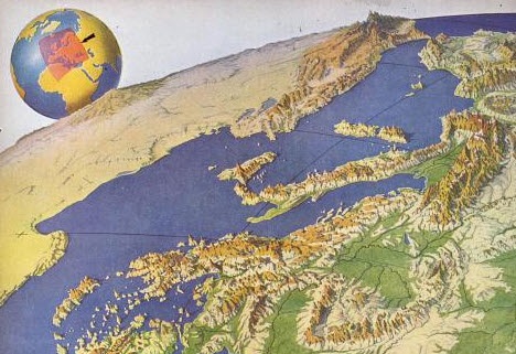
The story focuses on artist Richard Edes Harrison, whose World War II maps portrayed theaters of war with vivid clarity. He used the artist’s tools of shading, color and perspective to create maps “that could be intuitively understood by readers of widely varied levels of literacy and sophistication.” His “colorful and sometimes disorienting pictures (not quite maps)…emphasized relationships between cities, nations, and continents at the heart of the war. These maps were published in Fortune, then issued in an atlas that became an instant bestseller in 1944.”
After reading the article I ran a quick check of Google Books, one of my favorite go-to genealogy resources online, on “Richard Edes Harrison:. Sure enough, Google Books has a fully digitized copy of Life magazine (Feb 28, 1944) which includes the article “Perspective Maps: Harrison Atlas Gives Fresh New Look to Old World.” It’s not only chock full of his color maps, but includes a detailed section on how he drew his maps. You can see it here
What really caught my attention was the article’s explanation of how these World War II maps anticipated the information-sharing power of Google Earth. Google Earth shows us the terrain as well as geographic boundaries. That helps us understand things like movements of troops–or movements of ancestors.
As genealogists, we can learn so much by studying maps–particularly the powerful ones on Google Earth. Genealogy Gems Premium Members have access to my series of videos on Geographic Genealogy, including: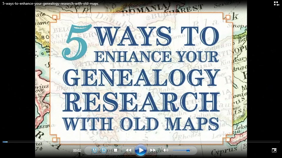
- Google Earth for Genealogy
- Time Travel with Google Earth
- 5 Ways to Enhance Your Research with Old Maps (brand new full hour class – retail value alone $39.95)
P remium Membership is a bargain at only $29.95 for an entire
  year’s access, plus right now you get the free bonus ebook Lisa Louise Cooke’s 84 Best Tips, Tricks & Tools from Family Tree Magazine.
Click here to learn more about Premium Membership.
by Lisa Cooke | Apr 24, 2014 | 01 What's New, Google, Maps
Google Maps Street View was given an edge today over Google Earth’s street view when Google launched a “time travel” upgrade. The ability to time travel is high on most family historians list, and Street View imagery for Google Maps desktop provides a taste of that prize.
According to Google’s blog post today they have “gathered historical imagery from past Street View collections dating back to 2007 to create this digital time capsule of the world.”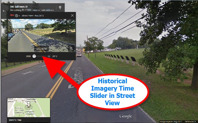 Here’s an example of viewing Gettysburg with the new feature. In many cases, there’s nothing earth shattering to see. But in some locations which have undergone substantial change in that short time period (such as viewing the reconstruction after the devastating 2011 earthquake and tsunami in Onagawa, Japan) the results are riveting.
Don’t worry if you don’t see Google Maps Street View Historical Imagery feature yet. When you have millions of users it can take a while to roll out upgrades.
Members Have Been Time Traveling for a While Now
If you’re a Genealogy Gems Premium Member then chances are you made a bee-line for the Time Travel with Google Earth premium video as soon as you joined. In that video we explore some incredibly powerful ways to travel back through our ancestor’s lives and times. And while I still think that those techniques deliver more relevant results for genealogists, this new Street View time travel in Google Maps is exciting in its own way. It offers a glimpse into the future.
Consider this: Google has been amassing incredible amounts of data over its short life including satellite and street view imagery. 7 years in and they can now begin to offer this collection of older imagery in a meaningful way. Imagine what historical street view imagery will look like in 10, 25, or 50 years from now!
After Looking Back in Time, I Offer This Prediction for the Future
While this feature has just rolled out in Google Maps, and is not yet available in our beloved Google Earth, I predict this omission will not last long. You may have already noticed that as you zoom in closer to street level in Google Earth a small clock icon appears at the bottom of the screen indicating historical satellite imagery is available. Next to the icon a date now appears indicating the earliest available imagery. Click the Historical Imagery icon in Google Earth’s toolbar and a time slider indicating the years available will appear.
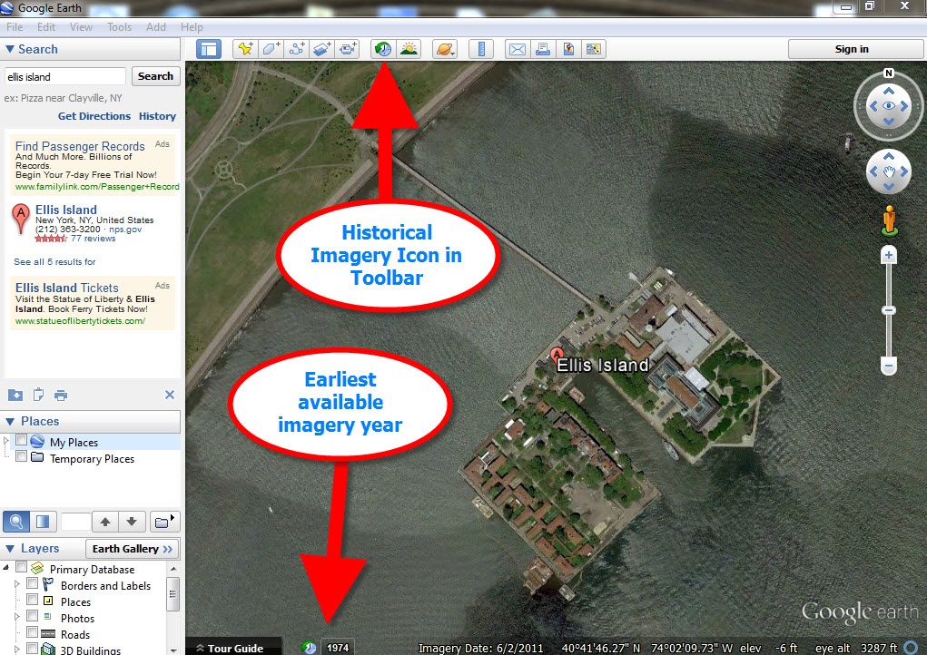
For most areas of the world this spans about as long as satellite imagery has been around. But in some key areas, such as London and parts of Europe, the slider goes back to the World War II era. Black and white aerial imagery of war torn areas are plainly visible. (If you have World War II veterans in your family tree, this is a feature you’ll want to explore.) It can only be a matter of time before this same Historical Imagery comes to Google Earth’s Street View.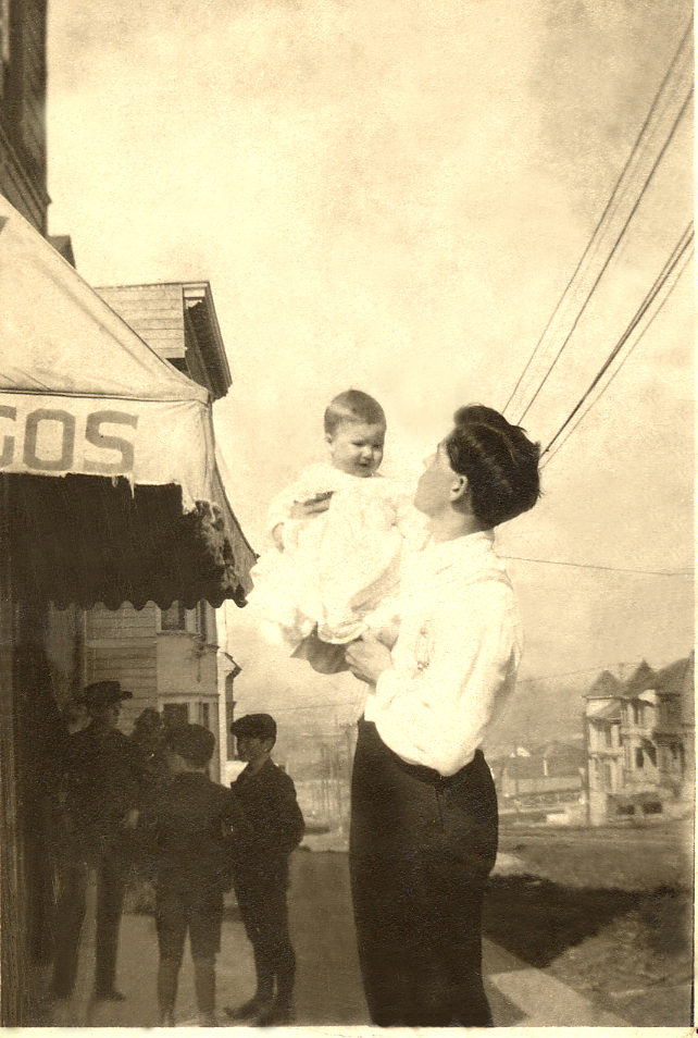 More Ways to Explore and Time Travel Now
If you are intrigued by the idea of using this technology to simulate your own genealogical time travel experience, watch my free video called Google Earth for Genealogy. You’ll travel along with me as I uncover the secrets of a photograph taken just over one hundred years ago, pinpoint the location today, and then travel back in time to further explore my ancestor’s neighborhood. From there, the sky is the limit with Google Earth and Google Maps!
Further Reading:
by | Feb 3, 2014 | 01 What's New, Google, Photographs
 Do you have old pictures but aren’t sure where they were taken? Sometimes Google Earth has the answer. Check out this question from podcast listener Dennis:
Q: “I am scanning slides from my only trip to my ancestor’s home in rural Germany and don’t recall the names or locations of a few people. The clue hear is ‘slides’. They were taken in 1986! I have a question regarding something I thought I heard on one of your podcasts regarding identifying a building via a picture that is uploaded to a web site. Can you give me some help with this?”
A: Yes! On my website, I offer a FREE video in which I demonstrate how to identify a building in an old photo using Google Earth. You can watch the free video by going to www.GenealogyGems.com, hover your mouse over VIDEO, and click on Google Earth for Genealogy in the drop down menu.
Another option is to use the free Google app on your smart phone or tablet. Open the app, tap in the search box, tap the Camera icon, and take a photo of the photo you have that contains the building you want to identify. (This works best with more well known locations.) It’s a long shot, but you never know – Google just may be able to identify it.
 Good luck, Dennis–and all the rest of you out there who are puzzling over how to identify old photos’ locations.
Find more tips on using Google Earth for Genealogy in my popular Google Earth for Genealogy 2-Disk Bundle. The free video is just the beginning of what you can do with Google Earth!
by Lisa Cooke | Jan 13, 2014 | 01 What's New, Google, Maps
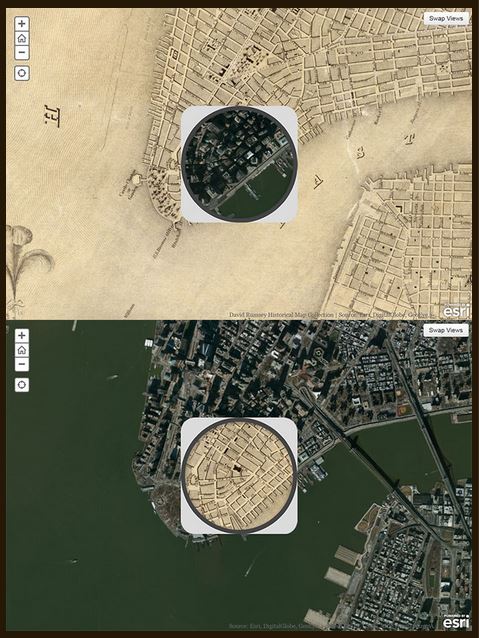
1836 map of New York City compared to modern satellite image, shown with each map in “spyglass” format. Image from David Rumsey Map Collection blog at DavidRumsey.com.
I love showing people how to use online tools to compare historical maps to modern ones. You can map out your ancestor’s address, check out their neighborhoods “then and now,” map their route to work, see if their old home still exists and more.
Well, the online Smithsonian magazine has created an exciting new interface for six American cities. Now you can compare modern satellite imagery with bird’s-eye views of:
You’ll see great city layouts before the fire that claimed much of old Chicago, the San Francisco earthquake, the Lincoln memorial and more. The historical map of New York City is the oldest, but the other maps capture each city at a critical point in their growth. For each city you can look at a historical map with a “spyglass” mouse-over of a modern satellite image, or vice-versa, as shown in the New York City map on the right. Each map is accompanied by a fantastic Smithsonian article; the historical maps come from the amazing David Rumsey Map Collection.
As many of you know, it’s possible to do something similar (or even better) with Google’s amazing mapping tools. Learn how to do that with these three Genealogy Gems resources:
1. My FREE Google Earth Video, which teaches you how to unlock mysteries in your research, from unidentified photographs to pinpointing homesteads;
2. My Google Earth 2-Disk Bundle, with detailed demonstrations and examples so you can SEE for yourself how to use Google’s mapping tools;
3. My new Time Travel with Google Earth video, in which you’ll see old maps, genealogical records, images, and videos come together to create stunning time travel experiences in Google Earth. This is available to Genealogy Gems Premium Members (learn more membership here).

by Lisa Cooke | Oct 18, 2013 | 01 What's New, British, Canadian, Google, Inspiration, Maps
Gail Rogers in Ottawa, Ontario, Canada recently shared how my presentation on using Google Earth for genealogy helped her find her way to the site of an old family business–and the place where her ancestor died. She’s given me permission to share it with you. I hope you find it as inspiring as I do!
“Just last week, I received an 1879 death certificate for my great-great-great-grandmother. She ran The Castle Inn in Stafford, Staffordshire, England after the death of her husband in 1863. To my sorrow and horror, I learned that she hanged herself probably within the establishment where she also lived!
“When I shared this with a group of English and Australian cousins who are also researching this family, one of them sent me a link to a 1960s photo of The Castle Inn, shortly before its demolition:
“Then I remembered your presentation about pinpointing your ancestor’s home in San Francisco. I’ve had several “family history” maps with icons that I’ve been working on for the past five years at Google Maps, so I went to the one for my Staffordshire ancestors, clicked on my icon for Eastgate Street in Stafford, and used the Street View to wander down the street, looking for the outline of the roofs, as you did with your old family photo. (You can view a video of my Google Earth for Genealogy class for free here on my website that demonstrates this technique.)
“I soon spotted the outline at the extreme left of the photo, “turned around” (virtually) and wham! There were the double Elizabethan-style timber-framed gables, just as they appeared in the older photo!”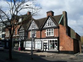
Gail, I was so glad to read that this helped you. I’ve gotten so much great feedback on that particular example of how to use powerful Google Earth (and Google Maps) tools to find important family landmarks.