by | Feb 2, 2014 | 01 What's New, Conferences, RootsTech
 One of the best kept secrets about #RootsTech is the fact that free sessions are held all day in the Demo Theater in the Exhibit Hall! At first glance it looks like a lounge full of comfy chairs. But don’t let that fool you. (Image right: My friend Janet Hovorka, talking about her new book Zap the Grandma Gap in the demo theater 2013. That’s my finger on the right!)
Folks in the genealogy industry will be presenting informative 15 minute segments that anyone can sit in on.
My sessions are less demo, and more crash course classes. You’re guaranteed to learn tips you can use:
FRIDAY Feb. 7, 2014 at 1:20 pm: Evernote Quick Tips for Genealogists
SATURDAY Feb. 8, 2014 at 12:40: Time Travel Using Google Earth
And if comfy chairs and usable tips aren’t enough incentive, how about a chance to win prizes! Every person in attendance at the demo is eligible.
Limited Seating and we start right on time (there’s only 5 minutes between these speed sessions!) so arrive early. And if you need a reminder, stop by the Genealogy Gems Booth #830 and pick up a demo flyer with the dates and times.
by Lisa Cooke | Jun 12, 2014 | 01 What's New, Google, Maps, Military
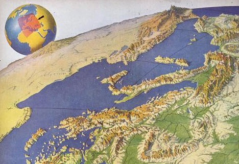 World War II started a revolution in map-making. It didn’t just change maps, but it also changed how the world looked at maps.
Maps suddenly became very interesting to everyone. Not just war strategists and troops but all those left behind on the home front. This interest was fueled even more by a revolution in how maps were made–a revolution that anticipated the information-sharing power of Google Earth.
“War has perennially driven interest in geography, but World War II was different,” reports this article in New Republic. “The urgency of the war, coupled with the advent of aviation, fueled the demand not just for more but different maps, particularly ones that could explain why President Roosevelt was stationing troops in Iceland, or sending fleets to the Indian Ocean.”
The story focuses on artist Richard Edes Harrison, whose World War II maps portrayed theaters of war with vivid clarity. He used the artist’s tools of shading, color and perspective to create maps “that could be intuitively understood by readers of widely varied levels of literacy and sophistication.” His “colorful and sometimes disorienting pictures (not quite maps)…emphasized relationships between cities, nations, and continents at the heart of the war. These maps were published in Fortune, then issued in an atlas that became an instant bestseller in 1944.”
After reading the article I ran a quick check of Google Books, one of my favorite go-to genealogy resources online, on “Richard Edes Harrison:. Sure enough, Google Books has a fully digitized copy of Life magazine (Feb 28, 1944) which includes the article “Perspective Maps: Harrison Atlas Gives Fresh New Look to Old World.” It’s not only chock full of his color maps, but includes a detailed section on how he drew his maps. You can see it here
What really caught my attention was the article’s explanation of how these World War II maps anticipated the information-sharing power of Google Earth. Google Earth shows us the terrain as well as geographic boundaries. That helps us understand things like movements of troops–or movements of ancestors.
As genealogists, we can learn so much by studying maps–particularly the powerful ones on Google Earth. Genealogy Gems Premium Members have access to my series of videos on Geographic Genealogy, including:
- Google Earth for Genealogy
- Time Travel with Google Earth
- 5 Ways to Enhance Your Research with Old Maps (brand new full hour class – retail value alone $39.95)
P remium Membership is a bargain at only $29.95 for an entire
  year’s access, plus right now you get the free bonus ebook Lisa Louise Cooke’s 84 Best Tips, Tricks & Tools from Family Tree Magazine.
Click here to learn more about Premium Membership.
by Lisa Cooke | Dec 30, 2014 | 01 What's New, British, DNA

Earliest surviving portrait of Richard III. Wikimedia Commons image.
An article recently published in Nature Communications confirmed the identity of the remains of King Richard III by DNA testing. This result wasn’t a huge surprise, but there were some eyebrow-raising findings along the way. More to the point, now a celebrity case study teaches us more about how to use DNA in family history research.
Prior to the genetic investigation of the skeletal remains presumed to be that of Plantagenet King Richard III, there was already mounting evidence that this was indeed his body. Genetic genealogists can take cues from this research to learn how to more fully integrate your genetic testing into your genealogy.
While these researchers were able to use radiocarbon dating and skeletal analysis methods that most of us won’t have access to, they did pore over a substantial amount of historical evidence to substantiate the last known whereabouts of Richard III. The archaeological, skeletal, and historical evidence were overwhelmingly in favor of this positive identification. But it was the genetic evidence that provided the last, ahem, nail in the coffin.
In this case the nail was made of mitochondrial DNA, or mtDNA. King Richard shares his mtDNA with anyone who is also related in a direct maternal line to his mother. There were two such candidates found, both sharing mtDNA with the skeleton presumed to be King Richard, thus further verifying its identity. In fact, lead researcher Turi King said of the findings, “If you put all the data together, the evidence is overwhelming that these are the remains of Richard III.”
Of interesting note to us as genetic genealogists is that one of the two mtDNA samples used for reference did have one difference from the mtDNA signature shared by the other individual and the skeleton. This did not jeopardize the integrity of the results, but rather provided a good case study in how DNA does change over time.
You would think that the DNA match confirming the identity of the skeleton would be the biggest news out of this round of DNA testing. But along with the direct maternal line testing, there was also direct paternal line testing to try to verify the paternal line of the skeleton.
Genealogists worked tirelessly to identify direct paternal descendants of Richard III’s great-great grandfather Edward III and five were found and tested. Their results revealed not one but THREE different paternal lines.
While the results were not quite as expected, they weren’t exactly unexpected either, as there are plenty of royal rumors of non-paternity (click here for a summary). Watch a brief video discussion of the yDNA results here:
Again, the YDNA portion of the study provides a great case study for us in how to use YDNA, namely that it takes a lot of traditional genealogical work to find direct paternal line descendants to be tested, and that the results are conclusive, but can sometimes provide more questions than answers.
The Richard III DNA drama has started many families talking about “doing” their own DNA. Learn how with my series of quick guides (purchase all 4 laminated guides or the digital download bundle for the best deal);
Visit my website to learn about expert consultations with me. You’ll get customized guidance on which tests to order and how to maximize your results for your genealogy research.
by Lisa Cooke | Feb 6, 2015 | 01 What's New, Canadian, Google Earth, History, Maps, Military, United States
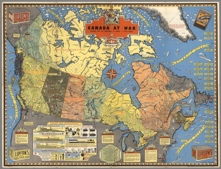
Canada at War by Stanley Turner, 1944. Online at the David Rumsey Map Collection. Click on image for full citation and to access image.
During World War II, millions of people anxiously followed the progress of battles and troop movements that affected their loved ones. Artists and map-makers stepped up to provide colorful, action-packed maps.
Toronto artist Stanley Turner was one of these. He created a series of maps between 1942 and 1945 that were printed and licensed as promotional giveaways to businesses in Canada and the U.S. Today you can find Turner’s maps digitized at the David Rumsey Map Collection.
Stanley wasn’t the only one making these beautiful maps. Read about Richard Eddes Harrison and the big changes in popular cartography during the war in my blog post, “World War II: A Revolution in Map-Making.”
Fast-forward 60 years in time, and the latest revolution in map-making and information-sharing is where? On Google Earth! Google Earth is packed with topography, but also shows us man-made features like roads and bridges, geographic boundaries, historical maps and photographs and so much more. These help us understand things like movements of our ancestors–whether they were troops in World War II or settlers in distant places.
 Want to learn more about using Google Earth for genealogy (or the Google Earth Pro version that was just released FREE to the public)? Become a Genealogy Gems Premium member. You’ll have access to video classes like these:
- Time Travel with Google Earth
- 5 Ways to Enhance Your Research with Old Maps (this class’ retail value alone is $39.95)
Premium Membership is a bargain at only $29.95 for an entire year’s access, plus right now you get the free bonus ebook Lisa Louise Cooke’s 84 Best Tips, Tricks & Tools from Family Tree Magazine. Click here to learn more about Premium Membership.
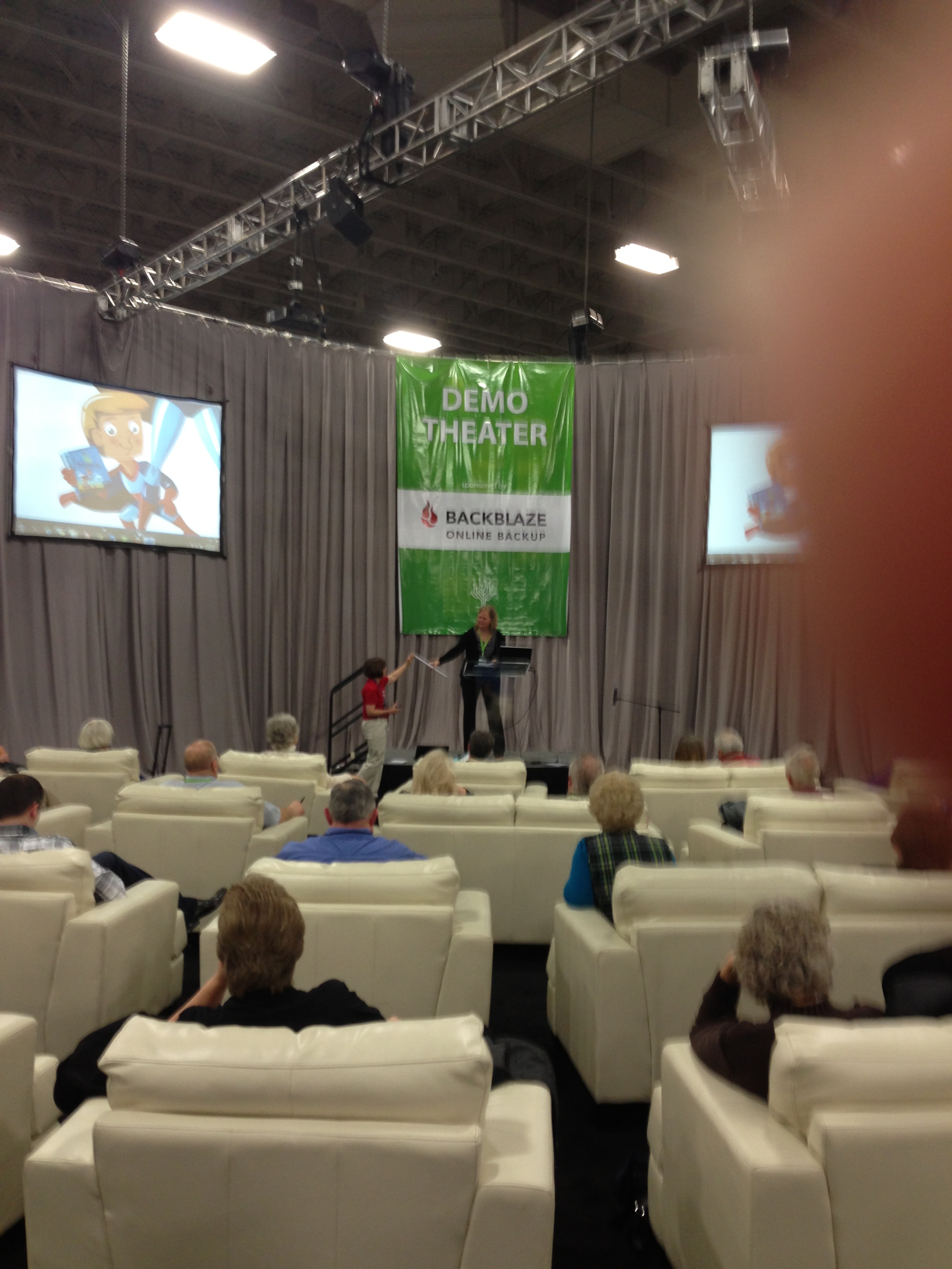 One of the best kept secrets about #RootsTech is the fact that free sessions are held all day in the Demo Theater in the Exhibit Hall! At first glance it looks like a lounge full of comfy chairs. But don’t let that fool you. (Image right: My friend Janet Hovorka, talking about her new book Zap the Grandma Gap in the demo theater 2013. That’s my finger on the right!)
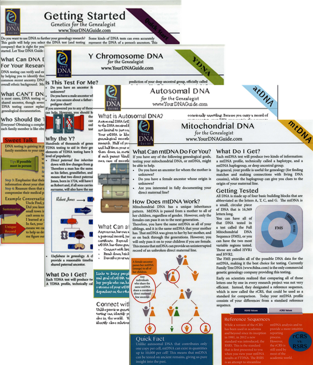 Getting Started: Genetics for Genealogists;