Do you have old pictures but aren’t sure where they were taken? Sometimes Google Earth has the answer. Check out this question from podcast listener Dennis:
Q: “I am scanning slides from my only trip to my ancestor’s home in rural Germany and don’t recall the names or locations of a few people. The clue hear is ‘slides’. They were taken in 1986! I have a question regarding something I thought I heard on one of your podcasts regarding identifying a building via a picture that is uploaded to a web site. Can you give me some help with this?”
A: Yes! On my website, I offer a FREE video in which I demonstrate how to identify a building in an old photo using Google Earth. You can watch the free video by going to www.GenealogyGems.com, hover your mouse over VIDEO, and click on Google Earth for Genealogy in the drop down menu.
Another option is to use the free Google app on your smart phone or tablet. Open the app, tap in the search box, tap the Camera icon, and take a photo of the photo you have that contains the building you want to identify. (This works best with more well known locations.) It’s a long shot, but you never know – Google just may be able to identify it.
Good luck, Dennis–and all the rest of you out there who are puzzling over how to identify old photos’ locations.
Find more tips on using Google Earth for Genealogy in my popular Google Earth for Genealogy 2-Disk Bundle. The free video is just the beginning of what you can do with Google Earth!
When Liberian national Thomas Eric Duncan was diagnosed with Ebola it was unnerving for everyone here in the U.S. As a new Dallas area resident, and someone who was hopping from plane to plane for a Fall series of speaking engagements, it definitely gave me pause.
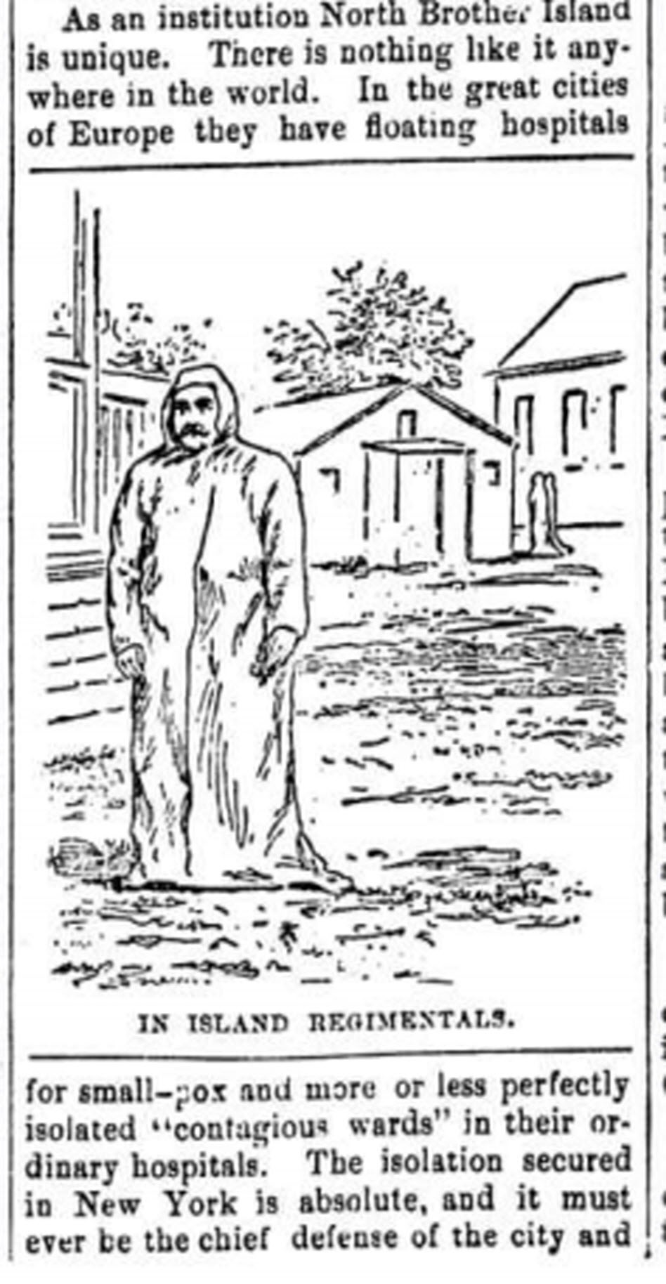
The Abbeville press and banner., October 12, 1892, Image 6/ www.chroniclingamerica.com
Epidemics, quarantines, and communities trying to protect citizens have been age old dilemmas, so it makes sense to look back through history at the strategies employed. There is much to be learned.
If we ask the question “what would have happened if Ebola had struck the U.S. 130 years ago?” we don’t have to look much farther than the location of one of the most recent Ebola patient: New York.
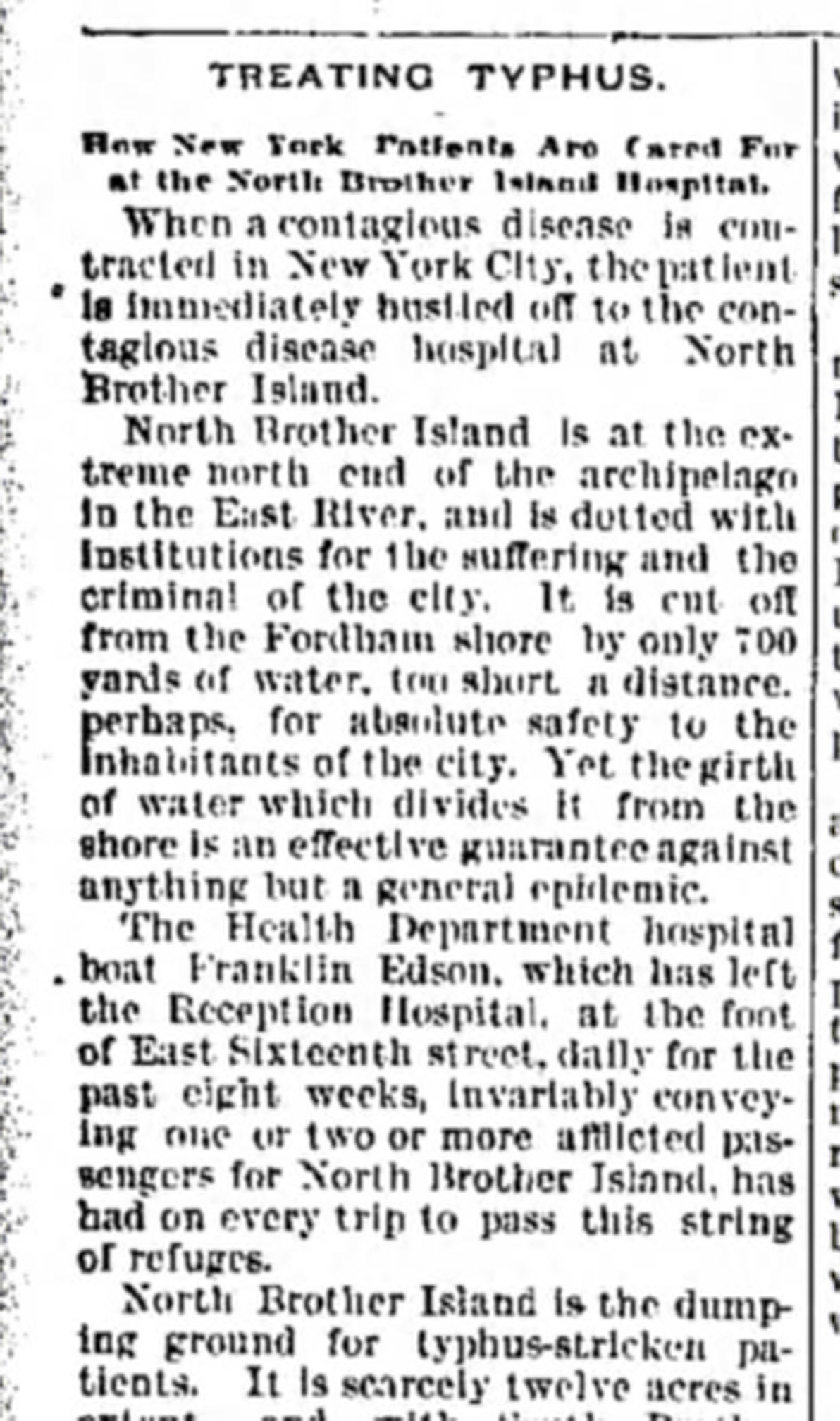
from the Humboldt Republican (Humboldt, Iowa) March 31, 1892 Courtesy www.Newspapers.com
In New York’s East River, tucked between the Bronx and Rikers Island lies North Brother Island, where in 1885 Riverside Hospital was relocated from Blackwell’s Island to isolate and treat small pox patients. From there it expanded to include the quarantine of other diseases.
North Brother Island stands idle today, closed to the public. However from 1907-1910 and 1915-1938 it housed the notorious Typhoid Mary, closing shortly after her death.
Although today the island is closed to the public, anyone can visit virtually with the aid of Google Earth. Join me on a 5+ minute tour of North Brother Island featuring the magazine and newspaper articles of the day, and written, audio and video tours of how it stands today a shell of what it once was. Click here to download and play my Google Earth Historic Tour KMZ file on your computer. It will be added to your “Places” panel in Google Earth under “Temporary Places.” Open the folder and click the “click to play the tour” icon. Be sure your speakers are on! And take time to click to watch the video and view the articles in the placemarks.
Using BillionGraves for genealogy research has never been easier.
BillionGraves aims to document and preserve the world’s cemeteries. They provide a platform for volunteers around the world (and their smartphones!) to capture headstone images and their GPS locations. The images are transcribed and the index is searchable on the BillionGraves website and other leading genealogy sites.
Learn more on using BillionGraves for genealogy, what it offers now and its hopes for the future in this video interview by Lisa Louise Cooke with Hudson Gunn. Then keep reading below to learn a few more tips from us here at Genealogy Gems on using Billiongraves for genealogy.
Ready to learn more about using BillionGraves for genealogy?
 Do you have old pictures but aren’t sure where they were taken? Sometimes Google Earth has the answer. Check out this question from podcast listener Dennis:
 Good luck, Dennis–and all the rest of you out there who are puzzling over how to identify old photos’ locations.