Today’s gem focuses on a challenge that we all face as family historians – getting organized, archiving all of our stuff, and digitizing materials an d photos. I know that’s biting off a big chunk, but it’s such an important one. And in this episode I’m going to start to break it down for your with the help of the Family Curator, Denise Levenick who has written a book called How to Archive Family Keepsakes. She’s got lots of practical advice to share.
NEWS:
FamilySearch recently announced that their U.S. Immigration and Naturalization Community Project is Half-way to its 2012 Goal of 30 Million Records
In August of this year, FamilySearch announced its next major U.S. community project-U.S. Immigration and Naturalization. The project will create an extensive, free, online collection of U.S. passenger lists, border crossing records, naturalization records, and more-invaluable to genealogy researchers. See what U.S. Immigration and Naturalization projects are currently underway, or check on their status at FamilySearch.org/immigration.
You can join the community of online indexers and arbitrators helping to make passenger lists and naturalization records freely searchable on familysearch.org.
Current and Completed Projects
To view a list of currently available indexing projects, along with their record language and completion percentage, visit the FamilySearch indexing updates page. To learn more about individual projects, view the FamilySearch projects page.
Google recently announced that Google Maps just got the biggest Street View update ever, doubling the number of special collections and updating over 250,000 miles of roads around the world. Google has increased Street View coverage in Macau, Singapore, Sweden, the U.S., Thailand, Taiwan, Italy, Great Britain, Denmark, Norway and Canada. And they are launching special collections in South Africa, Japan, Spain, France, Brazil and Mexico, among others. .
They’ve also recently updated the Google Earth satellite imagery database. This refresh to the imagery has now been updated for 17 cities and 112 countries/regions. So Google Earth has never been better for genealogy research. And of course if you would like to learn more about what Google Earth can do for you as a genealogist, check out my free YouTube videos which show you what you can learn in Google Earth for Genealogy Video Tutorial Series.
Genealogy Gems Premium Membership Update
I’m happy to let all of you Premium members know that I’ve put together a quick little video that will walk you through the process of setting up your Premium podcast feed in iTunes.You’ll find a link on the premium episodes page once you’ve signed in that will take you to the video and instructions for setting up your Premium iTunes subscription.
I have also added a video recording of one my most popular classes to the Premium Videos collection. It’s called How the Genealogist Can Remember Everything with Evernote.
From Premium Member Kelly: “Thank you so much for your podcast on Evernote. I’ve been on YouTube watching videos about it but they were hard to follow and more advanced or to techie. Your podcast was easy to follow and went over the basics and I really appreciate that. I think I finally ready to try it.”
If you would like to be able to watch the Evernote class from the comfort of your own home please join us as a Genealogy Gems Premium Member which you can do at www.genealogygems.com
MAILBOX:
From Patience: “I have noticed in your podcast, other’s podcasts, blogs, and at workshops I have attended that there is a concern about the next generation. I do understand, but I wanted to share with you my experience in hopes of easing everyone’s worries. I am 23 years old, and let me tell you I stick out like a sore thumb at workshops as I usually am the youngest by at least 30 years. That being said when I started researching I met one of my cousins on ancestry.com, and we really hit it off we have all the same interests and are like long lost twins. For a while, I assumed that she was retired, and much much older than I, but after several emails, I found out she is only two years older than me!!!
I too worry about my generation, but I think after some maturing, most will at least have an appreciation for the past, and everything it has to offer, or at least I hope…But all I know is that there are two very pretty twenty-something girls thousands of miles apart that would rather research and learn that go to parties…so that seems pretty hopeful I think.”
Jennifer Takes the iPad on the Road
“Kudos for turning me on to a nifty iPad shortcut. Your latest book has some tips in the back, which is where, of course, I skipped to after dutifully reading the first three chapters or so. The tips about swiping the comma/exclamation point to create an apostrophe, and the other shortcut for quotation marks, are so great! I will no doubt find many other useful items when I return to reading. Honestly, your books are so full of wonderful information, I have to take a break before my head explodes (not pretty).”
Pat Oxley, a Genealogist on Facebook posted her review of my new book on Facebook last week. “Despite another day of coughing and basically feeling yuk, I bought and downloaded Lisa Louise Cooke‘s new book “Turn your iPad into a Genealogy Powerhouse.” It is FABULOUS! I worked my way through the book, taking notes and then downloaded and played with some of the apps she suggested! Thank you Lisa Louise! I will say it’s a terrific book even if you’re NOT a genealogist. Many of her suggested apps could be applied to many different hobbies and interests. You can buy it through Lulu.com.”
GEM: Interview with author Denise Levenick, The Family Curator
Denise May Levenick is a writer, researcher, and speaker with a passion for preserving and sharing family treasures of all kinds. She is the author of How to Archive Family Keepsakes and creator of The Family Curator blog http://www.TheFamilyCurator.com, voted one of the 40 Best Genealogy Blogs in 2010 and 2011.
Gem: One More Thing From Tina in the UK: “Your recent blog post about items found when clearing out a house reminded me of my most significant find in my stepfather’s attic. He died in July 2009 and my mother wanted to clear out and sell their big house and move to a retirement flat to be near the family in Bristol. I should explain that my mother and father divorced when I was a baby and my stepfather was like a father to me. We threw out masses of stuff – he never did, EVER! – but this was mostly correspondence, company reports for all his shares etc which we sifted through without much of note being found. Then, in the attic there were two extraordinary finds:
(1) a box full of the small notebooks he kept from his schooldays till a few years before he died…early ones and especially the ones of his years in the Army in India and Burma…The later notebooks are a record of his expenses – with dates, items and expenses which brought back many memories (eg doll for Tina – bought in New York on holiday in 1958 – I remember it well, it was a sort of pre-Barbie!). Every ice-cream he ever bought us – there was a LOT of ice-cream (he loved it)!
(2) my grandfather’s old attache case – full of letters from my stepfather’s mother between about 1978 and her death in 1993. There were hundreds of them – and yes, I read every single one and they have formed the basis of the story of her life (yes, she also left a small diary, a collection of her own recipes of family favourites, and a very simple family tree), which I am now writing…what VERY little there was seemed to be in answer to some of his questions…It just shows how the smallest things can provide clues.”
Thank you Tina for sharing this – it certainly does remind us that clues can come from anywhere. But it also reminds us of something else – that while it’s wonderful to have our history recorded so it can be remembered, sometimes it’s the smallest things that are remembered most: Like ice cream. I think I’m going to sign off now and take my grandson Davy out for a cone. I hope he remembers it, because I know I will. Who will you invite out for a an ice cream and spend your precious time with today?
Disclosure: This article contains affiliate links and Genealogy Gems will be compensated if you make a purchase after clicking on these links (at no additional cost to you). Thank you for supporting Genealogy Gems!
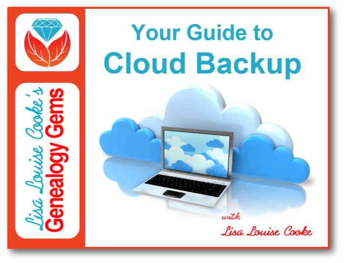
Our Black Friday genealogy sale is on! Start with a limited-time FREE viewing of the new Premium video, Your Guide to Cloud Backup. Then snatch up rare and exclusive savings on Backblaze cloud backup service, a new mobile genealogy bundle, and our new Irish guide and Irish genealogy guide bundle!
Backblaze Cloud Backup Sale: A Genealogy Gems Exclusive
Backblaze continually backs up all your computer files to a remote ‘cloud’ server. In the event of any loss (including a computer crash), all of your files can be restored. Ensure your research is protected from disaster with Backblaze!
Use coupon code gems2017cyber for 10% off any new Backblaze subscription. Offer good through November 27, 2017. Check it out at www.Backblaze.com/Lisa.
Not Sure About the Cloud? Watch this Free Video Now
Now through next Monday, November 27, 2017, you can watch the new Genealogy Gems Premium Video for FREE. In this brand new, half-hour video tutorial, Lisa Louise Cooke will provide answers to questions like:
What is cloud backup?
Why should I use cloud backup?
How does cloud backup work?
Is cloud backup safe?
What should I look for when selecting a cloud backup service?
Mobile Genealogy: How to Use Your Tablet & Smartphone for Family History Research
by Lisa Louise Cooke (paperback book)
Whether you have an iPad, an Android tablet, or a smartphone (or all three), Mobile Genealogy will help you put them to work for your genealogy research. Explore apps in-depth, get the latest cutting-edge strategies for mobile genealogy and family history, and use Lisa’s tips and tricks to make your mobile device a genealogy powerhouse!
Using Social Media for Family History
by Lisa Louise Cooke (45 min. video)
Discover how sharing your research on social media can benefit you, your family, and your research. Lisa will focus on two of the top site that you might not be using: Pinterest and Instagram. They are fun and easy to use, and the perfect place to reach the next generation.
The bundle is a $39.90 value but this weekend you’ll pay just $19.95.
Available through Monday, November 27. Click here to buy it now! (Bundle includes print book and video class download. Book ships to U.S. and Canada only.)
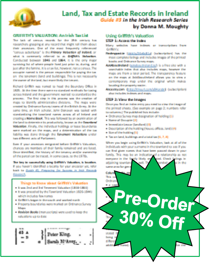
NEW Irish Genealogy Guide #3: Land, Tax and Estate Records
Donna Moughty’s Irish Guide series has proven so popular, we’re adding a third one! Jump on our Black Friday pre-order sale (shipping begins approximately Dec. 11, 2017) and you’ll get 30% offIrish Guide #3: Land, Tax, and Estate Records.
This Guide explains how and why Griffith’s Valuation was done, and how to use it to glean the most information about your family. After Griffith’s Valuation, the Revision Books allow you to follow the land and in some cases, to the 1970s, possibly identifying cousins still living on the land. Quick reference guide includes:
Explanation of the columns in Griffith’s Valuation
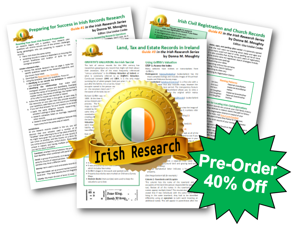
Save even more! Get 40% off the entire 3-guide Irish genealogy research bundle by Donna Moughty:
Irish Guide #1: Preparing for Success in Irish Records Research
Irish Guide #2: Irish Civil Registration and Church Records
Irish Guide #3: Land, Tax, and Estate Records
Purchase all three for only $20.90 through Monday, November 27, 2017. (Guides ship to U.S. and Canada only. Shipping estimated to begin December 11, 2017 on orders including Irish Guide #3.)
40% offHow to Find Your Family History in Newspapers
Lisa Louise Cooke’s tried and true methodology for genealogical newspaper research! If you think you know how to search for newspapers, this book will make you think again.
Please share these gems with your genealogy friends–or send them as your “wish list” to a loved one. Remind them to act quickly as these offers are only good through Monday, November 27, 2017.
Click the video player to watch episode 54 of Elevenses with Lisa about the 1890 census and substitute records. Below you’ll find the detailed show notes with all the website links I mention. Premium Members will find the downloadable ad-free PDF cheat sheet of these show notes at the bottom of this page in the Resources section, along with my BONUS 1890 Census Gap Worksheet.
What Happened to the 1890 Census
The census shows us our ancestors grouped in families, making it a valuable resource for genealogy. Soon the 1950 census will be available, but for now the most current census publicly available in 1940. In it we may find, depending on our age, ourselves, our parents, our grandparents, and our great parents. In many cases it’s quick and rewarding to make your way back in time to the 1890 census which was taken starting June 1, 1890. And that’s where the trail hits a bump. In January 1921 a large fire broke out in the Commerce Building in Washington DC where the 1890 census records were stored, and most were destroyed as a result. Only 6,160 individual names remain in the remnants. (Learn more about the destruction of the 1890 census at the National Archives.)
Prior to the 1890 U.S. Federal Census, the last census taken was in 1880. With about 99% of the 1890 being destroyed as the result of the fire, this leaves a 20 year gap in the census (1880 – 1900.)
Much can happen in a span of twenty years. For example, your ancestors could have been born and reached adulthood. Filling in their timeline for this period requires a bit more effort, but the results are worth it.
In this video and article we’ll cover:
How to find the remaining fragments of the 1890 population enumeration
What you can learn from the 1890 census records
Lesser known 1890 census schedules that can still be found.
The best 1890 substitute records and how to find them.
Surviving 1890 Federal Census Population Schedules
A very small portion of the 1890 census has survived, but it’s more than just the population schedule. Here are the six types of records still available.
List of the locations covered by the surviving 1890 federal census:
Alabama: Perryville Beat No.11 (Perry County) and Severe Beat No.8 (Perry County)
District of Columbia: Q Street, 13th St., 14th St., R Street, Q Street, Corcoran St., 15th St., S Street, R Street, and Riggs Street, Johnson Avenue, and S Street
Georgia: Columbus (Muscogee County)
Illinois: Mound Township (McDonough County)
Minnesota: Rockford (Wright County)
New Jersey: Jersey City (Hudson County)
New York: Brookhaven Township (Suffolk County) and Eastchester (Westchester County)
North Carolina: South Point and River Bend Townships (Gaston County), Township No. 2 (Cleveland County)
Ohio: Cincinnati (Hamilton County) and Wayne Township (Clinton County)
South Dakota: Jefferson Township (Union County)
Texas: J.P. No. 6, Mountain Peak, Ovilla Precinct (Ellis County), Precinct No. 5 (Hood County), No. 6 and J.P. No. 7 (Rusk County), Trinity Town and Precinct No. 2 (Trinity County), and Kaufman (Kaufman County)
Questions Asked in the 1890 U.S. Federal Census The following questions were asked by the census taker:
Name
Age
Sex
Address
Number of families in the house
Number of persons in the house
Number of persons in the family
Relationship to head of family
Race: white, black, mulatto, quadroon, octoroon, Chinese, Japanese, or Indian
Marital status
Whether married during the year
Total children born to mother
Number of children living
Birthplace
Birthplace of parents
If foreign born, how many years in the United States
Naturalized or in the process of naturalization
Profession, trade, or occupation
Months unemployed during census year
Able to read and write
Speak English; if not, language or dialect spoken
Suffering from acute or chronic disease (if so, name of disease and length of time afflicted)
Defective in mind, sight, hearing, or speech
Crippled, maimed, or deformed (with name of defect)
Prisoner, convict, homeless child, or pauper
Home is rented or owned by the head or a member of the family
(if so, whether mortgaged)
Head of family a farmer, if he or a family member rented or owned the farm
If mortgaged, the post office address of the owner
2. Schedules for Union Soldiers & Widows
According to the National Archives, “The U.S. Pension Office requested this special enumeration to help Union veterans locate comrades to testify in pension claims and to determine the number of survivors and widows for pension legislation. (Some congressmen also thought it scientifically useful to know the effect of various types of military service upon veterans’ longevity.) To assist in the enumeration, the Pension Office prepared a list of veterans’ names and addresses from their files and from available military records held by the U.S. War Department.
Index and images of schedules enumerating Union veterans and widows of veterans of the Civil War for the states of Kentucky through Wyoming. Except for some miscellaneous returns, data for the states of Alabama through Kansas do not exist. Some returns include U.S. Naval Vessels and Navy Yards. The schedules are from Record Group 15, Records of the Veterans Administration and is NARA publication M123.
Nearly all of the schedules for the states of Alabama through Kansas and approximately half of those for Kentucky appear to have been destroyed before transfer of the remaining schedules to the National Archives in 1943.”
The 1890 Oklahoma Territorial Census lists people who lived in the Oklahoma Territory. The seven counties making up the Oklahoma Territory at the time are listed below. Note the number as they were often listed only by these number on the census.
Logan County
Oklahoma County
Cleveland County
Canadian County
Kingfisher County
Payne County
Beaver County
How to find the records:
Oklahoma Historical Society – Search the 1890 Oklahoma Territorial Census for free. Order copies of print or digital records for a fee.
One of the primary uses of the census by the government is to compile statistical reports using the data gathered. Many of these can be found online at places like Google Books.
The Delaware African American Schedule came about because of one of these statistical reports. According to the National Archives, in 1901 the Chief Statistician for Agriculture wrote a report about agriculture in the state of Delaware. Just before it was to be published, some of the conclusions reached in the report were disputed. The controversy centered around what was then referred to as “Negro” farmers. The results was that additional research was conducted in an effort to find all “Negro” farmers in the 1890 and 1900 Delaware census records. The dust up over the statistical report was fortunate indeed because these records are now available.
The list is roughly in alphabetical order according to surname and contains the following information:
Name
Census Year
Enumeration District (ED) Number
ED Description (locality and county)
Occupation
5. Statistics of Lutheran Congregation & Statistical Information for the U.S.
These record collection offers limited usefulness because they don’t name people. However, if you have questions about Lutheran ancestors around 1890 or would like more contextual information about the time period, they might be worth a look.
Statistics of Lutheran Congregation reproduces a list of each Lutheran church or local organization compiled by the Census Office from information submitted by officials of the Lutheran officials.
How to find the records:
The National Archives – Contact the National Archives regarding National Archives Microfilm Publication M2073, Statistics of Congregations of Lutheran Synods, 1890 (1 roll). Records are arranged by synod, then state, then locality.
For each church or local organization, the following information is given in seven columns:
(1) town or city
(2) county
(3) name of organization
(4) number or type of church edifice
(5) seating capacity
(6) value of church property
(7) number of members.
6. Statistical information for the entire United States
Statistical reports were compiled and analyzed by the Census Office after the 1890 census was completed. These massive statistical reports are available in National Archives Microfilm Publication T825, Publications of the Bureau of the Census.
Now that we’ve scoured every inch of available records remaining from the 1890 U.S. Federal Census, it’s time to go on the hunt for substitute records. We’ll be focusing on the best available and easiest to find resources.
1885 & 1895 State Census Records:
The U.S. federal government was not alone in taking the census. Some states also took their own state census. These were usually conducted in the years between the federal censuses, most commonly on the “5” such as 1875, and 1885. You may find some as far back as 1825 and as recent as 1925, as in the case of the state of New York.
How to find the records:
Look for state census records at state archives, state historical societies, and state libraries. Many are also conveniently searchable online, most commonly at FamilySearch (free) and Ancestry (subscription.)
Lisa’s Pro Tip: Get a Bit More with Mortality Schedules
Do you happen to have someone in your family tree who was alive and well in the 1880 census but nowhere to be found in the 1900 census? Official death records may not have been available during this time frame where they lived, compounding the problem.
The U.S. Federal Censuses from 1850-1880 included a mortality schedule counting the people who had died in the previous year. Since the 1880 census began on June 1, “previous year” means the 12 months preceding June 1, or June 1 (of the previous year) to May 31 (of the census year).
Ancestry has a database of these schedules which fall just before the 20 year time frame we are trying to fill. However, this collection also happens to include Mortality Schedules from three State Censuses: Colorado, Florida and Nebraska. There were conducted in 1885. They weren’t mandatory so there are only a few, but if you happen to be researching in one of these states, you just might get lucky.
While you’re searching, be aware that not all of the information recorded on the census is included in the searchable index. This means that it is important to view the image and don’t just rely on the indexed information.
Ancestry 1890 Census Substitute Database
Ancestry has compiled a special searchable collection of records that can be used to fill in the gaps left behind by the loss of the 1890 census. It includes state census collections, city directories, voter registrations and more.
Find More 1890 Census Substitute Records at Ancestry
This substitute collection is a tremendous help, but don’t stop there. You can also manually hunt for substitute records to see if there might be something helpful that is overlooked in the 1890 census substitute search. This works particularly well if you have a specific research question in mind.
You might be wondering, why would I need to search manually? Many people rely on Ancestry hints to alert them to applicable records, and they figure the search engine will find the rest.
This is a mistake for two reasons.
only approximately 10% of Ancestry® Records Appear as hints.
There may be a record that meets your needs that was not captured in the 1890 Census Substitute Collection. Try going directly to the Card Catalog and filtering to USA and then by decade such as 1890s.
FamilySearch 1890 Census Substitutes
While FamilySearch doesn’t have one massive substitute database, you can find several focused 1890 census substitute collections available online, at Family History Centers around the country and world, and in book form at the Family History Library in Salt Lake City.
How to find the records: 1. Go to FamilySearch 2. Log into your free account
3. In the menu go to Search > Catalog 4. Click Titles 5. Search for 1890 census substitute 6. If desired, filter down to records available or at a Family History Center near you.
City Directories as an 1890 Census Substitute
Some of the best and most comprehensive substitute records are city directories. If published in your ancestor’s area when they lived there, they can offer a year-by-year record. And that can do wonders for filling in the gap between the 1880 and 1800 census.
How to find the records:
You can find city directories at the big genealogy websites like Ancestry, MyHeritage and FamilySearch, as well as state archives, historical societies and libraries. Google searches also come in very handy in unearthing lesser known websites and repositories. Two of my favorite places to look that are both free and online are Google Books and Internet Archive.
Google Books Search for the state and county. On the results page click the Tools The first option in the drop-down menu will be Any View. Change it to Full View. The third option is Any Time. Click the down arrow and select Custom Range and set it to 1880 through 1890.
Episode 30: Lisa’s 10 surprising things to find at Google Books
Like Google Books, the Internet Archive has a vast array of materials digitized and available for free. Watch Elevenses with Lisa episode 43for ideas and search strategies.
We’ve touched on some of the most popular and helpful records that can be used to fill in the gap left by the loss of the 1890 U.S. Federal Census. As you expand your search look for: