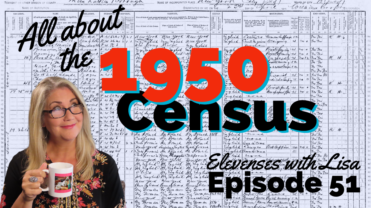
One-Step Tools for the 1950 Census with Steve Morse
One-Step Webpages by Steve Morse helps genealogists find relatives faster in the U.S. federal census. Steve Morse explains how to use his one-step tools for the 1950 census.
Show Notes
Premium Members: Download the show notes PDF
Become a Premium Member.
The 1950 US federal census is going to be released on April 1 of 2022. And getting the records fully indexed, and therefore searchable is going to take a little bit of time.
If you’re anxious to get digging into the records, you’re going to need to know a couple of things like where your ancestors lived. You’ll also find the enumeration district, or what’s called the ED number.
Thankfully, Steve Morris has developed a terrific free online tool at his One-Step Webpages website that can help you find those ED numbers.
00:54
Lisa: Wow, it’s a really big year for you! I imagine it is every 10 years or so when a new census record comes out, right?
01:03
Steve: Well, yes, we’re doing what we can to get ready (for the release of the 1950 U.S. Federal Census.) I’m trying to get the interfaces to tie into the actual census pages when they come online. So that’s been a big activity right now.
01:17
Lisa: Let’s talk about that. I want to talk about the website and how people can use it. And of course, I’d love to know even more about you. First of all, why do you call it One-Step Webpages?
The History of One-Step Webpages
01:33
Steve: That goes back to the origins of the site back in 2001.
The first major tool that I put up on the site was (designed for) researching the Ellis Island database. That database had just come online at that time. I was anxious to use it because there was some real answers that I had not been able to find up until then.
But when I got into it, I realized it was very difficult to use. And I saw that I could do everything they were doing in one step many steps on their website. So, without giving it too much thought, I put up my own tool, which was called Searching the Ellis Island Database in One-Step. I didn’t realize that by choosing that name, I become branded. All tools hereafter have that One-Step name now, and it became known as the One-Step website.
If I realized the significance of that choice of name, I might have gone with my second choice which was Searching the Ellis Island Database with Fewer Tears. And in which case, we would now have the Fewer Tears website! But we have the one we’re stuck with, the One Step website.
02:37
Lisa: Well, I’d say the One-Step site certainly does mean fewer tears, that’s for sure! I remember when you first launched it, I use it to find my great grandmother’s passenger list. Using your site I found that she was listed twice in 1910. The first time was in first class, and then also in second class. I have a feeling they found her in first class and moved her down to second class! But really, I found it because of your site and not the Ellis Island site. So, thank you.
And now of course, you’ve been creating One-Step tools for census records. I’d love to have you give us an overview of those tools. Tell us a bit about what’s on the website. And how can it help genealogists accomplish their goals?
Genealogy Tools at One-Step Webpages
03:24
Steve: Well, it’s whatever strikes my fancy!
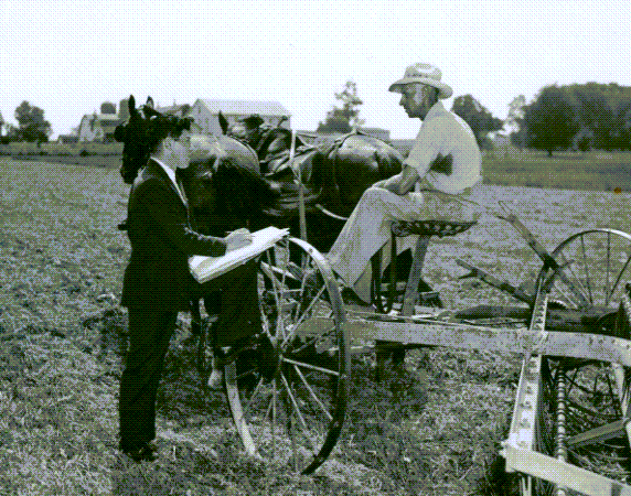
I got started with Ellis Island passenger lists records because I was trying to find a particular relative, my wife’s great grandfather. A year later, the website was used quite a bit, and the census was coming out. I got notified by a fellow that I worked with that he was working on the 1930 census. He was he was a volunteer at the National Archives, and he realized that people were going to be coming into find their records, and he wasn’t going to be able to help them. The census was not indexed. It had to be accessed by enumeration district. And these Eds were not easy to obtain.
I realized that would be a fun thing to get into. So instead of being known as a one trick pony – you know, I had the Ellis Island stuff – what if I could do two things? Maybe the site would be a little more important. So, I got involved with the census work then.
Through this fellow that contacted me who I’d worked with, he found Joel Weintraub. So, then the three of us started working on this together.
There are other sections as well. Again, it’s whatever strikes my fancy. I have the vital records section. I have a section for creating your own One-Step search application. I have things that have nothing to do with genealogy at all. They’re all on the website.
So, over all there are 300 tools. I tell people just go through them and see which ones strike your fancy and use them. I know nobody’s going to like all 300 tools, that’s impossible. But hopefully each person will like a certain subset of them. And all those subsets together will be the entire website.
05:12
Lisa: Wow, I didn’t realize there were 300 tools on the website. That’s amazing!
About Steve Morse of One-Step Webpages
So, what’s your background? Are you a computer programmer? Do you do all the programming for the website?
05:26
Steve: Well, I have a PhD in electrical engineering, specializing in computer science. It was not computer science in those days. So, I been in the field ever since – my entire career. I’ve done research, development, consulting, writing, so forth.
The 1950 US Census Project at One-Step Webpages
05:42
Lisa: The 1950 census is just about here. When did you first start working on that?
05:48
Steve: Well, we finished the 1940 census in 2012. When the 1940 census went online, it was about a year later that we first started putting out the call for volunteers. By 2013, we started fetching volunteers to do the work for the 1950 census.
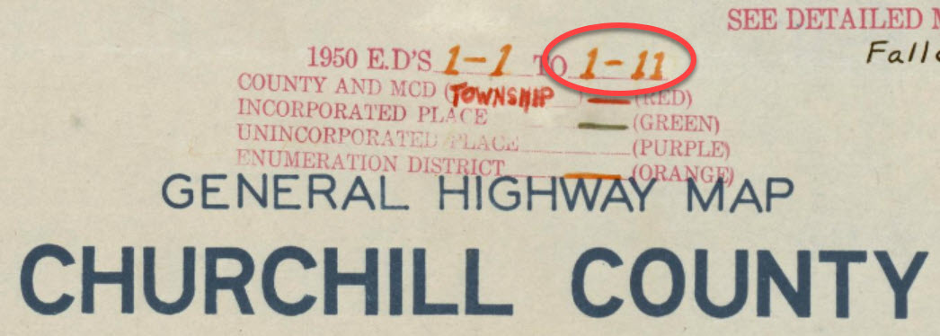
It involved looking at the various cities that we were going to support. We needed to have a list of all the streets in that city, and the EDS that each street pass through. And we did that by looking at the ED maps and using other tools as well.
Working with Joel Weintraub, we’ve had our team about 60 volunteers over the years. They weren’t all working at once, but in total, we had about 60 volunteers.
We set our sights a little higher for 1950 than for preceding years. I forget what the criteria was. But for 1950 we wanted to get every rural area that had a population of more than 5000. And we have succeeded in doing that.
So, we have all those cities index on the One-Step website. You can search any of those cities, by streets. Giving the streets and cross streets, you can get down to the enumeration district.
07:05
Lisa: Oh, that is fantastic!
You know, I just did a video (How to Find Old Rural Addresses on a Map) where we talked about how to take these rural addresses and using your tools, trying to help people figure out where their rural ancestors once lived.
I didn’t realize that there were so many people involved in creating the website. Is the National Archives pretty cooperative and kind of helping you gain access ahead of time?
07:36
Steve: No, we don’t have any access to the National Archives. We’ve had some questions from them. They’ve been very tight-lipped with the 1950 census. They’re keeping it very secret. Of course, the census pages are secretive, but even getting information as to how the census is organized or what have you. We’ve not been able to get much information out of them. We had a lot of cooperation with the 1940 census, but not so much with the census.
08:01
Lisa: Okay, interesting.
How to Find Enumeration District (ED) Numbers in One-Step
Well, we’ve talked a lot here on the Genealogy Gems channel about enumeration districts, or Eds, and the ED maps. But I would love to hear it from the one step man himself, how do we go about finding ED numbers?
08:20
Steve: I have a tool called Finding Enumeration Districts in One-Step. It covers both large cities and rural areas.
For the large cities, use our tool and put in the street. That will give you all the enumeration districts that that street passes through.
Then, you put in the cross streets. That will narrow it down to just those EDs that are common to the street and cross street that you entered. Hopefully you can get down to one ED.
Rural areas are different. We used to have two separate tools, one for large cities and one for rural areas. And that was sort of cumbersome to explain to people, but we had the two different tools. So, I’ve since merged them into one tool with one user interface. (The Unified Census ED Finder)
If you put down the streets in the streets, you’re using it in a large city mode. And there’s a drop-down list of the cities. In the state you select the state. And under City if the city is not on that list, it means we don’t have the tables for that city. So, then you select Other and you type in the name of the of the city. In that case, we’re going to search the ED definitions instead of the street to ED maps. We have the ED definitions, and we search those to see which definitions mentioned the name of that city. And for all of those that are mentioned, we report back. Hopefully there won’t be too many these for a small town. And then you know where to search.
Enumeration District Definitions
How do we give you these ED definitions? Well, the National Archives has them on microfilm, but you can’t go searching on microfilm. So, we’ve had our volunteers actually transcribe all the ED definitions for 1940 and 1950 prior to 1940. For 1940 we did transcribe all the EDs, all the definitions from the microfilm. NARA came to us for 1940 and asked if they could have our transcriptions. They, of course, had the microfilm, but they didn’t have it transcribed. So, we said, ‘sure, absolutely.’ We were glad to give that to them. They haven’t come to us for 1950. I keep saying “yet”, but at this late date, I’m sure they’re not going to. I’m sure they’ve done their own transcriptions.
I haven’t seen their transcriptions. But I’d venture to say that ours are going to be better for the following reason. Since we’re using the transcriptions to search for small towns, and we want to get as many towns in the ED as possible. More Eds than are mentioned in the on the microfilm. So, what Joel has done with the volunteers, is to go through the ED maps and see what other towns are in each ED and add that to the definitions. So, I believe in that case, our ED definitions would be more robust than the ones that the National Archives is going to have on their website.
11:00
Lisa: It sure sounds like it. That’s an amazing undertaking, and what a difference it makes!
Using ED Numbers to Search the Census
So, the genealogist is really going to benefit by knowing the actual address because then they can use the cross streets that you have to really zero in on the exact enumeration district that the address falls within. Please tell folks how that helps when the records are released, and they want to start searching. How do they use that number?
11:33
Steve: Well, of course, we don’t have it up and running yet. But what we plan on doing is, once the census does come out, you would click on the ED number that you just found, and that will take you right to the census pages.
The pages are hosted on some other website, either on NARA’s website, or FamilySearch’s, or one of the large commercial websites whose name I’m not going to mention, because I’m not advertising for them, but you know what I’m talking about.
11:59
Lisa: So how long would that take you? I mean, when the records first get released, and everybody gets access to them? It sounds like kind of a manual job to link up digitized records with the website. Is that going to take a while?
12:16
Steve: You have to know what the structure of their site is, and how you can get onto their site with the ED number.
We’ve been talking with FamilySearch, and they’ve been very cooperative. We’re getting information from them as to how we can link into their site.
So, on opening day, they’ll be very busy ingesting all the material from the National Archives. And so hopefully, we’ll have that information ready before opening day. So, an opening day we can link right into their website. And then at the same time, I’ve also been trying to figure out the structure on the National Archives website and the large commercial website and link into those as well. But we anticipate FamilySearch will be the first one that we will link into.
Enumeration District (ED) Maps
12:58
Lisa: And of course I noticed that right now there are many different kinds of links that do work that are on the website. Tell folks about some of the extra items, the collateral items that they can actually access right now with the links from your website.
13:15
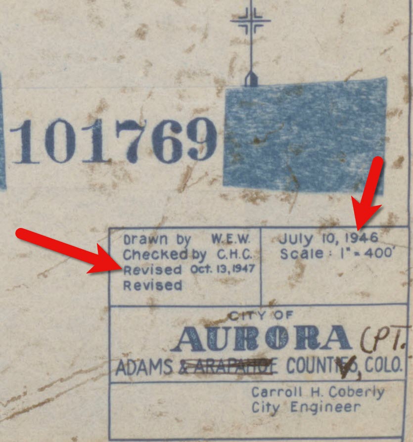
Steve: ED maps sounds like it’d be the best thing if you can get an ED map. Look at the ED map and see what the ED definition is what ED boundaries are so you know exactly what the correct ED is. Problem is the maps are not that easy to use. For one thing, they’re on the National Archives website. But it’s pretty hard to get to them from the National Archives website. You have to go to the catalog on their website, and then type in the correct string that will get you to the ED maps. And it’s not obvious what the string would be. And you can’t really navigate through them by from state to state.
What I’ve done on the One-Step website, is that I put up a tool to get the ED maps from NARA. But you get to it by entering a state and then the county, and then probably a town within the county. Entering all that information will then bring up the maps from NARA for that particular locality. Yes, it’s coming from NARA’s website, but it’s hard to get to from the NARA website. That’s why you can do it in “One-Step.”
14:18
Lisa: Yes, and I can attest to that. It’s much easier and absolutely wonderful to use.
How to Find Census ED Definitions
Maybe this is what you were discussing before, but I came across digitized pages on your website of the book that was describing each enumeration district in more detail. Is that what you were talking about when you mentioned the Census Definitions?
14:41
Steve: Yes, when he’s talking about the definitions, we have a tool that gets you to the microphone definitions. And another tool that gets you to the transcribed definitions. That’s what our volunteers did in transcribing what’s on the microfilm. So, we have tools for doing both of those.
Meaning of Census Occupation Codes
14:57
Lisa: Tell us a little bit about the codes. I know I saw occupational codes. And these are numbers that show up on the census records. If we’re wondering what they mean or the details behind those, your site can help us learn that as well. Tell us about that.
15:17
Steve: Well, for the most part, those codes don’t really tell you that much, although they do in certain cases.
They are codes that were added later by the Census Bureau to group different occupations together so they could get statistics as to how many people did various kinds of work. But you know, what your grandfather’s occupation was, it’s on the census page. So, the code will not tell you anything new, except for the following.
What if you couldn’t read what was written. It’s legible on the original, but on the microfilm copies you might not be able to read the occupation code. But, if you knew the code, you can then look up from the code to see what kind of occupations fell into that code. I have a tool that lets you decode the number that they added.
The census taker wrote down what the person said. The Census Bureau clerk’s later added a code to put people in certain categories. And then the One-Step tool lets you take that code and get back to what the actual occupation was.
You just might be curious to see what the Census Bureau thought about your ancestor if he had an unusual occupation. The example I give in my lectures is Donald Duck. His occupation was he was a trained duck. So, there’s no category “well-trained duck”. So, they had to put him in one of the standard categories. They assigned a number for that occupation. If you then decode that number it says, “hucksters and peddlers”. You now see what the census taker thought about your ancestor’s occupation.
16:59
Lisa: So, are there any other elements of the census or census records that you wish you had more time to work on or that you feel like you would want to add to your website? Or do you really feel like the One-Step webpages has reached the pinnacle of what’s possible with searching these records?
17:20
Steve: I can’t think of anything else. I think if I could, I would have done it.
17:24
Lisa: Exactly!
How to Prepare to Search the 1950 Census
17:27
Steve: With just one month ago (as of this recording), I think we’re in a good position right now. We’re ready to provide the tools that people will need on opening day.
I should mention, people should be using this before opening day to get their ED. They should have a list of the people they want to look up and get their addresses and then get the ED. Don’t leave that for opening day.
On opening day there will be an onslaught. In 2012 for the 1940 census, my website didn’t crash, but the National Archives website did. My website didn’t crash, but it flickered. I typically get between 100 and 250,000 hits a day, which is good considering this is a private website, it’s not a company, that’s a very respectable number. But in 2012, we got two and a quarter million hits! Obviously things have slowed down. So don’t leave it for opening day. Do it now. Get your ducks in a row, get all your ED numbers so on opening day, you can just dive in with the ED number and get right to the census page.
18:31
Lisa: Exactly. And in fact, in the video description for this video, here at the Genealogy Gems YouTube channel, I have some links to a few other videos we have here at the channel to help people get ready. I mean, there is so much that we can do even before the records get released to be prepared and get the most use out of them.
More Uses for the One-Step Webpages Tools
And of course, even after the records get indexed, and are fully searchable, the One-Step tools can still really help us, can’t they? I mean, particularly if you can’t find somebody or you’re just wondering if there are other entries for a person. They can still really prove to be helpful, right?
19:13
Steve: Yeah, even after it is indexed, the Location tools we have will still be very important. I’ll give you several examples as to when you would want to use the Location tools in spite of having a name index.
Your ancestor, your grandfather, came from a foreign country, spoke with a thick foreign accent, and had a long unpronounceable name. Well, the census taker probably got it wrong when he wrote it down. In that case, he had to take his best guess as to what he thinks your ancestor said. And then they had to transcribe all this. Then, another transcriber had to take their best guess as to what he thinks that the census taker wrote down. The census takers’ handwriting were sometimes of questionable quality. So, the chances of getting this right here are less and less. It’s like the game of telephone.
In most cases, you will find your ancestor by doing a name search. But there will be those cases and you’re going to run into them, when no matter how creative you are with the name search, you just won’t be able to find him. You have to do a location search. And that’s where the ED and other location tools come into play.
The other example that I give is when searching by location is useful. Let’s say you just bought a brand-new house and you’re very proud of your house. You want to find out who else lived in this house in prior years. We don’t know the names, but you do know the address. So, you want to find your house in the 1950 census, the 1940 census, 1930 census, and location tools are the only way you can do that.
20:41
Lisa: That’s fascinating. And it’s so true. I remember looking through the 1940 census at my Nikolowski family. The census taker had a hard time spelling Nikolowski but they also got the first name as “Vaulter” because my great grandmother’s saying “Vaulter” (in her accent) not “Walter”. And that’s exactly how he recorded it!
I just want to thank you, on behalf of all genealogists really, for making these kinds of tools available to us. You help us in so many ways be more successful.
More About Steve Morse and One-Step Webpages
We don’t get a chance to talk every day, so while I have you here, I just want people to get to know you. Is there something about you that maybe they don’t know? Or would be interested to know? Perhaps what you do in your spare time when you’re not creating One-Step tools.
21:33
Steve: My hobbies or electronics. My degree is in electrical engineering. It’s really computer science. So, I’ve always loved electricity and electronics, and I play around with that. And I’m a gadgeteer, I build things.
21:48
Lisa: Oh my gosh, well, I can only imagine what’s down in your basement…the kinds of things that you must be coming up with, how interesting!
Steve Morse, thank you so much. I encourage everybody to go visit https://stevemorse.org/. Thank you for being here on the show. It’s been an absolute pleasure!
22:07
Steve: Thank you for having me. It’s been a pleasure speaking to you as well.
Resources
Download the ad-free show notes (Premium Member log in required.
Not a Premium Member? Become a Genealogy Gems Premium Member.