Recently we heard from Gordon in Billings, Montana, U.S.A, who passed on news about historical Norwegian maps online now at their National Map Works. He says:
“I have been enjoying your podcasts for a couple of years now, so I though I would pass on a piece of information that some of your listeners might want to hear about.
I don’t know how many of them do research in Norway like I do but I suspect that most of the ones that do, do not make a habit of reading the Norwegian newspapers. Since my wife was born in Norway, we do read her hometown paper on a regular basis. Just yesterday, that paper, Bergens Tidende, had an article reporting that the “Statens Kartverk” (the National Map Works) has recently digitized and posted on-line 8000 historical maps of Norway. (Click here for the article.)
Unfortunately, the website for the maps has not put a link in their English section yet, but there isn’t much to read beyond place names on the maps anyway. You can view the maps here.
Just choose a county, click the green button, and see a wonderful collection of maps for anyone with ancestors from Norway.”
Thanks for the tip, Gordon! I’ll add this tip of my own: Open the website in Chrome and Chrome will automatically offer to translate the website. Simply click the Translate button, like you’ll see below:
A new project backed by top British scientists is crowd-sourcing space exploration by offering donors the chance to put their DNA on the moon. Their first Kickstarter campaign successfully ends today: over £600,000 has been raised in less than a month!
Lunar Mission One hopes to put a research craft on the “South Pole” end of the moon within ten years. The vessel will drill deep into the rock in an effort to learn more about the moon’s origin and history.
Around 6700 individual pledges were made in this first phase of funding. Those who pledged at a certain amount will receive space in a “digital memory box” that will be sent into space with the research craft, a sort of 21st-century time capsule and digital archive on the moon.
“People will be able to upload whatever they want to their memory box – including personal messages, photos, audio and video,” promises the Lunar Mission One website. “There will also be the option to submit a strand of hair for those who wish to store their DNA for inclusion in the time capsule.”
“The price of the digital memory boxes will be determined by capacity – starting from as little as a few dollars. Most digital information-only purchases are expected to be $10+. Customers who want to combine digital information with a strand of hair, will pay $100+. We are also developing prestige packages ($1,000+) and a lottery option from $1.”
What do you think? It’s not too late to join the fun! According to the Lunar Mission One website, “Following the Kickstarter fundraising, and for the next four years, people will still be able to reserve space in the private archive, through an online portal. This could be for themselves or as a gift. Individuals will be able to get involved in other ways, such as through membership of our Supporters Club.” Learn more at the Lunar Mission One website.
Map of Hollywood, 1928. Online at David Rumsey Historical Map Collection. Click on the map for full citation information.
Pictorial maps are both fun and useful for finding our family history. These use illustrations in addition to regular cartographic images to communicate their messages.
For example, this 1928 map of Hollywood, California, inserts faces of the famous and illustrations of local attractions. But maps like those don’t just exist for popular tourist destinations. And now there are even more pictorial maps online and FREE to use at the David Rumsey Map Collection.
According to a press release, “Over 2,000 pictorial maps and related images have been added…in the form of separate maps, pocket maps, case maps, atlases, manuscript maps, and wall maps.” These include “certain panoramic and birds-eye maps, diagrammatic maps, and timelines.” Pictorial maps were especially popular during the 1920s-1940s, but David Rumsey includes many from the 19th century and before. The collection continues to grow; check back often to look for the maps you want most.
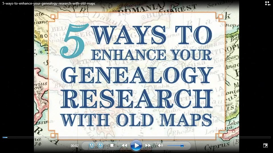
Did you know that I teach an entire video class on using historical maps in genealogy research? I’ve put a free excerpt on the Genealogy Gems YouTube Channel: Using Sanborn Fire Maps for Genealogy and Family History. Watch it below! Genealogy Gems Premium members can watch the full class, which goes in-depth on four MORE types of helpful historical maps, and download the companion handout! (Click here to learn more about Premium membership.)
Imperial Airways Map of Empire & European Air by Laszlo Moholy-Nagy, 1937. Online at DavidRumseyHistoricalMaps.com. Click on the image to see full citation information.
Among more than 15,000 maps and images newly posted at the David Rumsey Map Collection, these caught my eye as particularly useful for family history. Do any of them look relevant to YOUR genealogy?
1. A massive group of German Invasion plans for England, Wales, and Ireland in WWII;
More old home movies are being digitized and more historical footage is coming online. Do you know how to integrate these with your family tree or blog? Wouldn’t it be great to show that you found great-grandpa in four censuses, the SSDI and a 1937 news reel showing him driving his fire truck? (That really did happen to me. Click here to read about it and see the footage.)
Here a few ways you can share your old family footage online:
2. If you have Legacy Republic digitize your old family movies, you can upload them through your Legacy Republic account into your FamilySearch family tree. (Click here to watch a video about how it works.)
3. Add an online video source citation to your Ancestry tree. Create a new source in an ancestor’s individual profile. The Source Citation section asks for any URL related to this citation. Enter the URL. Then it asks whether you have media items to attach. You will be walked through the process of uploading video from your own computer. If you choose the option to record a video, Ancestry will access your computer’s microphone and camera and record you speaking for up to 12 minutes.
Wish you knew more about how making or finding family footage? Learn more here:
Genealogy Gems Premium members can click here to access a Premium podcast and video on how to create your own family history video (learn more about Premium membership here).
Click here to watch Lisa’s free YouTube series about blogging your family history or click here to listen to free Family History Made Easy podcast episodes about genealogy blogging (episodes 38-42).
Learn about finding and using old film footage on YouTube and other websites in the updated-for-2015 2nd edition of The Genealogist’s Google Toolbox (there’s an entire, expanded chapter on YouTube that inspired my own find of that 1937 newsreel).
 Works. He says:
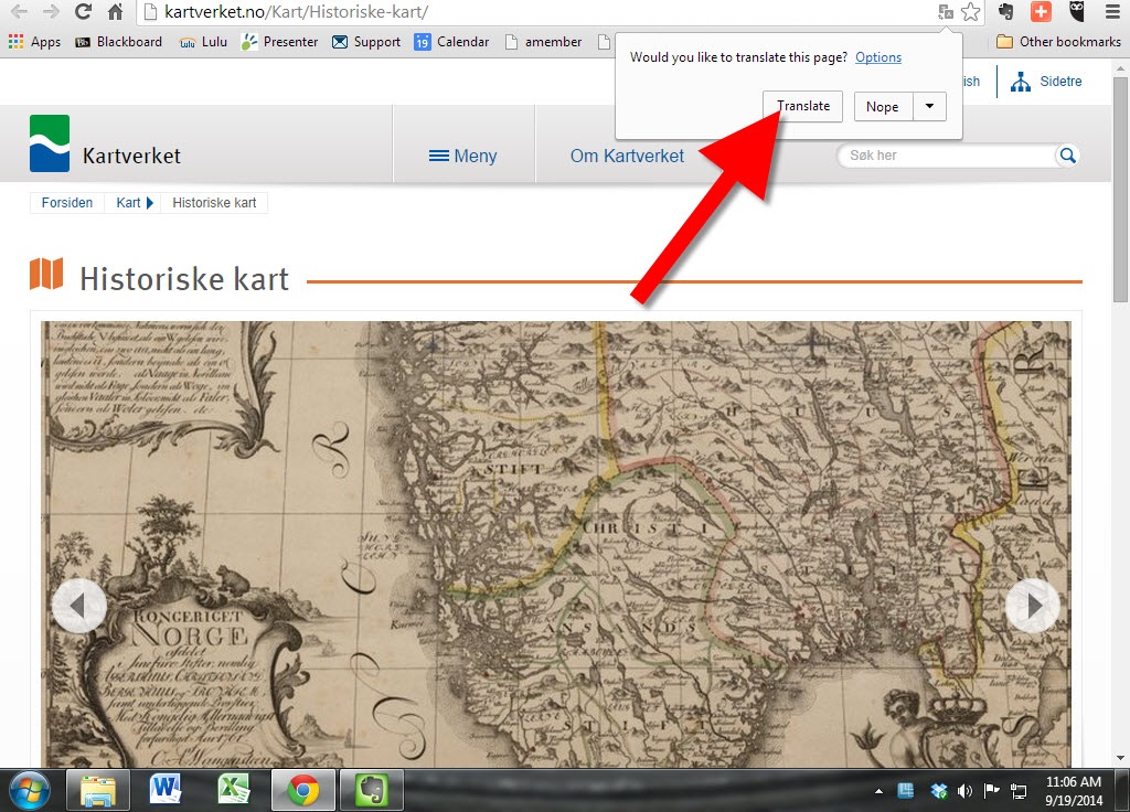
 campaign successfully ends today: over £600,000 has been raised in less than a month!
 Did you know that I teach an entire video class on using historical maps in genealogy research? I’ve put a free excerpt on the