Recently we heard from Gordon in Billings, Montana, U.S.A, who passed on news about historical Norwegian maps online now at their National Map Works. He says:
“I have been enjoying your podcasts for a couple of years now, so I though I would pass on a piece of information that some of your listeners might want to hear about.
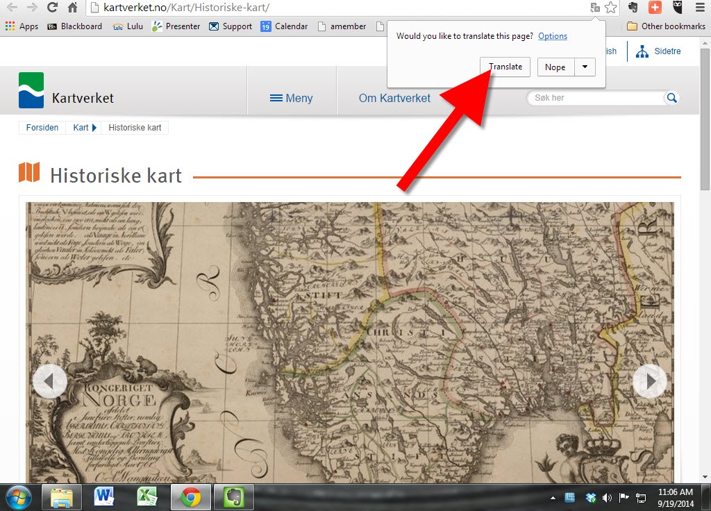
I don’t know how many of them do research in Norway like I do but I suspect that most of the ones that do, do not make a habit of reading the Norwegian newspapers. Since my wife was born in Norway, we do read her hometown paper on a regular basis. Just yesterday, that paper, Bergens Tidende, had an article reporting that the “Statens Kartverk” (the National Map Works) has recently digitized and posted on-line 8000 historical maps of Norway. (Click here for the article.)
Unfortunately, the website for the maps has not put a link in their English section yet, but there isn’t much to read beyond place names on the maps anyway. You can view the maps here.
Just choose a county, click the green button, and see a wonderful collection of maps for anyone with ancestors from Norway.”
Thanks for the tip, Gordon! I’ll add this tip of my own: Open the website in Chrome and Chrome will automatically offer to translate the website. Simply click the Translate button, like you’ll see below:
Matt from Omaha, Nebraska (U.S.) recently told me about a project his cousin is working on that is so cool the story was picked up by U.S.A. Today.
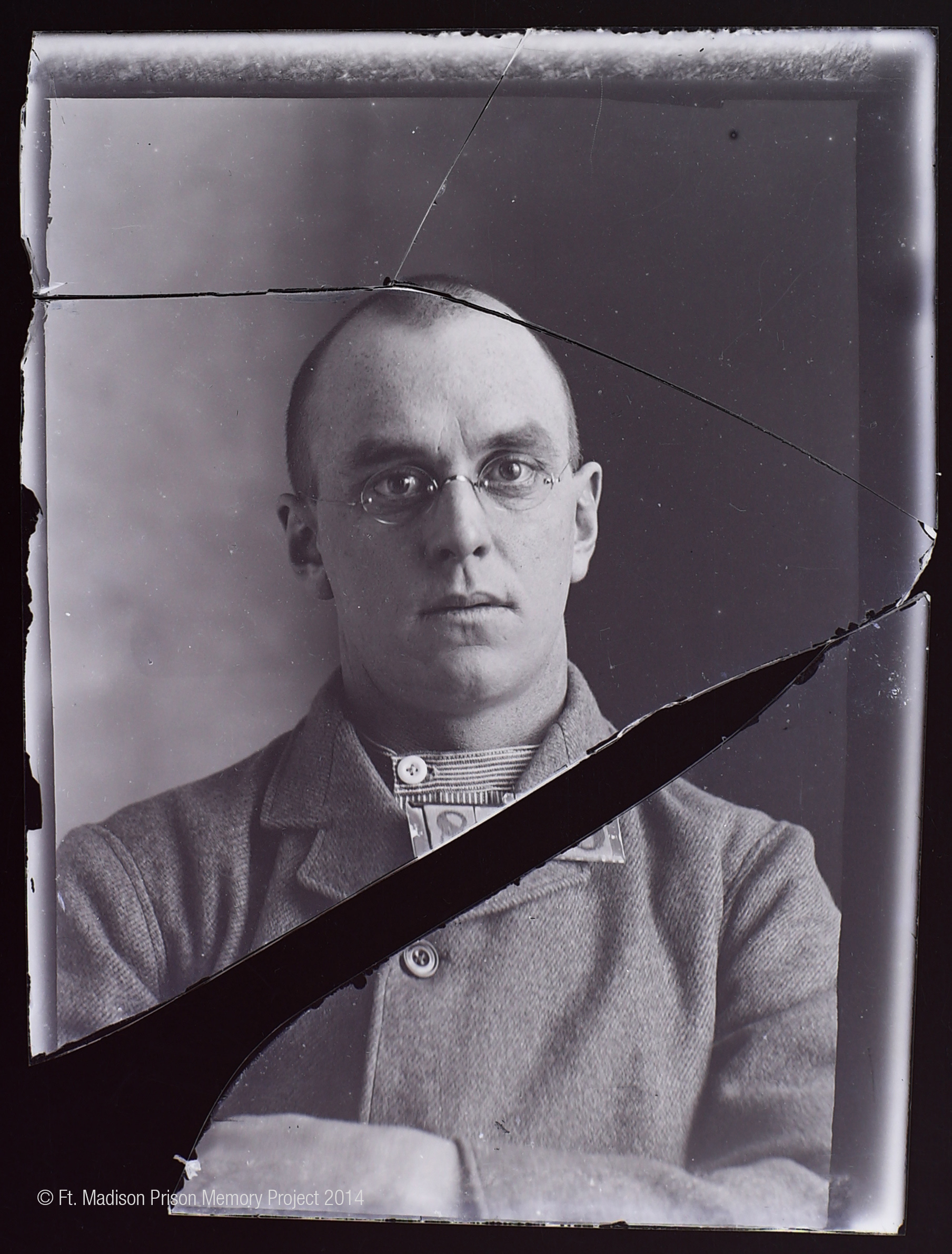
While poking around at an 1800s-era Iowa prison about to be torn down, Mark Fullenkamp came across boxes of old glass negatives. Upon closer inspection, he found they were intake photos of the inmates. Some were 150 years old!
Mark first set out to digitize and reverse the negative images of over 11,000 prison inmate photos. Others gradually became involved, like scholars at University of Iowa where he works and even inmates at the Iowa Correctional Institution for Women. A doctoral candidate who was interviewed by U.S.A. Today says she’s struck by the moment these photos were taken: when their lives were about to change forever. Though many look tough for the camera (and presumably the other inmates), she sees a lot of emotion in their expressions: “The eyes are everything.”
Now Fullekamp’s team is trying to connect names and stories with the photos. It’s not easy, but many of the pictures have inmate numbers on them. Some files have surfaced with inmate numbers and names in them. Others are stepping forward with memories.
Imperial Airways Map of Empire & European Air by Laszlo Moholy-Nagy, 1937. Online at DavidRumseyHistoricalMaps.com. Click on the image to see full citation information.
Among more than 15,000 maps and images newly posted at the David Rumsey Map Collection, these caught my eye as particularly useful for family history. Do any of them look relevant to YOUR genealogy?
1. A massive group of German Invasion plans for England, Wales, and Ireland in WWII;
 Works. He says: