
Stunning Irish Historical Maps and More: New Genealogy Records Online
Digitized Irish historical maps are among new genealogy records online. Also: Irish civil registrations; Irish, British, and Scottish newspapers; Westminster, England Roman Catholic records; wills and probates for Wiltshire, England and, for the U.S., WWI troop transport photos, Tampa (FL) photos, Mayflower descendants, NJ state census 1895, western NY vital records, a NC newspaper, Ohio obituaries, and a Mormon missionary database.
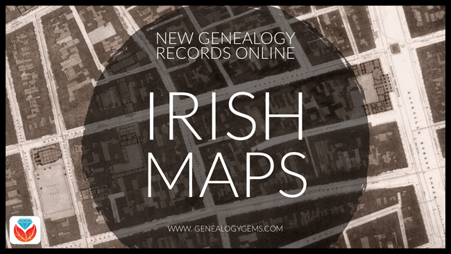
Beautiful Irish historical maps
 Findmypast.com has published two fantastic new Irish historical map collections:
- Dublin City Ordnance Survey Maps created in 1847, during the Great Famine. “This large-scale government map, broken up into numerous sheets, displays the locations of all the streets, buildings, gardens, lanes, barracks, hospitals, churches, and landmarks throughout the city,” states a collection description. “You can even see illustrations of the trees in St Steven’s Green.”
- Ireland, Maps and Surveys 1558-1610. These full-color, beautifully-illustrated maps date from the time of the English settlement of Ulster, Ireland. According to a collection description, the maps “were used to inform the settlers of the locations of rivers, bogs, fortifications, harbors, etc. In some illustrations, you will find drawings of wildlife and even sea monsters. Around the harbors, the cartographers took the time to draw meticulously detailed ships with cannons and sailors. Many of the maps also detailed the names of the numerous Gaelic clans and the lands they owned, for example, O’Hanlan in Armagh, O’Neill in Tyrone, O’Connor in Roscommon, etc.”
(Want to explore these maps? Click on the image above for the free 14-day trial membership from Findmypast.com!)
More Ireland genealogy records
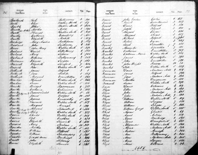
Sample page, Ireland marriage registrations. Image courtesy of FamilySearch.
FamilySearch.org now hosts a free online collection of Ireland Civil Registration records, with births (1864-1913), marriages (1845-1870), and deaths (1864-1870). Images come from original volumes held at the General Register Office. Click here to see a table of what locations and time periods are covered in this database. Note: You can also search free Irish civil registrations at IrishGenealogy.ie.
New at the British Newspaper Archive
The Irish Independent, a new national title for Ireland, is joined in the Archive this week by eight other brand new titles. These include four titles for Scottish counties: Aberdeenshire, Lanarkshire, Angus (Forfanshire) and Wigtownshire. There are also four new papers for England, two of which are from London (Fulham & Hampstead), one for Worcestershire and one for West Yorkshire. Also, significant additions have been made to the British Newspaper Archive’s online coverage for the Brechlin Advertiser (Scotland, added coverage for 1925-1957) and Southend Standard and Essex Weekly Advertiser (added coverage for 1889-1896).
Roman Catholic Records for Westminster, England
Over 121,000 new Roman Catholic parish records for the Diocese of Westminster, England are now available to search on Findmypast.com in their sacramental records collections:
- Parish baptisms. Over 94,000 records. The amount of information in indexed transcripts varies; images may provide additional information such as godparents’ names, officiant, parents’ residence, and sometimes later notes about the baptized person’s marriage.
- Parish marriages. Nearly 9,000 additional Westminster records have been added. Transcripts include couples’ names, marriage information, and father’s names. Original register images may have additional information, such as names of witnesses and degree of relation in cases of nearly-related couples.
- Parish burials. Transcripts include date and place of burial as well as birth year and death; images may have additional information, such as parents’ names and burial or plot details.
- Additional congregational records. More than 16,000 indexed records of confirmations, donations, and other parish records are included here.
London Marriage Licences 1521-1869
Findmypast has published a searchable PDF version of a published volume of thousands of London Marriage Licenses 1521-1869. Search by name, parish, or other keyword. A collection description says, “Records will typically reveal your ancestor’s occupation, marital status, father’s name, previous spouse’s name (if widowed) and corresponding details for their intended spouse.” Note: The full digital text of this book is free to search at Internet Archive.
Wills and Probate Index for Wiltshire, England
Explore more than 130,000 Wiltshire Wills and Probate records in the free Findmypast database, Wiltshire Wills and Probate Index 1530-1881. “Each record consists of a transcript that will reveal your ancestor’s occupation, if they left a will and when they left it,” says a description. “The original Wiltshire wills are held at the Wiltshire and Swindon Archive. The source link in the transcripts will bring you directly to their site where you can view their index and request an image. If you wish to view an image, you will have to contact Wiltshire Council and a small fee may be required for orders by post.”
New records across the United States
WWI: Ancestry.com subscribers may now access a new online collection of photographs of U.S., WWI Troop Transport Ships, 1918-1919. Browse to search by ship name.
Florida. The city of Tampa, Florida has digitized and published two historic photo collections on Hillsborough County Public Library Cooperative Digital Collections:
- The Greater Tampa Chamber of Commerce Collection includes over 30,000 images of Tampa events dating from about 1950 until 1990, and includes many local officials and dignitaries.
- The Tampa Photo Supply Collection includes more than 50,000 images of daily life and special events (weddings, graduations) taken by local commercial photographers between 1940 and 1990, primarily in West Tampa, Ybor City, and South Tampa.
Mayflower descendants. AmericanAncestors.org has published a new database of authenticated Mayflower Pilgrim genealogies: Mayflower Families Fifth Generation Descendants, 1700-1880. The collection includes the carefully-researched names of five generations of Mayflower pilgrim descendants.
New Jersey. The New Jersey State Census of 1895 is now free to search at FamilySearch.org, which also hosts an 1885 New Jersey state census collection. “The state of New Jersey took a state census every 10 years beginning in 1855 and continuing through 1915, says a FamilySearch wiki entry. “The 1885 census is the first to survive in its entirety.” Click here to learn more about state censuses in the United States.
New York. Ancestry.com has published a searchable version of a genealogy reference book, 10,000 Vital Records of Western New York, 1809-1850. According to a collection description, “The 10,000 vital records in this work were drawn from the marriage and death columns of five western New York newspapers published before 1850….Birth announcements were not published in these early newspapers, but many of the marriage and death notices mentioned birth years, birthplaces, and parents’ names, and where appropriate such data has been copied off and recorded here.”
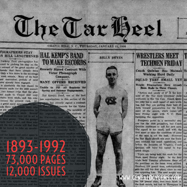
North Carolina. The first 100 years of the Daily Tar Heel newspaper are now free to search in digitized format at the North Carolina Digital Heritage Center. The collection spans 1893-1992 and includes over 73,000 pages from more than 12,000 issues. Click here for a related news article.
Ohio. FamilySearch also now hosts an index to Ohio, Crawford County Obituaries, 1860-2004, originally supplied by the county genealogical society. Obituaries may be searched or browsed; images may include additional newspaper articles (not just obituaries).
Utah and beyond (Latter-day Saint). The Church of Jesus Christ of Latter-day Saints (Mormons) has published a database of early missionaries. It covers about 40,000 men and women who served between 1830 and 1930, and may link to items from their personal files, including mission registry entries, letters of acceptance, mission journal entries, and photos. Those who are part of FamilySearch’s free global Family Tree will automatically be notified about relatives who appear in this database, and may use a special tool to see how they are related. Others may access the original database here. Click here to read a related news article.
Keep up with new and updated genealogy records online by subscribing to our free weekly email newsletter!

Disclosure: This post contains affiliate links and Genealogy Gems will be compensated if you make a purchase after clicking on these links. Thank you for supporting Genealogy Gems!
A Blizzard of New and Updated Genealogical Records
It’s snowing like crazy in some parts of the U.S. this week and it’s blown up a blizzard of great new and updated genealogical record collections! Take a look at this week’s round-up for Bishop’s Transcripts in England, Veteran Memorials in New Zealand, and records for Peru, United States, and Canada.
England – Devon – Bishop’s Transcripts
England, Devon Bishop’s Transcripts, 1558-1887 is a collection found at FamilySearch. Though a rather small collection, these Bishop’s transcripts contain an index from the county of Devon and cover the years of 1558-1887. Availability of records will vary by year and locality.
Starting in 1598, parish priests were to make a copy of their parish register and send it to the archdeacon or bishop each year. Many priests stopped producing bishop’s transcripts with the beginning of civil registration in 1837, but they did not fully disappear until after 1870.
As bishop’s transcripts generally contain more or less the same information as parish registers, they are particularly valuable when parish records have been damaged, destroyed, or lost. However, because bishop’s transcripts are copies of the original records, they are more likely to contain errors than parish registers might be.
This collection refers to baptism, marriage, and burial records. Baptism record entries are the most common in the index, followed by burial records, with marriage records being the smallest portion.
England – Worcestershire – Probate Records
The Worcestershire Probate Index 1660-1858 at Findmypast contains over 51,000 records taken from four types of probate documents. Each record includes a transcript only, however the transcript may include some or all of the following information:
- First and last name(s)
- Sex
- Date
- Occupation
- Place
- County
- Country
- Document type
England – Buckinghamshire – Marriages
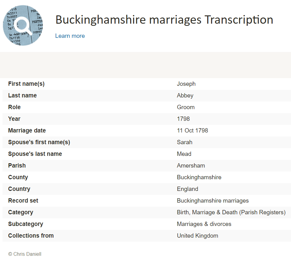
The Findmypast collection titled Buckinghamshire Marriages contains over 49,000 records. The collection consists of transcripts covering 26 parishes within the English county of Buckinghamshire. These transcripts will cover the years between 1538 and 1838. Here is the list of parishes and years covered within this collection:
- Amersham 1561-1812
- Aston Clinton 1560-1812
- Bradenham 1627-1810
- Chalfont St Giles 1584-1812
- Chalfont St Peter 1538-1812
- Cheddington 1552-1812
- Chenies 1593-1836
- Chesham 1637-1838
- Cholesbury 1576-1810
- Edlesborough 1568-1812
- Fingest 1607-1812
- Hawridge 1600-1812
- Hedgerley 1540-1811
- High Wycombe 1600-1812
- Hormead 1575-1813
- Instone 1665-1812
- Iver 1605-1812
- Ivinghoe 1559-1812
- Masworth 1591-1812
- Mentmore 1575-1812
- Pitstone 1576-1812
- Slapton 1653-1812
- Soulbury 1575-1812
- Stoke Poges 1563-1812
- Turville 1582-1812
- Wendover 1576-1812
New Zealand – Church Records, Veteran Memorials, and Civil Service Examinations
Three new databases for New Zealand are available at Findmypast. The first, New Zealand Officiating Ministers 1882 is an index containing over 600 records and covering 13 religious denominations. Each record includes a transcript that will reveal the officiator’s official title and the church they served.
The second collection titled, New Zealand Waikaraka Cemetery Memorial 1902-1940 will help you find out if you have military ancestors who were memorialized as veterans who fought for the Empire and died at the Auckland Veterans’ Home between 1902 and 1940. Each record includes a transcript that will list their birth year, death year, age at death and force or regiment.
Lastly, the final collection at Findmypast is the New Zealand Civil Service Examinations 1906-1907. More than 700 records are available to explore and uncover the details of those who sat for the annual examinations for admission to, or promotion in, the Civil Service in mid-December 1906 and mid-January 1907. This collection is of transcripts only, but may contain the following information:
- First and last name(s)
- Examination location
- Notes
Peru – Puno – Civil Registration
Also at FamilySearch this week, Peru, Puno, Civil Registration, 1890-2005 has been updated. This collection includes births, marriages, deaths, and indexes. Some of these records have been indexed and are available for search. It should be noted that these records are written in Spanish.
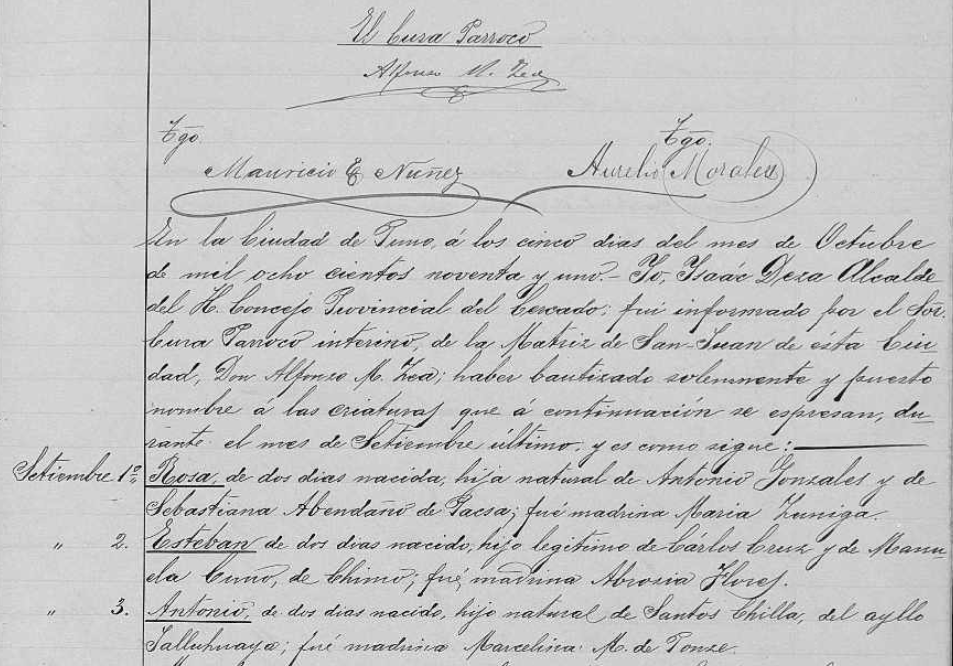
Civil registration record for a birth in Peru via FamilySearch.org.
Within these records you may find any of the following helpful information:
Birth records:
- Date and place of registration
- Name and gender of child
- Date, time, and place of birth
- Legitimacy
- Religious affiliation
- Parents’ names, ages, origin, and residence
- Presenter’s name, age, civil status, occupation, origin, and residence
- Witnesses’ name, age, civil status, and residence
- Sometimes, grandparents’ names
Marriage records may include the following:
- Date and place of registration
- Names of the bride and groom
- Date and place of marriage
- Groom’s age, civil status, nationality, race and occupation
- Names of groom’s parents, origin, and residence
- Bride’s age, civil status, nationality, race, and occupation
- Names of bride’s parents, origin, and residence
- Bride and groom’s religious affiliation
- Names, residence, and ages of witnesses
Death records may include:
- Time, date, and place of registration
- Name, gender, and age of the deceased
- Cause of death
- Date, place, and time of death
- Civil status, and occupation of deceased
- Nationality, origin, and residence of deceased
- Parents’ names of deceased if a minor
- Presenter’s name, age , and occupation
- Presenter’s origin, nationality, and residence
- Names of witnesses
United States – California – Cemetery Transcriptions
California Cemetery Transcriptions, 1850-1960 is a small collection at FamilySearch, but keep an eye on it as it will likely be added too. The collection consists of abstracts from cemeteries for 1850-1960 in the following counties:
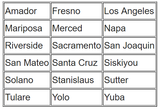
You can do a search for your targeted ancestor, or you can browse through the collection. To browse through any of the FamilySearch collections, you can read our article here and follow the step-by-step instructions.
Cemetery abstracts are actually quite useful to genealogists, especially if there has been a loss of death records in the targeted area.
Cemetery abstracts may contain the following information:
- Name of Cemetery
- Location (Town, County, State)
- Full name of deceased
- Lot number
- Age
- Date of Death
- Place of Death
- Names of Parents, Husband or Wife
- Other Important Facts
- Place of Birth
- Date of Birth
WWII Veterans – Interviews
We have found a free collection of oral histories and interviews of WWII veterans from around the world. Chronicles of Courage: Stories of Wartime and Innovation is an online video archive of in-depth interviews put together by the Flying Heritage Collection. The project, which took 15 years to complete, went live Wednesday on the 75th anniversary of Pearl Harbor. All 335 video interviews — some of which are two hours long — will be available on the Flying Heritage Collection’s website at www.flyingheritage.com/chronicles.
Another free collection includes eyewitness accounts by U.S. military personnel and family members in Pearl Harbor at the time of Japan’s 1941 attack. You can now access this site online. The Pearl Harbor Archive (http://1941.mapping.jp/), also carries photos of U.S. warships ablaze and sinking. The interactive website material was gathered by Katrina Luksovsky, 49, an American living on Ford Island in the center of the harbor. The website was created by Hidenori Watanabe, 42, an associate professor of network design at Tokyo Metropolitan University.
The website works similar to Google Earth and is really quite remarkable. If you are a WWII buff, this is right up your alley!
Canada
The Canadian Museum of History and Library and Archives Canada collaborate on new exhibition gallery. This gallery is named Treasures from LAC and will showcase some of Canada’s most historically significant documents, making them more accessible to Canadians and enhancing public understanding of Canada’s history and heritage. Many of the documents showcased in the gallery will be referenced in the Canadian History Hall, a new permanent exhibition opening July 1, 2017 at the Canadian Museum of History. The LAC documents will complement the Hall and add greatly to the visitor experience.
Hire a Professional at LegacyTree
If you don’t have time to scour these records yourself, why not hire a profession al? The team of expert genealogists at Legacy Tree Genealogists can help bust through your brick walls! They do the research and you enjoy the discoveries!
al? The team of expert genealogists at Legacy Tree Genealogists can help bust through your brick walls! They do the research and you enjoy the discoveries!