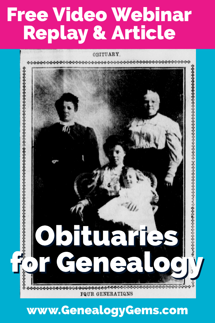
This week in Elevenses with Lisa episode 73 we are talking obituaries and the important role they can play in your genealogy. Obituaries can reveal a lot of really interesting and helpful information about your ancestors! My guest is Shannon Combs-Bennett, the author of the article A Genealogist’s Guide to Finding and Using Historical Obituaries published in Family Tree Magazine.
Episode 73
In Elevenses with Lisa episode 73 Lisa Louise Cooke and Shannon Combs-Bennett will discuss:
The backstory on obituaries (which is vital to understand about any genealogical record)
what they can tell you about your ancestors
where you can find them both online and offline
and strategies you can use when they aren’t where you expected to find them.
Episode 73 Show Notes
(Please note: This interview transcription has been minimally altered for ease of reading and clarity.)
Lisa: I think of obituaries as being such a cornerstone of the work that we do. It’s often one of the first places people start, right?
Shannon: Yeah, it is, they’re pretty accessible for most people. Sometimes you have to dig a little deeper, though the further back in time you go. But they seem to be one of the basic, I guess you could call staples, bread and butter type documents that genealogists try to find.
Type of Death Records Found in Newspapers
(01:28) Lisa: Exactly. And we typically find them in newspapers. So, I’d love to start there. Because obituaries are not the only kind of death record we’re finding in newspapers, right?
Shannon: There are actually several different types of death records published in a newspaper.
Obituaries Of course the obituaries, which are the most common.
Funeral Announcements You can also have funeral announcements. So, you might not get the obituary, but maybe you can find the announcement that this funeral home is servicing this family or that this wake will occur at such and such place, or the religious ceremony will occur at this church with graveside services.
Card of Thanks In addition to that, you sometimes can find what were called for a long time card of thanks where families would put articles in the newspaper, essentially, in the advertisement and personal sections, thanking people for coming and participating in the service of their loved one.
So, there’s a wide variety of different types of information. And if you don’t know it’s there, you don’t know to go look for it.
Coroner Inquests
Lisa: Exactly. I remember I was doing some newspaper research in the British Newspaper Archives, from my husband’s family. I didn’t find a death notice, but there was an entire coroner’s inquest published in the newspaper! And I didn’t realize that we could find something like that. So, it’s wonderful to see the depth of the kinds of information that surround the death of a person that could be found in newspapers.
Shannon: And those aren’t as common here in the United States. But if your loved one died in a larger city, you can sometimes find (coroner inquests) in the newspapers. I was doing some research and found in from San Francisco, and they have published books of coroner’s inquests, so they’re not in newspapers, but the announcement was in the newspaper that there was an inquest. Then I was able to go to the library and thankfully they were all digitized. I found them online where I would find all sorts of information about the person, their family, the circumstances of their death. And if you’re doing family medical histories, sometimes those can be real gold mines.
The History of Obituaries
(4:03) Lisa: So, let’s take a moment and talk about the history of obituaries. Because, as you know, when we understand the history of any kind of genealogical record, then we do a lot better job of utilizing it. Please give us a little bit of a background story on obituaries. How long have they been around?
Colonial Times Shannon: You can find obituaries in even some of the earliest colonial newspapers here in the United States. Sometimes they were passing through an area and died. Or you might see information that someone had died abroad and there might be a little note in the newspaper.
Early 19th Century In the early 1800s you can see themes developing around newspaper obituaries. (And sometimes if it was a very important person to the community you’ll be more than likely to find it.) These early newspaper obituaries don’t always have a lot of family information, but you’ll find all sorts of virtuous prose written about them where they were talking about how godly and worthy they were and those types of things.
Then the obituary started to morph and actually became a part of the personal and advertisement section of the newspaper. So, one reason you may not find information in an obituary for your ancestor is because your family didn’t have the money to pay for the obituary to put be put in. And then if they weren’t a real prominent person, they wouldn’t get the prime real estate in the actual reading sections. So, yeah, if your family were on the poor side, you might not find anything about them, unfortunately.
20th Century (06:06) And then, as the 20th century came in these started to evolve from a celebration of death to a celebration of people’s accomplishments. You start finding late 1800s into the early 20th century is how the obituary as we know it today started to evolve. It went from maybe one or two lines about a person dying to three and four paragraphs about them, their families, especially if they had, you been a pensioner or veteran, or a pioneer of a town, the early 20th century saw a lot of those people who had really struck it out west for their fame and fortune start passing away in those towns. Sometimes you would even find the obituary, not only in the place where they died, but in their hometowns back further to the east. You might find obituaries, especially for those pioneering folk you could call them, back where they came from.
Lisa: That’s a great point. And that’s really kind of a nice newspaper research tip that expands beyond obituaries. It’s that idea that people often started back east, but then relocated out west, and particularly with the telegraph coming into play, they could send that article back to where they came from and get it to all those people who would be interested to know whatever happened to that person.
Shannon: Right.
21st Century Now in the 21st century we’re moving more and more away from print newspapers for the obituaries. We’re going to almost completely digital newspapers for the obituaries and digital obituary sites. I’ve had several of my close family members in the last 10 years who have passed away, and the funeral homes are offering to put obituaries on their websites. And when my mother passed away, I was speaking with the funeral home director, and they had kept records. This was in Texas. And they had records going back several decades with written obituaries that, if you called the funeral home, you could see if they had one written up. It was not even necessary published in the paper, because the family couldn’t afford it. But the funeral home had it.
Lisa: How interesting!
It really drives home the point that you’ve got to know what kind of timeframe you’re looking at right to see what you can find and where you’d expect to find it.
Obituaries in Small vs. Large Cities
(08:48) I would imagine it’s true that in small towns, you might be more likely to find obituaries then perhaps let’s say in Chicago.
Shannon: Yeah, because you know, everybody knows everybody, in a small hometown. Those would be more likely to have the longer, more in depth information written about a person talking about their family, and where they came from, what they did, if they were the pillar of a community, or even just a local farmer.
And then in the cities, unless you were a prominent citizen, that’s where you’re more than likely to find a paragraph or less, maybe only even a few sentences: first and last name, age, died on this date, and maybe that’s all you get, unfortunately.
Where to Find Obituaries in Old Newspapers
(09:39) Lisa: Let’s talk about where to find these Historical Newspapers. Where do we start?
Shannon: Okay. Well, there are a lot of different newspapers online.
Chronicling America at the Library of Congress Of course, the Library of Congress Chronicling America is a great start. See if they have one of the local newspapers for the place that you’re researching for the timeframe your ancestors were there. Start there because it’s free – you got to start with the free resources first.
FamilySearch Family search also has a free obituary, historical obituary site that you can search. (Ed. Note: this link will take you to a resource page at the FamilySearch Wiki which includes many links to sources for obituaries.)
And then you can move into the paid / subscription websites such as:
(Disclosure: Thank you for using these affiliate links. We will be compensated if you make a purchase and that helps support this content which we make available for free.)
(Ed. Note: Of course there are many other websites featuring obituaries, and some are niche websites unique to their location. Google searching can help you locate these resources. Learn more about my strategies for strategic googling here.)
Obituaries at Libraries
(10:36) Sometimes you can also contact the local library for the place the person had died. I’m originally from Indiana, and I’ve had good luck calling around to the various county libraries. Unfortunately, they don’t have a lot of the newspapers digitized. But for a small fee, they were willing to send me a photocopy. And in some cases, now I can get email PDFs for a few dollars. I like to support the local library, so I’m okay with doing that. Because our local libraries need a lot of support.
Don’t give up if you can’t find it digitized, is what I’m trying to say. There’s a lot of information to be found, and there are a lot of places out there, especially for older newspapers. Be resourceful I guess you could say.
Obituary Indexes
(11:29) Lisa: You talked about online indexes. So sometimes we don’t get the actual obit but we could get enough information out of the index that we could then go track it down in person.
Shannon: Yeah, that’s very true. I’ve used those several times. One of the links that is in the article is to the Dayton, Ohio index. And you can put in as much information as you know. Sometimes I find it’s easier to start with a little bit of information, and then sort through and add details to weed through the large number. But all it will give you is the person’s name and the date of publication, so not even the date of death (so you know it’s somewhere in that timeframe) and then the page, issue, column number so that you can contact the Dayton Public Library, and they can help get you the paper. And a lot of the libraries are like that.
Obituary Search Strategies
(12:29) Lisa: When you do online searches for obituaries, do you tend to just go straight in and do a search on the name? Or do you go into the card catalog and find newspaper and obituary collections first and then try to search? Do you have any special tactics that you use to try to make sure you’re successful?
Shannon: That’s actually a really great question. It depends. If I have a really unique name and I am pretty sure of the location, maybe timeframe of the death, sometimes I’ll just start looking for that person. Especially like I said, if it’s a really unique name.
Unique Names I had an ancestor named Bathsheba Kelly. I’m thinking there’s not many people named Bathsheba. So I was pretty confident maybe if I just started looking for her by name and the timeframe she died in Ohio, we’d be good to go.
Other times, yeah, I first want to narrow it down by collection because you don’t want to just go searching willy nilly, right? That’s going to waste a lot of time. Try to find like a five year, maybe a 10 year span. If you’re not quite sure, having a timeframe will help weed them down.
Common Names If it’s a common name, you need to add in a lot more. Maybe those advanced searches. It may take you going town by town, or year by year as you go wading through all the names.
Indexes If there is an index for the database I do like to use those first because that can help weed out a lot of information right off the bat.
Printing Print it out, write it down, keep it on a separate browser tab or whatever you need to do so that you can methodically keep track of your search. That can really help. Don’t give up!
Obituary Publishing Timeframes
(14:54) Lisa: I know I had an experience once where I was searching a weekly newspaper in California on microfilm, and I knew that obituaries were always on page seven, because I’ve just had been through so many issues of this particular newspaper. I looked at the obituary column in the next issue following the death of my great grandfather, and he wasn’t there. And I was like, What? I looked at the next week and he wasn’t there, and I went back a week. I wondered if maybe I got the date wrong. It turned out his obituary was on the front page! And that goes back to us saying that some people were kind of considered the pioneer of their town, even though in the family, he wasn’t Mr. Celebrity or anything, but he was revered for that. And they had him on the front page.
I’d love to have you touch on when you don’t see them where you think you’re going to see them. And what’s the timing of when we could expect to see their obituary published? And do you have any other tips on when they’re not where you think they’ll be? What are the kinds of places within the paper where you tend to find these kinds of articles?
Shannon: Yeah, that’s actually a really good question. Again, it depends. Like you said, even if you don’t think that your family member was someone famous, if you’re not finding the obituary where you expect to find it, try going through the newspaper cover to cover.
Sometimes if your ancestor died in mysterious circumstances, there might not be an obituary, but there might be an article about a court case. So that’s always a good thing to know. Because those death records, especially if it was salacious gossip, is going to turn up somewhere.
Lisa: It’s newsworthy.
Shannon: That’s right. If it’s newsworthy, it’s going to be in there.
Where Obituaries are Located in a Newspaper
(16:46) I was recently doing some research on professional genealogists. I wanted to find out when genealogists became a profession here in the United States. I figured if an obituary of a professional genealogist told me they were 80 years old and when they died, then I can kind of backtrack to when, they started became a professional. I did not find these obituaries in the late 1800s where I thought they should be. Sometimes they were in the Personal section. Sometimes they were in the miscellaneous advertisement section. But then once again, it goes back to somebody had to pay the newspaper to put this in it. So, they wouldn’t be in these larger newspapers. I was looking at like the New York Times, The Hartford newspaper, the Boston Globe, The Washington Post, and the Chicago Tribune. I wasn’t finding these obituary pages for them. I was finding obituaries in the Personal section, which kind of threw me for a loop a little bit.
Lisa: You kind of have to follow the money, right?
Shannon: Yeah.
Lisa: It’s so interesting that you’re talking about the history of genealogists, because I remember, quite a few years ago, I went to the census records. I started searching on genealogist as an occupation or the industry. That’s really interesting too to see who was doing it 100 years ago.
Obituaries were not always published the very next week after a person’s death, right?
Shannon: Right. A lot of people think that they are. I guess 1) it depends on the religion and the culture that you’re looking at – what was done in that time frame. Or 2) it depends on the place. This might sound kind of odd to some of us who don’t live in really cold places, but when the ground freezes in our northern most states sometimes you wouldn’t be able to bury somebody until the next spring. And, and you may have a death notice when they died, but then a full obituary for when the service and the burial took place. So sometimes you may have several months gap in between when they died, and when information was published about them in the newspaper.
The other thing maybe, especially if they were in business, or if they traveled, or if they were in the military, they could have died abroad. So, you’re only going to hear the information see the death notice or the obituary when the ship lands.
Information Found in Obituaries
(20:00) Lisa: Before I let you go, I’d love to have you talk about the Obituary Fast Facts section in your article. What are some of the interesting facts and little bits that you want to share with us?
Shannon: Sure! Well, some of the things that you can find in an obituary can be surprising. As genealogists, we want to find all the family information we can. We want to know when they were born, who their parents were, if possible, family members, that type of thing. But other things that you can find in obituaries are :
Employment Information employment information, which can then give you clues as to where else they might have been.
Migration Information If they were a migrant, to that area, it can give you information, you know, where they originated from. If they immigrated to the Untied States, sometimes they list that they landed at the port of Philadelphia, or New York, or New Orleans, or wherever. And that can help lead information for passenger lists and future information.
Associated People But most importantly, people who are listed in the obituary have to be somebody known to the deceased person, either a friend or a family, or a close acquaintance. I want to encourage people to not forget those associate people and collateral lines, because you might be able to find information about your ancestor while researching them.
Lisa: Great point!
About Shannon Combs-Bennett
(21:30) Shannon, tell folks a little bit more about yourself and what you do.
Shannon: I’m an author, lecturer, and an educator, full time student – a perpetual student is what my father would call me. You can find me at my blog, which is Trials and Tribulations of a Self-Taught Family Historian. You can also find me on Facebook and LinkedIn and on Twitter, I’m not I’m not on Twitter as much as I used to be. I’ve spoken all across the United States. I’ve even spoken internationally in Scotland and in France for the Heraldic and Genealogical Congress. But I think that’s because I come from a background of teachers. I love educating, writing, lecturing and helping people learn more information about their pasts and about who they are and who their families were. It doesn’t hurt that my undergraduate degree was in human genetics. So sometimes I can throw a little bit of that DNA in there.
Do you have a question about using obituaries for genealogy? Have you found something fascinating in an obituary? Tell us about it in the Comments below:
New archival collections at your favorite repository may be the long-awaited key to solving your family history mysteries! But how can you keep up with what’s new at archives and libraries? Professional archivist Melissa Barker shares her favorite tips.
Not long ago, Lisa Louise Cooke read my article on what’s new at the Utah State Archives. She asked me how I keep up with new archival collections at my favorite repositories.
New Archival Collections May Be Just What We Need
Many of us can say that our ancestors were living in a certain area and their records should be located at certain local archives, libraries, or genealogical or historical societies. Maybe we have even done research there in the past, either by visiting the facility, contacting them by phone or email, or using their records online. Records, photographs, ephemera, and artifacts are constantly being discovered and made available in all of our wonderful archives. Many of these records may not make it to microfilm or online, but they are so rich with family information. (Don’t know where to look? Click here to learn how to find archives and libraries near your ancestor’s locale.)
But trying to keep up with all the new records that are being processed in archives, libraries, and genealogical societies can make your head spin! So how are genealogists supposed to stay current?
3 Ways to Keep Up with New Archival Collections
1. Check the archives website. See if they have announced new records collections that are available for research (many archives do). The archives may even have a blog or newsletter that you can subscribe to, which will give you the latest news right at your fingertips. Not only will the archives announce new records that are available but they will even let their patrons know what has been recently donated to the archives and which records are currently being processed.
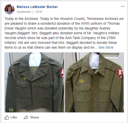
2. See if the archive has a social media presence. Archives like to post photos of new discoveries and records collections that are ready for the researcher. I know at the Houston County, TN. Archives I like to scan and post images of great documents or artifacts to Facebook, Twitter, Instagram, and Pinterest. (Like the post pictured here that I shared recently.)
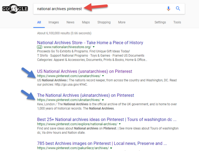
LISA’S TIP: Remember to use Google search terms to find your favorite archive’s website and social media homes! A quick search such as National Archives Pinterest might be faster than trying to find it on the actual social media site. That search brings up tempting boards for National Archives in both the US and the UK:
3. When visiting an archive, ask: “What’s new?” Talk to archivists about records collections that have recently been processed and made available for research. This is a great way to find more information and records about your ancestors. As an archivist who processes records on a daily basis that are not online or even microfilmed, I get excited about sharing what I find with the genealogy community.
Until next time, this is The Archive Lady, remember it’s not all online, so contact or visit an archive today!
Learn More about Using Archival Collections
Listen to me on the free Genealogy Gems Podcast! This year the podcast is celebrating its 10th-year anniversary. Tune in to hear more inspiring stories and tips to help your family history research. Listen on your computer or on your mobile device through the Genealogy Gems app. Click here to learn more.
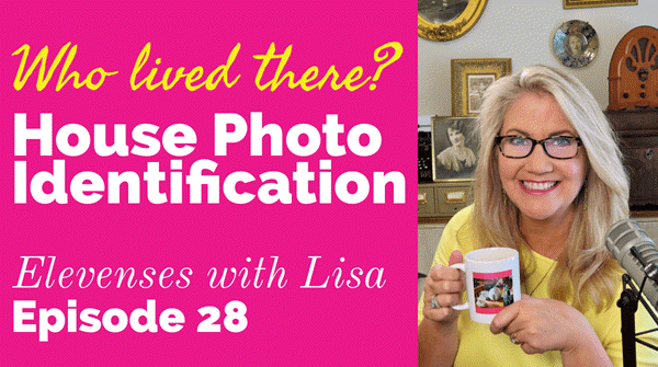
Original air date: 10/8/20 Join me for Elevenses with Lisa, the online video series where we take a break, visit and learn about genealogy and family history.
In this episode we’re going to take many of the things we’ve learned in past episode of Elevenses with Lisa and apply them to one of your genealogical problems. My goal isn’t to find the answer myself, but rather to provide a toolbox of strategies that you can use to experience the joy of the discovery yourself when researching a home or location, as well as in a wide variety of other genealogical situations! Keep reading for notes that accompany this episode.
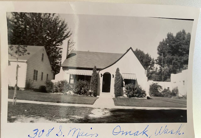
Cynthia Owens is a regular viewer and participant in the Live chat each week during Elevenses with Lisa. She emailed this photo and wrote “This picture was with my mother’s belongings…photo of a house in Omak, Okanogan, Washington with only an address written on it. 308 S. Main, Omak, WA. I have hundreds of photo’s (B & W) that have no information on them and a lot of people who I don’t know. I have a gold mine and no idea how to mine it.”
The house photo in Cynthia’s family collection.
Cynthia said that so far she has found the names of the last two owners in county records and some directories. She also determined that the house was built in 1928. She writes, “I have a lot of family on both sides of my parents who could have owned it.”
Formulate Your Research Question
The research question in this case boils down to: Who owned the home at 308 S. Main, Omak, WA in the 1930s?
Compile Known Family Names
We start by compiling a list of family surnames that we will be on the lookout for. These are families who are known to have lived in Washington state during that time frame.
Cynthia’s mother’s family names:
Woodhead
Patience
Cynthia’s father’s family names:
Tucker
Stubbs
Tonks
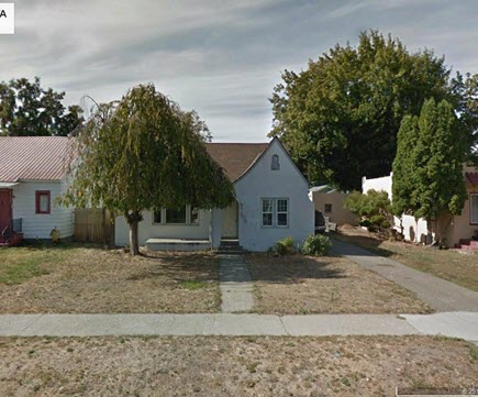
Answer the Question Does the house still exist today?
To answer this question, we turn to the free Google Earth Pro software. By simply searching the for the address and using Street View we are able to determine that yes, it is. Google Earth also allows us to obtain a high-quality image.
The house in Google Earth’s Street View today.
Google for Land Records
I conducted a simple Google search: Okanogan County Land Records
The results:
The Central Regional Branch of the Washington State Archives
“The Central Regional Branch provides archival and records management services to local government agencies throughout Benton, Chelan, Douglas, Franklin, Grant, Kittitas, Klickitat, Okanogan, and Yakima counties.”
Special Guest: Kathy Nielsen, Librarian Kathy Nielsen is a reference librarian and an educator. She has a masters degree in History and in Library Science. Kathy is currently a popular genealogy speaker on California’s Monterey Peninsula. She incorporates her skills as an historian, a storyteller and a librarian in her search for her family’s history. Kathy Nielsen stopped by to offer suggestions on obtaining land records. Watch Elevenses with Lisa episode 20 on House History featuring Kathy Nielsen.
The FamilySearch Wiki
Visit the free FamilySearch Wiki here. Search for the county in the wiki and then click on Land Records.
County Auditors Department
Where land records are located.
You can do a title search.
The records may not be online.
Email or call and inquire what the options are to access the records or have a search done.
Access varies by county.
Follow the chain of ownership back in time:
Grantee = the person who bought the property
Grantor = the person who sold the property.
Real Estate Websites
Trulia.com
Zillow.com
These sites don’t provide owner names but do show you recent transactions.
Result: The house was sold in 1997. It went on the market briefly in 2013.
Assessor’s Office (Tax Records)
These are typically only available to the current owner.
More Places to Look for Real Estate Related Information
City Directories
City directories are usually published yearly. Look also for Reverse Directories that allow you to look up the address in order to find who lived there. Kathy suggests contacting the local public library staff to inquire about City Directories and other records. Many libraries are currently staffing online reference chat.
State Libraries
Kathy recommends expanding out from the local area library to nearby communities, and the state. The Washington State Library is also currently answering questions. They have a genealogy department and city directories.
WorldCat.org
WorldCat is the world’s largest network of library content and services. The online catalog that itemizes the collections of 17,900 libraries in 123 countries and territories.
National Register of Historic Places
According to the website: “The National Register of Historic Places is the official list of the Nation’s historic places worthy of preservation. Authorized by the National Historic Preservation Act of 1966, the National Park Service’s National Register of Historic Places is part of a national program to coordinate and support public and private efforts to identify, evaluate, and protect America’s historic and archeological resource.” Click here to learn more about and search their digital database.
Department of Archaeology and Historic Preservation (Washington State)
From the website: “On this site you will find information on historic buildings, the archaeology of Washington State, how to navigate our regulatory processes and how to nominate properties to the State and National Register of Historic Places.”
Neighbors
Contacting and talking to neighbors is often one of the quickest and easiest ways to gain information. The 411.com website offers a free reverse address lookup. The results will give you the name of the current owner and residents, and even plot nearby neighbors (with names) on a map.
Researching the Home from Home
If you’re unable to research in person, make significant headway with these online resources.
Historical Societies
Google to find the official website of the historical society located in the area where the house is located. These sites may include searchable databases and information on how to contact them for resources and lookups.
Result: The Okanogan County Historical Society features a searchable database.
Facebook
Search Facebook for the name of the county historical society in the area where the house is located. Facebook pages often include more up to date information than the official website.
Old Maps
Depending on the town and area, you may be able to find an old map from the approximate time frame that includes details on homes. Two excellent free resources are:
Davidrumsey.com
Historical maps in the Layers panel of Google Earth Pro
Search at Genealogy Records Websites
Searching for various combinations of the address, town and surnames from the family tree may lead you to an answer. Here are a few examples of searches run at Ancestry.com and FamilySearch. (Your results may vary depending on the date you are searching):
Keyword: (address) 308 Main St, Omak (exact)
Results: 25 (These were not all exact)
Residence: (town) Omak (exact) and Keyword: (address) 308 Main St. (exact)
Results: 5
Search each surname in Okanogan County at Ancestry.
Results for Cynthia’s mother’s family names:
Woodhead (Paul Woodhead married in Okanogan in 1941)
Patience (No results)
Cynthia’s father’s family names:
Stubbs (results from the 1970s)
Tonks (None)
Tucker (8 results)
FamilySearch.org
Run the same at the free FamilySearch.org genealogy website. Search each surname with Omak (exact) & 1920-1940 (restricted to) U.S. On the day I searched, the only surname from the list with results was Tucker. Cynthia’s next step would be to compare the results to her known family tree.
Search the Census Specifically
You can search the census by using the search fields and using variations of names, town, county and specific address. If you don’t find the specific address that way, brown the records of the town, looking for addresses written in the left margin. At Ancestry, look for the link to a map of the location found in a census.
Results: 1930 Census: 104 West First St., Omak (Jess Tucker)
Use Google Earth to determine if the addresses found are the same today. Plot each finding on the map using placemarks.
Result: 1930 Census Address: 104 West First Street, Omak = not there today
A search in the 1940 for Jess Tucker found him still living with his mother. She was recorded as “Frances Write” living at 504 Main St., Omak, close to the house in question. When searching the census be sure to look at the pages on either side of the results page. In this case Jess is found on the next page living at “no number” as a renter at his mother’s home.
1940 Census Enumeration District Maps
Ancestry has a collection of 1940 Enumeration District Maps from the National Archives (where they can also be found here along with additional helpful search strategies.) Enumeration districts are geographic areas that were designed to allow an enumerator (the census taker) to visit every house in the district within a two-week time period. A month was allowed in more wide-spread rural areas. These maps vary in the amount of detail provided. They may or may not indicate house numbers.
Go the Ancestry Card Catalog and search for the 1940 Census Enumeration District Maps collection. In the search fields for this collection, enter the enumeration district number which can be found in the upper corner of the 1940 census page.
State Census
State Censuses were often conducted every ten years in years ending with “5” which makes them a great supplement to the U.S. Federal Census. They also sometimes include information not gathered at the federal level. Therefore, an important question to ask is “was a State Census taken in this approximate time period?”
Here’s a State Census list from the National Archives.
Results for Washington state: No state census taken after 1898.
Card Catalog Include Useful Unique Sources
Not all useful records will surface with a straight-forward search. Dig into the Card Catalog of your favorite genealogy records website to find unique and useful collections that may include addresses.
Example: Search the Ancestry card catalog for Okanogan County, WA Found: Washington, Postmaster Indexes, Prior to 1965 Strategy: Browse the alphabetically organized Okanogan cards for each family name.
Another unique record type that often includes address are Draft Cards. Search by location then surname. Also try Keyword searches. Not all cards include complete addresses but many do.
The Future is Bright
Here’s a summary of the wide variety of genealogical research strategies we’ve covered in this episode:
I really want to hear from you. Did you enjoy this episode? Do you have a question? Please leave a comment on the video page at YouTube or call and leave a voice mail at (925) 272-4021 and I just may answer it on the show!
If you enjoyed this show and learned something new, will you please share it with your friends? Thank you for your support!
Show Notes: The 1931 Canadian Census was released by the Library and Archives Canada on June 1 of 2023. These digitized images can (as of now) be browsed by general location. The challenge with this census, like with other census records when they first come online, is that there is no index. Creating the index that makes the census searchable by name and other identifying factors takes a while. So right now, the digitized images are available online to browse. Ancestry.com is partnering with the Library and Archives Canada and using its artificial intelligence technology to generate the index. Until that happens, I have four strategies for you that are going to help you find your ancestors right now. And you’ll be able to find them much faster than if you just browsed the images one by one. Once the index comes out, it’s not necessarily going to be perfect. They never are. So, these strategies can help you if you run into trouble finding someone in the 1931 Canadian census. And they’ll also help you better understand the information that you do see in the images.
My first strategy for finding your ancestors in the 1931 census of Canada is to check the earlier census records. Our goal is to identify the enumeration sub-district and the municipality where they lived. If we can find it in an earlier census, we can use that information to find them more quickly in the 1931 Canadian Census.
In my case, the person I’m looking for in the 1931 Canadian census is my husband’s great-grandfather, Harry Cooke. He emigrated to Canada in 1912, along with his second wife, Martha. I started my search for them by seeing if I could find them in a census record sometime after 1912, but prior to 1931.
Harry lived in Regina, Saskatchewan. So, I was able to use the Census of Prairie Provinces that was taken in 1926 in Saskatchewan, Alberta, and Manitoba. You can use the Census Search Tool at the Library and Archives Canada website to search those census records.
If your ancestors lived in other provinces, again, that Census Search Tool is going to help you find the most recent census records available for them.
In 1926 Harry Cooke was in sub-district number 8 and the municipality was Sherwood, so I made note of that. Also, while looking at that 1926 census, I found there is an area where it talks about where each household is located. They list the Township, Range and Meridian. So, I also made note of the township number listed, which in this case was 17. If your ancestors happen to live in a city, there may be a street address listed. Though many people came to Canada to work the land, so you may not be fortunate and find that information. But make note of the street address if it’s listed. Sometimes it’s written right across the Township, Range and Meridian columns.
Strategy #2 Check City Directories for Addresses
I really easy way to look for city directories is just to google it. I found the 1931 city directory for Regina by going to Google.com and typing in 1931, Regina city directory. The very first result was the city directory for Regina in 1931 at Internet Archive. I happen to have heard that there was a directory for 1931, so that’s why I searched for it specifically. If you don’t happen to know the year you can run a Google search for a time frame. Do this by entering the name of the town or the closest big city to where your ancestors lived in the search field. Add the phrase city directory, and then enter a number range. Google calls this search operator a numrange. Here’s an example:
Regina city directory 1912..1931
This type of search brings up links to web pages that mention Regina, the words city directory, and also a four-digit number that falls within the specified range, which for us would be the year that the city directory was published!
The Internet Archive has thousands of digitized and searchable city directories. Many genealogy record websites use The Internet Archive as their cloud hosting service for their records. They digitize everything and upload it to Internet Archive where they can host it, and then link to it on their website. So that is a great place to look.
However, it’s a good idea to run a Google search because that way you are going across the internet, and hopefully you’ll find the city directories that you need.
In my case, in 1931 Harry and Martha are still at 520 Osler Street. So that reinforces what I had found in the 1926 census.
Strategy #3 Search at the Library and Archives Canada website
At the time of this writing, without an actual index, we’re going to enter the province name, the city / district if you have it, and the sub-district.
In the case of Harry and Martha Cooke, I found them in 1926 in sub-district #8, so that was the first place I searched. However, in 1931 sub-district #8 was not associated with the municipality of Sherwood. In fact, it didn’t mention township 17 either, so it was very suspicious.
It is possible that enumeration sub-districts can change over time. This can happen because as a country grows, the population grows. District lines must be redrawn in a way that allows a single census taker (enumerator) to cover the area within a certain given amount of time. In a more populated city, that can mean that the sub-district actually shrinks a little bit, and there are more sub-districts added. However, the previous sub-district does give you a great starting point. It’s very possible that the person you are looking for is in a sub-district close to the original. So, you’ll just have to browse a little further. And that takes us to strategy number four.
Strategy #4 Browse the Records Faster Using Clues
You could go through each digitized page of the 1931 Canadian census one by one looking for your relatives. That took an especially long time when the records were first released on June 1 of 2023. On my computer each image took at least two hours to load…it was crazy! But it’s not surprising, because I’m sure everybody and their brother wanted to look at these records.
Thankfully, now it’s running much faster. But it could still take quite a long time to look page by page. There are a few more things that you can do to make the process much faster.
First, as you pull up each sub-district, keep track of your search with a research log. After checking the sub-districts before and after the one Harry Cooke was in in 1926, I went back to the beginning and started with sub-district #1. The very first image in each sub-district is going to be a title card that will include the township number, and the municipality covered in that sub-district. So, since you already located that in the earlier census record, you are going to be able to immediately tell if that group of images is worth going through.
If it doesn’t match, go on to the next sub-district. This is why a research log is important. Genealogy Gems Premium Members can download the worksheet in the Resources section at the bottom of these Show Notes. It’s just a really simple way to keep track of everything that you’re finding and make sure that you’re not covering the same base twice.
You might come across a title card that has the right municipality but not the right township number, or vice versa. I found that in one case while looking for the Cookes. Just make note of it on your worksheet, and keep moving, looking for an exact match.
If you find a sub-district that looks really promising, perhaps it includes the township or the municipality you need, take a quick look at image number two. This is the first page that shows people in the neighborhood. There are a couple of things to look for.
If you know that your ancestors were British, like Harry and Martha were, then you might expect them to be in a neighborhood with predominantly British people. That was really common. When our ancestors left their homeland and came to a new country, they oftentimes emigrated with other people from the country that they knew. They may have heard about the opportunity from those people. And once they arrived, they tended to congregate together. They lived together in communities and neighborhoods because they shared a culture and language. They could support each other and help each other.
One of the things that tipped me off that sub-district #8 wasn’t the right place to be searching for the Cookes was that it was comprised primarily of Russians, Austrians, Romanians, and Hungarians. Harry and Martha didn’t speak those languages, so I would not expect them to be there. Also, when I looked at the 1926 census, I made note of who his neighbors were. And indeed, it was a very predominantly British neighborhood. So that was a clue to me that even though I might have had the right township number, it didn’t mention the right municipality, and it certainly had a completely different makeup when it came to the neighborhood.
Also, as you’re reviewing the surnames and going down the list on the image, take a look at the township column. As you’ll recall, we made note of the township number and / or the address that we found in the earlier census. As you scan the surnames on the page, also check if the correct township number or address is showing up.
In my search, I saw a lot of different street names (not Osler St.). I don’t know Regina very well, so in another browser tab, I opened up Google Maps. I did a search for 520 Osler St., and then I selected “Directions” and entered one of the street names that I was seeing on the census. And sure enough, they were miles and miles apart. That’s another clue you’re not in the right area for browsing.
Our goal is to find our relatives as quickly as possible without spending hours reviewing pages that are not likely to include them. So, again, if you don’t find that exact match of Township and Municipality on the sub-district index card, look at these other factors to see if you’re in the right ballpark.
In the end, I am happy to say I found Harry and Marth Cooke pretty quickly. They were in sub-district number 11. The title card showed that it covered township 17 and the municipality of Sherwood. It was an exact match! They were on image number 18 residing in a very predominantly British neighborhood on Osler St., exactly where I would expect them to be.
1931 Canadian Census Search Wrap Up
The 1931 Canadian Census is full of valuable information about your Canadian relatives. While it take a little more time to search without an index, these strategies can help you do so faster. You can also apply (and tweak) these techniques to other types of searches where an index is unavailable, or your relatives aren’t showing up in the search results. And remember, if you find an address, look up the location in Google Maps to see it for yourself.
Originally designed specifically for the iPad in 2010, the free Flipboard app has moved onto all the major mobile platforms. And this cool new technology has just gotten better with a big dose of genealogy!
Genealogy Gems has published the magazine in conjunction with the RootsTech program team in a continuing effort to help family historians embrace new technologies and present RootsTech attendees with the possibilities.
Consider what’s been happening in the mobile space this last year:
Smartphone usage in the U.S. increased by 50 percent (Kleiner Perkins)
The number of emails being opened on mobile increased by 330 percent (Litmus)
Tablet usage doubled in the U.S. (Pew Research Center)
The bottom line: More than ever folks are accessing websites, videos, podcasts, blogs and other online information on their mobile devices. That’s where the free Flipboard app comes in.
The free Flipboard app is a social-network and online aggregator of web content and RSS channels for Android, Blackberry 10, iOS, Windows 8, and Windows Phone 8. Content is presented in a captivating magazine format allowing users to “flip” through it with a simple swipe of the finger.
As a genealogy new media content creator and publisher, we’re excited to introduce a creative use of this emerging technology to the genealogy industry. RootsTech 2014: Where Genealogy and Technology Converge is a free magazine available at http://tinyurl.com/RootsTech2014. The magazine pulls together great web content from RootsTech speakers, exhibitors, and official bloggers in one beautiful and convenient place.
This magazine has presented an opportunity to crowd-source the know-how and talent of all of those who work to make RootsTech a success. The magazine offers an exciting look at the RootsTech experience the innovative technologies emerging in the genealogy industry, and a new vehicle for everyone in the RootsTech community to converge! The pages go beyond text and images by also delivering video and audio!
 1. Check the archives website. See if they have announced new records collections that are available for research (many archives do). The archives may even have a blog or newsletter that you can subscribe to, which will give you the latest news right at your fingertips. Not only will the archives announce new records that are available but they will even let their patrons know what has been recently donated to the archives and which records are currently being processed.