by Lisa Cooke | Jul 27, 2013 | 01 What's New, Findmypast, Research Skills
 If you’ve ever used the Periodical Source Index (PERSI), you know what a genealogy gem it is. PERSI is a master index to thousands of genealogical and historical periodicals, published by the Allen County Public Library’s Genealogy Center (ACPL). According to the Journal Gazette, PERSI contains about 2.5 million citation and adds another 100,000 a year. This is where you go to see if someone’s written about your family or ancestral hometown in state, regional, ethnic, local and other journals and newsletters.
You can currently search PERSI through the HeritageQuest Online databases at your local library and with your Ancestry.com membership. But the trick is accessing those articles once you find them. The best way right now is to order them directly from ACPL (click on Article Fulfillment Form). It costs $7.50 USD to order up to 6 articles at a time, plus $.20 per page and you get the articles in the mail.
Now findmypast.com has big plans to make PERSI easier to use. Findmypast.com is becoming the new online host of PERSI, and they plan to link digital images of as many articles as possible to the index. “PERSI unearths hidden gems for genealogy researchers,” says D. Joshua Taylor, lead genealogist for findmypast.com. “We look forward to working with various societies and publications to get permission to digitize their articles.”
That sounds like an enormous undertaking, but certainly one that’s long overdue and will pay off for family history researchers. I’ll keep you posted on their progress!
by Lisa Cooke | Mar 11, 2016 | 01 What's New, Records & databases
Here’s our weekly roundup of new genealogy records online. Do you see anything you should be searching for your ancestors?
ENGLAND – LAND AND TAX. About a quarter million land tax and valuation records for Plymouth and West Devon (1897-1949) are now searchable for Findmypast.com subscribers. Transcriptions and images can reveal an ancestor’s owner/renter status, property location and size, property use and more.
US – ARIZONA VOTERS. A new database of Arizona voter registrations (1874-1932) is available at Ancestry.com. According to the collection description, “This database consists of Great Registers [lists produced from voter registrations] compiled by county recorders for each county in Arizona, by district. They list the names of eligible voters who registered to vote within the state of Arizona.” In this database you’ll see the state’s transition to female suffrage in 1912.
US – CALIFORNIA PASSENGER ARRIVALS. Over 375,000 names have been added to an existing collection of free FamilySearch.org passenger arrival records for San Francisco, CA (1954-1957). These include inbound passengers, crew lists and changes in crew.
US – DELAWARE WILLS AND PROBATE. Ancestry.com has updated its collection of Delaware Wills and Probate records (1676-1971). The indexed images now span nearly 300 years and include records from all counties (some locales and time periods are not included). Over 134,000 names are indexed.
US – MASSACHUSETTS VITAL RECORDS. Now available to search for free on FamilySearch.org is a new collection of indexed images of Massachusetts delayed and corrected vital records. Spanning about 150 years (1753-1900), the collection is relatively small (31,710 indexed names) but often delayed and corrected vital records can be brick-wall busters!
Use these Google Gems to Find Records You Need
 Google Search Tips 101: Keyword Search Tips
2 Mysterious Deaths in the Family? How to Google for Answers
Google Alerts for Genealogy
by Lisa Cooke | Jun 23, 2014 | 01 What's New, Libraries, Photographs, Preservation
You have precious family history files, both physical and digital. Have you ever wondered if they are in the proper form for safe, long term preservation? Consider taking a cue from the United State’s oldest federal cultural institution and the largest library in the world, holding more than 158 million items in various languages, disciplines and formats.
According to their announcement today the Library of Congress today released “a set of recommended formats for a broad spectrum of creative works, ranging from books to digital music, to inform the Library’s acquisition practices. The format recommendations will help ensure the Library’s collections processes are considering and maximizing the long-term preservation potential of its large and varied collections.”
The recommended formats can be viewed here www.loc.gov/preservation/resources/rfs/ and cover six categories of creative output:
- Textual Works and Musical Compositions
- Still Image Works
- Audio Works
- Moving Image Works
- Software and Electronic Gaming and Learning
- Datasets/Databases
What I like about this recommendations is that they rank the various file formats on the digital side of things in order of preference. So even if you aren’t in the position to change your digital file’s format right now, you will know where it falls in the spectrum of long-term preservation.
For example, here are the recommendations for digital photograph files formats in the order of preference:
Formats, in order of preference
- TIFF (uncompressed)
- JPEG2000 (lossless (*.jp2)
- PNG (*.png)
- JPEG/JFIF (*.jpg)
- Digital Negative DNG (*.dng)
- JPEG2000 (lossy) (*.jp2)
- TIFF (compressed)
- BMP (*.bmp)
- GIF (*.gif)
Download the PDF of recommendations from the Library of Congress here
by Lisa Cooke | Oct 21, 2016 | 01 What's New, Records & databases
Scottish genealogy records are as popular as plaid this fall. Deeds, paternity records, and censuses are just a sampling. Also this week, records for Ontario, New York State, Philadelphia, and the women’s suffrage movement!
Scotland – Deeds
Findmypast offers Scotland Deeds Index 1769 with over 1,000 transcripts. This collection contains the details found in minute books kept by the Court of Session and includes a variety of different types of deeds including: assignations, discharges, bonds, obligations, protests, and leases. Each deed transcript will record the type of deed, the date it was recorded, and the two parties named in the original court document, their addresses, and occupations.
By understanding what each type of deed is, you may be able to glean additional clues to your research. For example, a discharge is granted once evidence is shown to a granter that a debt or payment has been paid in full. Discharges were also given to release an individual from specific tasks or duties. A heritable bond, however, is in regard to land, property, or houses that pass to an heir or next of kin. In some of these cases, the records could be proof of parentage. For more details about the types of deeds in this collection, read here.
Scotland – Paternity Decrees
Containing over 25,000 records, Scotland, Paternity Decrees 1750-1922 will help you find out if your ancestor was involved in a paternity dispute that appeared before Scotland’s Sheriff Court. These records could identify illegitimate ancestors and break down brick walls in your research. You will find cases from jurisdictions across Scotland including: Kirkcudbrightshire, Lanarkshire, Midlothian, and Roxburghshire.
Each record offers a date of birth and sex of the child whose paternity is in question as well as the name, occupation, and residence of both the pursuer and defender.
Scotland – Census and Population List
Also at Findmypast, Scotland Pre-1841 Censuses and Population Lists now contains over 3,500 early census fragments and parish lists from Jedburgh, Greenlaw, Ladykirk, Melrose, Applegarth, and Sibbaldbie. Until 1845, these courts were for governing the local parish and overseeing parish relief. Many kept up-to-date lists of the parish residents, their occupations, and their birth places.
The details recorded in each transcript will vary, but most will include a birth place, occupation, and address.
Scotland – Registers & Records
Over 1,700 new records have been added to the collection titled Scotland Registers & Records at Findmypast. These additions include Written Histories of the Highland Clans & Highland Regiments.
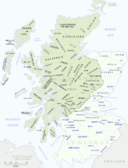
By Gsl [Public domain], via Wikimedia Commons
Scotland Registers & Records contain images taken from 21 different publications related to Scottish parishes and families. The records vary and include parish records, topographical accounts, and memorial inscriptions.
Some of these records reach back as far as the year 1100! To see a list of each of the publications within this collection, click here, then scroll down to the subheading, “What can these records tell me?”
Canada – Ontario – Birth Index
Findmypast offers a collection titled Ontario Birth Index 1860-1920. It is comprised of 1.7 million civil registration records. Civil registration in Canada is the responsibility of the individual provinces and territories and it was not standard practice until the late 1800s.
Each record contains both a transcript and an image of the original document. Information should include:
- Ancestor’s name and date of birth
- Place of birth
- Parents’ names
In some cases, the record may also provide:
- Parents’ occupations
- Where the parents were married
- Name of the attending physician
- Address of residence
Special Savings for You

If you are interested in subscribing to Findmypast, we want to let you know about a special savings. Findmypast is now offering a year subscription for $34.95, a savings of $79.95. Click here for more details!
United States – New York – City Directories
New York Public Library is digitiz ing its collection of New York City Directories, 1786 through 1922/3, and sharing them for free through the NYPL Digital Collections portal.
The first batch—1849/50 through 1923—have already been scanned and the 1786–1849 directories are in the process of being scanned. The whole collection will be going online over the coming months.
See the digitized directories here.
City directories contain more than just names and addresses. You may be surprised to learn that they record the price of travel and postage, the kinds of occupations around the city, the layout of streets, and at what time the sun was predicted to rise and set!
City directories might also contain images, maps, illustrations of buildings, and advertisements.
United States – Massachusetts – Women’s Suffrage
The Massachusetts Historical Society has announced that seven collections relating to women in the public sphere have been digitized. A grant made it possible to create high resolution images that are accessible at the MHS website, as well as preservation microfilm created from the digital files. The seven collection titles and links are listed below.
Juvenile Anti-Slavery Society records, 1837-1838
http://www.masshist.org/collection-guides/view/fa0427
Massachusetts Association Opposed to the Further Extension of Suffrage to Women, 1895-1920
http://www.masshist.org/collection-guides/view/fa0121
New England Freedmen’s Aid Society records, 1862-1878
http://www.masshist.org/collection-guides/view/fa0423
Rose Dabney Forbes papers, 1902-1932
http://www.masshist.org/collection-guides/view/fa0212
Society for the Employment of the Female Poor trustees’ reports, 1827-1834
http://www.masshist.org/collection-guides/view/fa0428
Twentieth Century Medical Club records, 1897-1911
http://www.masshist.org/collection-guides/view/fa0411
Woman’s Education Association (Boston, Mass.) records, 1871-1935
http://www.masshist.org/collection-guides/view/fa0393
United States – Pennsylvania – Newspapers
Check out the Philadelphia Inquirer on Newspapers.com. The Philadelphia Inquirer is one of the oldest surviving papers in the United States. The Philadelphia Inquirer was established in 1829 and originally titled the Pennsylvania Inquirer. It was originally a Democratic paper that supported President Jackson.
This collection covers the years of 1860-2016.
If you’re looking for specific mentions of an ancestor, you might find them in lists of death notices, marriage licenses, local social news, the day’s fire record, or building permits issued. This newspaper is searchable by keyword or date.
United States – Nebraska – Marriages
New this week at FamilySearch are the Nebraska, Box Butte County Marriages, 1887-2015. Information found in these marriage records does vary, but you may find any of the following:
- Name
- Age
- Estimated birth year
- Birth city/town, county, state, and country
- Marital status
- Marriage date
- Marriage city/town, county, and state
- Parents’ names
- Previous spouse
More Helpful Tips for Scottish Genealogy
Lisa’s Premium Member episode 116 is  just what you need. Marie Dougan, a professional genealogist specializing in Scottish research, joins Lisa in this episode to talk about how to research Scottish ancestors. If you haven’t taken that plunge and become a Premium Member, why not do so today! There are over 100 Premium Member podcast episodes and over 30 video classes on a wide variety of genealogy topics waiting to inspire and educate. Join today!