by Lisa Cooke | Oct 7, 2013 | 01 What's New, Ancestry
Do you feel like every time you log in to your favorite genealogy data website, it’s changed? Well, that’s probably because it has. The sites themselves are gaining weight, both the weight of additional users and additional records. It only makes sense that the way you navigate these sites will change and (hopefully!) improve.
You’ll notice this in recent changes to Ancestry.com. The site has responded to user feedback by introducing three new features, described in a recent press release:
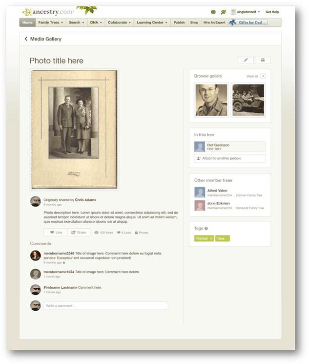
Ancestry photo comment sharing
1. Username=real name for new users.
“With more than 50 million family trees on Ancestry.com, connecting with other members can yield family history gold. We know it’s hard to make a personal connection with “TheRealCookieMonster53.” In an effort to promote collaboration and sharing, members profiles will use real names instead of usernames. Users can still change their setting at any time from their Member Profile page to show their preferred name.
Although this change is only for new users, we encourage everyone to update their Member Profile to a more personal and transparent name (sorry Cookie Monster).”
2. Comment sharing across all copies of a photo.
“Today, commenting happens on individual copies of photos which means most comment activity on shared photos is missed. We have made a new update on the site that will enable comment sharing across all copies of a shared photo so everyone can join the conversation. We’ll email users when new comment activity occurs, but also make sure the email volume isn’t overwhelming.
In addition, we’re refreshing the media page so it’s simpler to update, share, and view your family photos and stories.” (editor’s note: I’d be interested to hear if you, my lovely readers, find the emailed photo comments helpful, and limited as promised by Ancestry.)
3. Related Content suggestions in the image viewer:
“The Interactive Image Viewer has been updated with the Related Content panel. This is currently the most requested feature for the image viewer. A fantastic way to discover new content is just another avenue to easily flesh out more relevant records, the Related Content panel not only includes Suggested Records but will also show Related Trees.”
by Lisa Cooke | Mar 6, 2013 | 01 What's New, British, History, Immigration, Records & databases
If you have British roots, you’ll want to check out the new collection available on Findmypast.com: a half million criminal records dating from 1770-1934!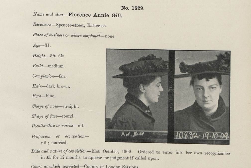
This sounds like a pretty gripping collection, whether you’ve got British roots or not. It contains records like mug shots, court documents, appeals letters and registers from prison ships (which were used when mainland prisons were crowded). According to Findmypast.com, the records “provide a wide variety of color, detail and fascinating social history, chronicling the fate of criminals ranging from fraudsters, counterfeiters, thieves and murderers and their victims.” The 500,000 records you can search now are only a fifth of the full collection of 2.5 million that will be online soon.
The company calls this the largest collection of historical criminal records from England and Wales to be published online and is done in association with the National Archives (UK). Findmypast.com members can click here to access the criminal collection directly (make sure the box for “Institutes and Organizations” is checked).
Here’s a little more background on connections between British convicts and the U.S. and Australia….
During colonial times, Britain often punished criminals by forcing them to emigrate. The most famous destination was Australia: the first British settlement on that continent in 1787 was actually a penal colony. Australia celebrates that fact about its heritage today: learn more about the “First Fleet’s” arrival here.
Up to about 50,000 British convicts were also forced to emigrate to the American colonies during the 1700s. These included prisoners of war from Ireland and Scotland. Read more about this in Bound for America: The Transportation of British Convicts to the Colonies, 1718-1775 (Clarendon Paperbacks) by A. Roger Ekirch. Findmypast.com isn’t able to tell us yet how many records in the criminal collection relate to forced emigrations, but anyone with roots in the U.K. should check out this collection for sure.
by Lisa Cooke | Jan 29, 2014 | 01 What's New, Family History Library, FamilySearch, Libraries, Research Skills, RootsTech
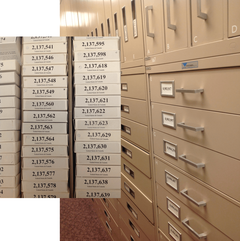
 Whether you’re going to RootsTech next week or not, at some point in your genealogical research you’ll want to use the Family History Library (FHL). The FHL, located in Salt Lake City, Utah, USA, has 6.875 billion historical records on microfilm, which contain an estimated 20.6 billion names. That’s a lot of ancestors!
The FHL and its sponsor organization, FamilySearch International, are busy digitizing and indexing all those records, but it’s going to take some time. And some of those records may never be digitized because of publication rights limitations or other issues. So you should know how to access all those great microfilms!
Yesterday I republished Episode 16 of the original Family History: Genealogy Made Easy podcast. It features a great interview with Margery Bell on using the Family History Library. The show notes have updated tips on using the online catalog. Click here for some must-have tips on preparing for your visit. You’ll get a lot more out of your limited time in the library if you know exactly what information you’re looking for and where you’re going to look for it!
by Lisa Cooke | May 31, 2017 | 01 What's New, Google Earth, Maps |
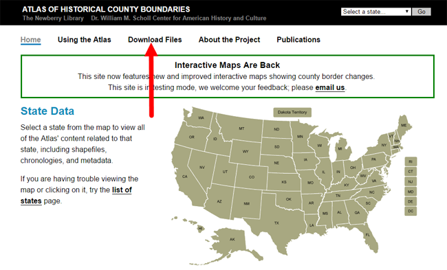
The Newberry Library’s online Atlas of Historical County Boundaries is finally fully updated and interactive! Read the good news here–and my preference for using the powerful geographic data that drives the Atlas.
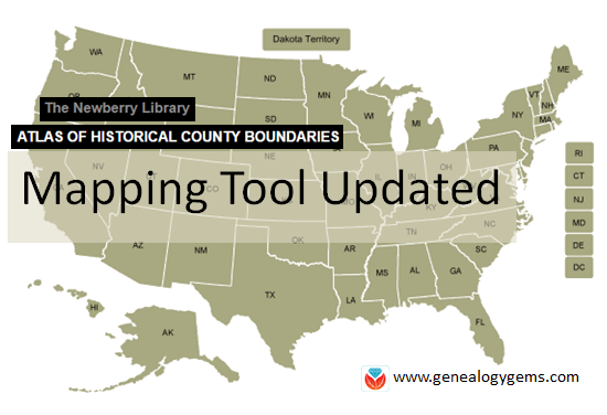 The Atlas of Historical County Boundaries at The Newberry Library’s website has been undergoing upgrades for quite some time. Genealogists who rely on this fantastic online resource to research old county boundaries in the U.S. have been able to access the basic data that drives the map (dates and geographic boundary changes). But they haven’t been able to use the popular interactive map. Great news: the Atlas is finally fully interactive again.
Changing Boundaries Reflected in the Atlas of Historical County Boundaries
Understanding changes in county boundaries over time is key to doing genealogy research in the United States. Boundaries have changed repeatedly–and some dramatically. County governments typically keep important genealogical sources: vital records, court records, land records and more. We need to know which county would have housed our ancestors’ records during specific time periods so we can find the records we want.
What’s New at the Atlas of Historical County Boundaries
According to the Newberry Library’s press release, users can now:
- view a base layer map that allows an overlay of boundaries on top of cities, towns and other geographic features;
- zoom in and out of maps and expand the view to full screen;
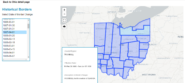
- select a date of interest from a drop-down box with all border change dates for that state; and
- view information about border changes in a hover box that changes as users hover over different counties.
Here’s what the new interface looks like:
Google Earth Pro vs. the Atlas of Historical County Boundaries
It’s great to see improved functionality on the Atlas site. But after reviewing the update, I still think the experience of using data from the site is superior in the free Google Earth Pro (GEP) program. To use the entire data set in Google Earth Pro, simply download the KMZ data file onto your computer,and when you click to open the file, your computer will detect the KMZ format and know to automatically open Google Earth Pro (as long as you already have GEP installed on your computer.)
Using the file in GEP allows you to use the data in conjunction with the rest of your genealogical information (such as placemarks indiciating places lived & schools attended, historic map overlays, embedded old family photos and home movies, etc.). This provides a more integrated genealogical research experience. Learn more by clicking here to watch a free video I’ve made about using Google Earth for genealogy.
by Lisa Cooke | Jun 12, 2014 | 01 What's New, Google, Maps, Military
 World War II started a revolution in map-making. It didn’t just change maps, but it also changed how the world looked at maps.
Maps suddenly became very interesting to everyone. Not just war strategists and troops but all those left behind on the home front. This interest was fueled even more by a revolution in how maps were made–a revolution that anticipated the information-sharing power of Google Earth.
“War has perennially driven interest in geography, but World War II was different,” reports this article in New Republic. “The urgency of the war, coupled with the advent of aviation, fueled the demand not just for more but different maps, particularly ones that could explain why President Roosevelt was stationing troops in Iceland, or sending fleets to the Indian Ocean.”
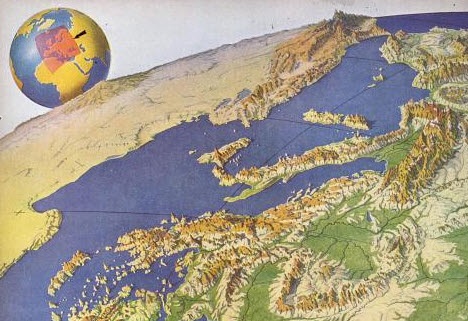
The story focuses on artist Richard Edes Harrison, whose World War II maps portrayed theaters of war with vivid clarity. He used the artist’s tools of shading, color and perspective to create maps “that could be intuitively understood by readers of widely varied levels of literacy and sophistication.” His “colorful and sometimes disorienting pictures (not quite maps)…emphasized relationships between cities, nations, and continents at the heart of the war. These maps were published in Fortune, then issued in an atlas that became an instant bestseller in 1944.”
After reading the article I ran a quick check of Google Books, one of my favorite go-to genealogy resources online, on “Richard Edes Harrison:. Sure enough, Google Books has a fully digitized copy of Life magazine (Feb 28, 1944) which includes the article “Perspective Maps: Harrison Atlas Gives Fresh New Look to Old World.” It’s not only chock full of his color maps, but includes a detailed section on how he drew his maps. You can see it here
What really caught my attention was the article’s explanation of how these World War II maps anticipated the information-sharing power of Google Earth. Google Earth shows us the terrain as well as geographic boundaries. That helps us understand things like movements of troops–or movements of ancestors.
As genealogists, we can learn so much by studying maps–particularly the powerful ones on Google Earth. Genealogy Gems Premium Members have access to my series of videos on Geographic Genealogy, including: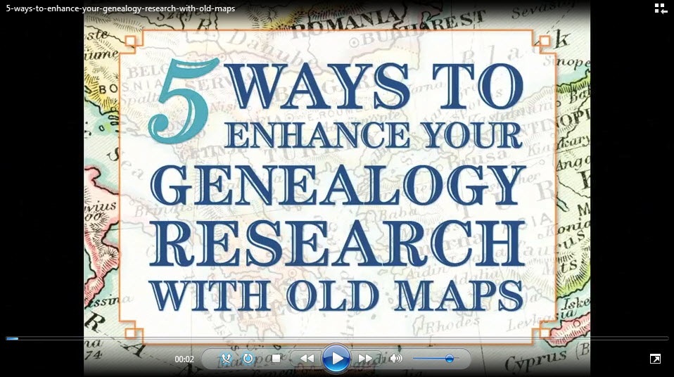
- Google Earth for Genealogy
- Time Travel with Google Earth
- 5 Ways to Enhance Your Research with Old Maps (brand new full hour class – retail value alone $39.95)
P remium Membership is a bargain at only $29.95 for an entire
  year’s access, plus right now you get the free bonus ebook Lisa Louise Cooke’s 84 Best Tips, Tricks & Tools from Family Tree Magazine.
Click here to learn more about Premium Membership.