Send a Letter, Make Cousin Connections
When was the last time you sent a letter or email to someone you didn’t know? Gail did, and you will be touched and inspired by her sweet story of finding a long lost cousin in Italy. Sometimes, all it takes is sending a letter to make a monumental cousin...Genealogy Source Citations – Podcast Episode 271
Show Notes: Finding great sources of information is part of what makes genealogy so fun! But citing those sources may not be so much. In this episode professional genealogist, Gail Schaefer Blankenau makes the case why source citation is a vital part of great genealogy research and she’s going to give us the resources to help get the job done right.
Listen to the Podcast
Show Notes
- Complete show notes
- Watch the video version of the interview
- Downloadable ad-free show notes
(Premium subscription required Become a Genealogy Gems Premium Member today.)
These wonderful sponsors make this free show possible:
MyHeritage DNA
Get your MyHeritage DNA kit here
Get 20% off Newspapers.com. Click here and use coupon code genealogygems

Visit Fort Wayne
Fort Wayne, Indiana is the home of the second largest free genealogy library in the country. Make your plans to visit today. Learn more at https://www.visitfortwayne.com

Learn more about the free genealogy resources at VisitFortWayne.com
Resources
- Downloadable ad-free show notes (Premium subscription required Become a Genealogy Gems Premium Member today.)
We Dig These Gems! New Genealogy Records Online
 Our review of new genealogy records online this week includes the 1939 Register for England and Wales; church records for Illinois and Kyiv, Ukraine; New York naturalizations and Mexican vital and church records. Which of these may name your family members?
ENGLAND AND WALES POPULATION REGISTER. The 1939 Register is now online at Findmypast, as we blogged about earlier this week. Click here to learn more about this crucial record set for those researching English and Welsh families.
FLASH SALE! Receive a 10% discount off 300 credits on Findmypast now through Friday 13thNovember 2015 at 11.59pm GMT using the code 1939REG10. Click the graphic below to have the discount automatically set up for you.
(When you use our links and graphics you are helping to support the free Genealogy Gems Podcast – thank you!!)
ILLINOIS CHURCH RECORDS. Ancestry has updated its collection of United Methodist Church records for 87 counties in central and southern Illinois. The collection now spans 1824-2009, bridging record gaps like the lack of government vital records in the past and privacy restrictions for more recent records. Click here to search for baptisms, marriages, deaths, family buy worm medication for cats migrations and more. These records are for congregations that are no longer in existence.
MEXICO. For October, Ancestry announced the addition of “more than 250 million Mexican birth, marriage, death, and church records—plus U.S. census, border crossing, and naturalization records.” click here to search Mexican records on Ancestry–through Monday, October 9, access to these collections is free.
NEW YORK NATURALIZATIONS. Ancestry’s collection of naturalization records for New York (1882-1944) have been updated. click here to search for immigrant ancestors who may have naturalized in New York, which welcomed millions of immigrants who may have done this paperwork during that time.
UKRAINE CHURCH RECORDS. You can new browse a new collection of Orthodox church records for the Diocese of Kyiv, Ukraine (1734-1920) on FamilySearch. These include duplicate records of baptisms/births, marriages, and burials/deaths created by church officials for civil authorities. Click here to view these records for free (sign-in may be required).

Please help spread the great news! Thank you for sharing these new genealogy records online with your genealogy societies, fellow researchers and family.
Simply copy and paste the URL for this page:
- into an email
- on your Facebook page
- on your society Facebook page
- on Pinterest
How to Find Enumeration District Maps
Looking for enumeration district maps for the U.S. Federal Census? You’re not alone!
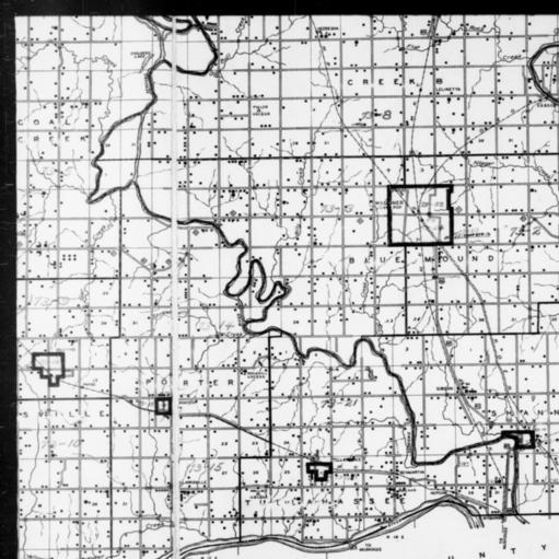
1940 Census Enumeration District Map, Oklahoma, Wagoner County, http://research.archives.gov/description/5836456
Recently Genealogy Gems podcast listener Michelle in Denver, Colorado, wrote in with this question:
“Where can I find individual enumeration district maps? I don’t need a state-wide map showing the divisions between enumeration districts, but a map showing the numbered households within a single enumeration district.”
My answer: How to find Enumeration District Maps
First, here’s a little back story from the National Archives (U.S.) website:
“An enumeration district, as used by the Bureau of the Census, was an area that could be covered by a single enumerator (census taker) in one census period. Enumeration districts varied in size from several city blocks in densely populated urban areas to an entire county in sparsely populated rural areas.
Enumeration district maps show the boundaries and the numbers of the census enumeration districts, which were established to help administer and control data collection. Wards, precincts, incorporated areas, urban unincorporated areas, townships, census supervisors` districts, and congressional districts may also appear on some maps. The content of enumeration district maps vary greatly.
The base maps were obtained locally and include postal route maps, General Land Office maps, soil survey maps, and maps produced by city, county, and state government offices as well as commercial printers. Census officials then drew the enumeration district boundaries and numbers on these base maps.” (Check out the full article here.)
Enumeration district maps are not available in all years and all locations. 1940 ED maps are available on the National Archives (U.S.) website. (Scroll down to item 3 for instructions on getting to these through the Online Public Access search.) You’ll see that only the enumeration district numbers and street names are marked on the maps. Individual homes are not.
You might be wondering, are there enumeration district maps before 1940? They are limited but the answer is yes. Enumeration District maps are also available for the 1900 through 1930 censuses. You can browse and download the maps for free at FamilySearch. Search for title The United States enumeration district maps for the twelfth through the sixteenth US censuses, 1900-1940.
For censuses before 1900, the government used voting districts as enumeration districts. Find voting district maps in the Library of Congress book, Ward Maps of the United States : A Selective Checklist of Pre-1900 Maps in the Library of Congress. (The links here lead to WorldCat search results for these titles. WorldCat will tell you about libraries that have these books.)
Next, turn to the book Cartographic Records of the Census Bureau for a listing of maps available back into the 19th century at the National Archives. It’s available as an ebook which you can read online or download for free from Google Books. This book is an invaluable resource for finding much early maps at available at the National Archives on microfilm.
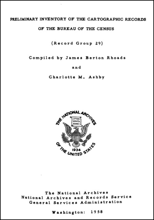
Read Preliminary Inventory of the Cartographic Records of the Bureau of the Census free at Google Books.
Enumeration District (ED) Map Finder
If you just want to find the enumeration district number of an address you already know, go to the Unified Census ED Finder at Steve Morse’s One-Step genealogy website.
At the top of the Unified Census ED Finder page start by selecting the census year (currently 1870 through 1950.) Next, enter as much information as you know about the location such as the county. Select the city from the list of cities displayed. You will then be able to enter street-level information. If you select “other” from the city list, you can then type in the city or town name. Continue to follow the prompts and instructions.
Here are a few more things to keep in mind as you find and use ED maps:
In cities, there are often two columns of numbers in the census population enumeration (typically on the far left of the page). There’s house number and the number representing the order in which the enumerator visited the house (which has nothing to do with the house number). If you can’t find a relative in once census, pull the address from one census and use it in the Steve Morse database above to pull up the enumeration district for your missing decade.

Sanborn Fire Insurance Maps can be helpful when searching for old Enumeration District Maps.
Depending on the year you are researching, try to locate a Sanborn fire insurance map for the area. Sanborn maps do include drawings of individual homes and include their house number. Genealogy Gems Premium Podcast Episode 47 is all about Sanborn fire maps. On the show notes page I even include a list of links to many Sanborn map collections, organized by state.
Final Thoughts: The Newest ED Maps Available Online
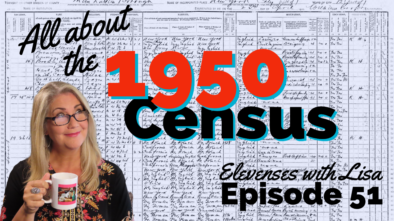
The 1950 enumeration district maps are now available for free online. Read my article The 1950 Census for Genealogy and watch the video to learn how to access them for free.