Genealogy & Family Tree Video Classes

Choose from our vast catalog of free and Premium genealogy video classes and tutorials. Start by selecting a topic below. Tip: On desktop use Ctrl F (Win) or Cmd F (Mac) to search the entire list of videos by keyword. Note: The search box and Categories menu on the right (desktop) or the bottom of the page (mobile) apply to audio podcast episodes and articles.

Beginner

DNA

Elevenses

Ethnicities

Google

Maps & Geography

Methodology 

Organization & Preservation

Photos & Videos 

Records

Story & Sharing 

Technology Tools

Websites

Videos marked “Premium” require a Premium Membership. Premium Members also have access to the downloadable ad-free show notes handout for all videos. 

Beginner

Home Research – Family History at Home
15 Freebies for Genealogy
Free Genealogy
Inherited Genealogy – How to Deal with It
Data Flow for Genealogy
Getting Started with DNA Testing (Premium)
Google.com Getting Better Search Results (Premium)
Evernote for Genealogy  – Beginner
FamilySearch Strategy Essentials
FamilySearch Wiki Navigation
Take Control of Preserving Your Family History Information (Premium)
RETURN TO TOP OF PAGE

DNA

5 Tips for Understanding DNA Results with Diahan Southard (Premium)
Autosomal DNA Results: Make the Most of Them with Diahan Southard (Premium)
DNA: Glue that Holds Families Together with Diahan Southard (Premium)
DNA Match with No Tree? No Problem! (Premium)
DNA Problem Solving
DNA Q&A with Ancestry’s Crista Cowan
DNA Painter Quick review with Blaine Bettinger
Forensic Genealogist – How to Become One with Dr. Claire Glen
Forensic Genealogy Future and Phenotyping (Premium)
Gedmatch Shared Matches Tool with Diahan Southard (Premium)
Getting Started with DNA Testing with Diahan Southard (Premium)
Organizing Your DNA Matches with Diahan Southard (Premium)
Mitochondrial DNA Quick Introduction with Diahan Southard (Premium)
Mitochondrial DNA Match Page Quick Overview with Diahan Southard (Premium)
MyHeritage DNA Genetic Groups
MyHeritage DNA Results: Get the Most Out of Them (Premium)
YDNA Quick Introduction with Diahan Southard (Premium)
YDNA Haplogroups Quick Overview with Diahan Southard (Premium)

Become a Premium Member
RETURN TO TOP OF PAGE

Elevenses with Lisa (2020: The 1st Year)

Note: Elevenses videos beyond the 1st year are included under the various topics on this page.

  1. Pilot (Premium)
  2. Research Plan (Premium)
  3. BSO Strategies (Premium)
  4. Mobile Organization (Premium)
  5. Online Organization
  6. Organization Paper (Premium)
  7. Organizing Data Q-A (Premium)
  8. Organize Digital (Premium)
  9. Evernote (Premium)
  10. Saving Your Genealogy from Destruction (Premium)
  11. Inspiring Ways to Captivate Non-Genealogists (Premium)
  12. Google Earth (Premium)
  13. Google Search – Get Better Results (Premium)
  14. Creating Family History Videos (Premium)
  15. Learning from History (Premium)
  16. Using Adobe Spark Video (Premium)
  17. Ancestry Top Tips (Premium)
  18. Irish Genealogy Professional Consultation (Premium)
  19. Filling Blanks in Your Research (Premium)
  20. House History
  21. Free Genealogy
  22. Your Ancestor’s Neighborhood (Premium)
  23. Google Photos
  24. Your Online Mindset (Premium)
  25. Elevenses with Lisa Viewers Voices (Premium)
  26. Newspaper Navigator and the Library of Congress
  27. Google Lens for Genealogy
  28. House Photo ID
  29. Family Bible
  30. Google Books
  31. Allen County Genealogy Center
  32. Artificial Intelligence
  33. Early American Genealogy (New England)
  34. Passenger lists
  35. Viewer Voices 2 (Premium)
  36. Rumsey Maps
  37. Provenance of Records
  38. A Cup of Christmas Tea with Tom Hegg (Dec 2020)

RETURN TO TOP OF PAGE

Ethnicities

German Genealogy for Beginners
German Villages – How to find them
Irish Genealogy Expert Solutions Beginner Part 1 (Premium)
Irish Genealogy Filling in the Blanks Intermediate Part 2 (Premium)
Italian Genealogy
Italian Dual Citizenship
Jewish Genealogy
Native American Genealogy
Public Records Office of Ireland

Become a Premium Member
RETURN TO TOP OF PAGE

Google

The Genealogist’s Google Search Methodology (Premium)
Google: Common Surname Search Strategies (Premium)
Google – Getting Better Search Results (Premium)
Google – 5 Genealogy Search Hacks (Premium)
Google – 5 Search Secrets for Genealogy (Premium)
Google – More Search Strategies (Premium)
Google – How to Reconstruct Your Ancestor’s World (Rootstech 2023)
Google Books – Getting Started (Premium)
Google Books – 10 Surprising Finds
Google Books – New Features
Google Drive (Premium)
Google Images Best Search Strategies
Google Lens for Genealogy
Google Photos Introductory Tour
Google Scholar for Genealogy
(Premium) 

Get Lisa’s book: The Genealogist’s Google Toolbox
RETURN TO TOP OF PAGE

Maps & Geography

5 Ways to Use Old Maps in Your Research (Premium)
Best Websites for Finding Old Maps (Premium)
Create a Historic Map Collection for Your Research (Premium)
Davidrumsey.com Free Maps and How to Find Them
Exporting MyMaps to Import into Google Earth 
Google Earth for Genealogy
(Beginner) 
Google Earth – How to Plot Land
Google Earth: Time Travel (Premium)
Google Earth – Ways to Use it for Genealogy (Premium)
House History Research (Premium)
House Photo Identification
Illuminating Locations (Premium)
Neighborhoods in Google Earth (Premium)
Paths – Create Emigration Paths in Google Earth (Premium)
Rural Address – How to Find & Map Them
Sanborn Fire Insurance Maps – Beginner (Premium)
Sanborn Fire Insurance Maps, Applying them to Research – Intermediate (Premium)
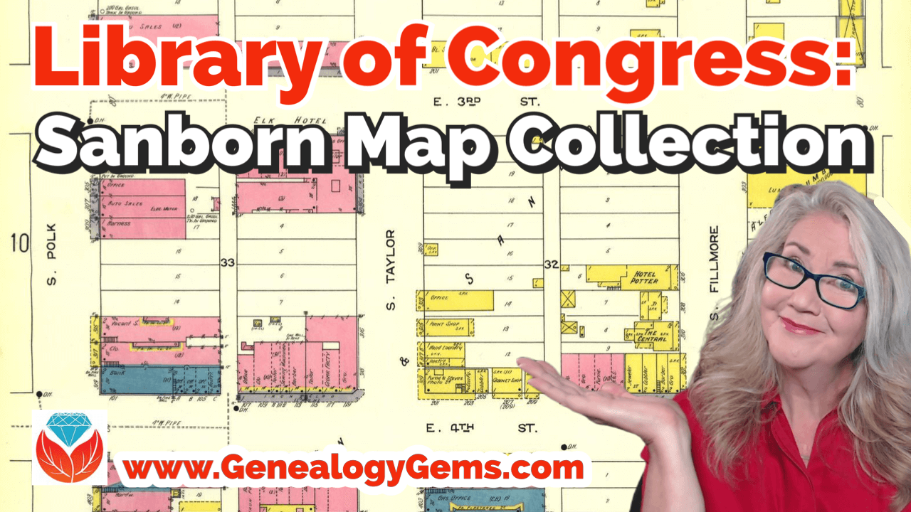
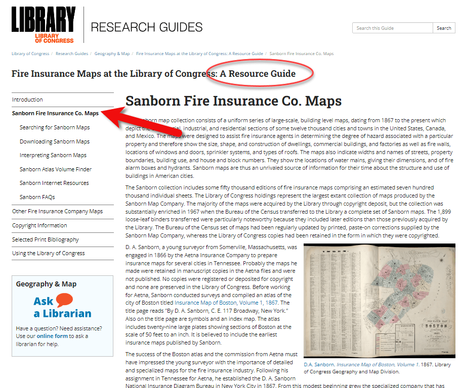
Sanborn Fire Insurance Map Collection at LOC
Towns of Origin – 16 Ways to Find Them

Become a Premium Member
RETURN TO TOP OF PAGE

Methodology

Big Picture in Little Details (Premium)
Birthdates Conflict and How to Solve It
Cold Case Strategies (Premium)
Finding Hard-to-Find Records
Free Genealogy
Home Research – Family History at Home
How Alice the Genealogist Avoids Rabbit Holes (Premium)
Living Relatives – How to Find Them (Premium)
Maiden Names 12 Strategies for Finding Them
Newspapers – How to Get the Scoop on Your Ancestors (Premium)
Productivity and BSOs (Premium)
Rate Your Readiness for Genealogy Success
Research Plans (Premium)
Restart Your Genealogy
Source Citations
Story Behind Genealogy Records
Timelines – Beginner (Premium)
Towns of Origin – 16 Ways to Find Them
Transcription and Analysis (Premium)
Witness Research

Become a Premium Member
RETURN TO TOP OF PAGE

Organization & Preservation

Archival Storage Options
Clean Up Your Genealogy Database
(Premium)
DAR – How to Join
Data Organization (Premium)
Digital Organization (Premium)
Digital Preservation Library of Congress Style
Documenting Family History with Shotbox
Evernote Organization (Premium)
Evernote: Organize Your Research (Premium)
Hard Drive Organization Part (Premium)
Heirlooms – Passing Them and Their Stories On (Premium)
How Alice the Genealogist Avoids the Rabbit Hole Parts 1 & 2
How Alice the Genealogist Avoids the Rabbit Hole Parts 3 & 4
Inherited Genealogy – How to Deal with It
Inspiring Relatives’ Interest to Protect the Family History (Premium)
Mobile Computing Organization (Premium)
Online Productivity (Premium)
Organize All this Stuff! (Premium)
Organize Your Online Life
(Premium)
Paper Organization (Premium)
Save Your Research from Destruction (Premium)
Take Control of Preserving Your Family Tree Information (Premium)
5 Family History Holiday Ideas

RETURN TO TOP OF PAGE

Photos & Videos

5 Ways to Improve Old Home Movies
Creating Family History Story Videos (Premium)
Dead Fred – The Secret to Finding Old Family Photos
(Photo) Digital Preservation Library of Congress Style
Edit Your Home Movies
Frith Photo Collection at FindMyPast
Google Images (Photos) Best Search Strategies
Google Photos Introductory Tour
House Photo Identification
How to Make a Video with an Adobe App (Premium)
Solving Unidentified Photo Album Cases (Premium)
Video Magic (Creating Family History Videos) Part 1 (Premium)
Video Magic (Creating Family History Videos) Part 2 (Premium)
Video Magic (Creating Family History Videos) Part 3 (Premium)
Videos – 10 Ways to Add Volume to Family History with Videos (Premium)

Become a Premium Member
RETURN TO TOP OF PAGE

Records

1931 Canada Census – 4 Fast Search Strategies
1950 Census Overview
1950 Census Questions
1950 Census Enumeration District Maps
1950 Census Indexing at FamilySearch
1950 Census Search Strategies (Premium)
1890 Census & Substitute Records
15 Freebies for Genealogy
Cemetery Research & Finding the Stories
Church Record (Premium)
Comparing the Newspaper Giants (with Sunny Morton) (New)
Compiled Family Histories at Ancestry 
Compiled Family Histories & Genealogies
– Best Places to Find Them (Premium
Early American Ancestor Records with NEHGS
Ellis Island Records (Passenger, Customs & Detention LIsts)
Family Bibles (Premium)
Freedmen’s Bureau (Premium)
Institutional Records (Premium)
Marriage Records – 5 Steps for Finding Them
Marriage Records Case Study with J. Mark Lowe
Marriage Records and Gretna Green with J. Mark Lowe
Newspapers – Getting the Scoop on Your Ancestors
Newspapers – 5 Top Research Tips
Newspapers at Google Books 
Newspapers – Finding Family Recipes
Newspapers – Reconstructing Your Ancestor’s Life
Newspaper Navigator at the Library of Congress
Newspapers.com – Digging Deeper (Premium)
Obituaries at Newspapers.com
Ohio Records at Ohio Memory (Premium)
Passenger Lists (Ellis Island Records)
Passenger Lists Deciphering
PERSI Like a Pro! with Allison Singleton (Premium)
School Records
Virginia Early Records

RETURN TO TOP OF PAGE

Story & Sharing

Airplane! Director David Zucker on Family History
Behind the Scenes with Director David Zucker (Premium)
Christmas Cup of Tea with Author Tom Hegg
Creating Family History Story Videos (Premium)
Crime Stories with Author Nathan Dylan Goodwin
Elevenses with Lisa Pilot Episode (Premium)
Emigration Paths Tours in Google Earth) (Premium)
Genealogy Gems Viewer Voices 1 (Premium)
Genealogy Gems Viewer Voices 2 (Premium)
Inspiring Non-Genealogists in Your Life (Premium)
Instagram & Pinterest for Genealogy (Premium)
Interview Questions (Premium)
Learning from History with Daniel Horowitz (Premium)
Family History Narrative Research 
Reconstructing Your Family’s Amazing Stories (Premium)
Self Publish a Book! 
Share Your Life Story in a More Meaningful Way (Premium)
World War II Fallen Stories
Writing and Publishing a Family History Book

Become a Premium Member
RETURN TO TOP OF PAGE

Technology Tools

10 Tech Tools You Can’t Live Without (Premium)
Artificial Intelligence
AI Chatbots and Genealogy – should you use them?
AI Time Machine at MyHeritage
Apps – How to Find Essential Apps for Genealogy (Premium)
Cloud Backup (Premium)
Data Flow for Genealogy
Dropbox (Premium)
Evernote for Genealogy  – Beginner
Evernote: 10 Projects to Enhance Your Genealogy (Premium)
Evernote and Collaborative Genealogy (Premium)
Evernote: Creating a Research Plan in Evernote (Premium)
Evernote Organization (Premium)
Evernote: Organize Your Research (Premium)
Evernote: Making It Effortless to Use for Genealogy (Premium)
Evernote versus Snagit
Future of Technology & Genealogy (Premium)
GEDCOMs
Google Drive (Premium)
iPad – Genealogy on the Go (Premium)
Newspaper Navigator at the Library of Congress
Online Mindset – Take Control of Your Online Activity (Premium)
RootsMagic with Founder Bruce Buzbee
Snagit (Beginner)
Snagit (Intermediate)
Tech Can Wreak Havoc on Genealogy (Premium)
Time Travel Technology (Premium)
VPNs – Why I Use One
YouTube – Find Your Family History

RETURN TO TOP OF PAGE

Websites

Which Genealogy Website Should I Use? (Premium)
Ancestry – Compiled Family Histories 
Ancestry Top Search Tips (Premium)
Ancestry – What’s this Records Hint? Geneanet
ArchiveGrid (Premium) 
Ellis Island Passenger Search
FamilySearch Strategy Essentials
FamilySearch Wiki Navigation(Beginner)
FamilySearch Wiki Deep Dive (Premium)
Genealogy Center at Allen Co Public Library Website
Genealogy Giants – Comparing Ancestry, MyHeritage, FamilySearch, Findmypast (Premium)
Google Scholar for Genealogy (Premium) 
History Hub (NARA) 
Internet Archive – 10 Records You’ll Love to Find
MyHeritage – 10 Don’t Miss Features
Newspaper Navigator at the Library of Congress
Newspapers.com – Digging Deeper (Premium)
One-Step WebPages with Steve Morse
PERSI Like a Pro! with Allison Singleton (Premium)
State Library of Pennsylvania
U.S. National Archives – In Person Access
U.S. National Archives Website
WikiTree (Beginner)
WorldCat – 5 Things You Should Do

Sanborn Fire Insurance Maps for Genealogy

Show Notes: Discover Sanborn Fire Insurance maps with Julie Stoner of the Geography and Map Division of the Library of Congress. Learn the best search strategies, how to download the Sanborn maps for free, and hidden online resources! Sanborn maps are an invaluable tool for family history because they provide an up-close look at the places where your ancestors lived. 

 Watch the Video:

Show Notes

Resource: Download the ad-free Show Notes handout
(Premium Membership required)

Sanborn fire insurance maps at the library of congress for genealogy

Sanborn Fire Insurance Maps for Genealogy

(This interview has been minimally edited for clarity.)

Lisa: Today we’re talking about Sanborn fire insurance maps and how we can use them for genealogy. They’re available at the Library of Congress. Here to tell us more about that is Julie Stoner. She’s a reference specialist in the geography and map division of the Library of Congress.

Julie: Thanks so much, Lisa. Happy to be here.

I adore the Sanborn fire insurance maps because they give us such a unique perspective and view of our ancestors’ world.

What are Sanborn Fire Insurance Maps?

Start us off and tell us exactly what are Sanborn fire insurance maps?

Julie: The Sanborn fire insurance maps are a uniform series of large scale maps. They date starting from about 1867, though, they mainly start in the 1880s, and they run mostly through the 1950s. There are some from later dates as well.

It was a company started by a man named D.A. Sanborn. He was drawing these maps at a building level to sell to fire insurance companies so that they could then assess how much to charge people for the fire risk of their building. We use them for a lot more things today than they were originally intended for because they show the building level details of a city.

We have over 12,000 cities and towns represented. Some smaller towns may only have a few sheets. But the larger cities may have multiple volumes. They would go back and create a new map every 10 or 15 years or so. Therefore, you can really see how a city changed over time and how the buildings changed over time, and how a neighborhood was built. These maps can be used for all sorts of things now.

Lisa: I love the fact that they have such detail and are really unique. There really aren’t any other maps quite like these, are there?

Julie: It’s true. We do have other maps, like real estate atlases, and things like that of maybe a few cities, here and there, like Washington D.C. or New York. We have land ownership maps, but nothing of quite this scale or detail.

Sanborn Fire Insurance Maps Online Collection

Lisa: Let’s talk about the scale of the map collection. At the Library of Congress you have the physical map collection, and then there’s the collection that we can access online. Tell us a little bit about the scope of the collection? And does it vary whether we’re online or in person?

Julie: It does vary a bit because of copyright restrictions. As I said, we have about 12,000 different cities and towns represented, that equals over 700,000 map sheets. So, that’s a that’s a lot of sheets of maps. And a few years ago, the library, in conjunction with a third party, took on a project to scan all of the public domain Sanborn maps. Public domain means that there are no copyright restrictions on those maps. So that included anything published before 1922 at that point. Then anything published before 1964, in which the copyright wasn’t renewed. The library took on this project to scan all those, and those are completed and are all online on our website and can be downloaded.

That copyright date is now a rolling date. This means that there are now maps between 1923 and 1926 that are public domain that we haven’t scanned yet, and we are working to get those scan to get those online. And as soon as new maps come into the public domain, we hope to process them and upload those when that happens. So, a very large chunk of the Sanborn maps are online. But, if they are not, you can always come and see them in person as well, because we do have the physical copies.

Sanborn Map Resolution

Lisa: You mentioned that the part that the part of the collection that is in the public domain is available online. And they’re downloadable. Are those pretty high-resolution maps, so that we’ll be able to use those in our own genealogy projects?

Julie: For sure! They are definitely high resolution. The library scans them at the highest resolution that we can and so there’s actually a variety of files that you can download. We have JPEG images, which are a bit lower quality but are good for something like PowerPoints or computer screens. And then we have our TIFF files, which are the largest high-resolution files which have. These are a good size for printing.

Lisa: I know that the online collection, which I think most of our folks would be interested in accessing from home easily, is at the Library of Congress at the loc.gov website at https://www.loc.gov/collections/sanborn-maps. Tell us a little bit about what we’ll find there on the website.

Fire Insurance Map Research Guide at the Library of Congress

Julie: Sure, so that link that you said is a landing page for our digital images. Let’s start with the fire insurance map research guide that we have that is about our fire insurance maps in general, not just the Sandborn maps. There are a few other companies though Sanborn took those over in time. They became pretty much became the only one.

On the research guide page, there’s a large section on the left side of the page that says Sanborn Fire Insurance Company Maps. If you click on that, you will find a number of links to help you with your research of the Sanborn Fire Insurance Company maps.

Sanborn fire insurance map resource guide

The Research Guide at the Library of Congress

How to Search for Sanborn Maps

I want to point out the easiest way to find the maps. Under the searching for Sanborn Maps tab you will see some information including a link to our Sanborn Fire Insurance Map Checklist. This is the easiest way to find the maps that you’re looking for. It will take you to our fire insurance map index. And this is the easiest way to search for maps.

It’s so large that it can be a little overwhelming. This checklist is taken from a 1981 publication produced by the library that lists all of the Sanborn maps that we have in our collection. While the library has the largest collection of Sanborn maps in the world, we do not claim to have every one ever made. We are missing some. For example, if you found a map at your historical society that is not on this list, it just means that we don’t have it in our physical collection. Not that it doesn’t exist.

You can search by state at the Map Index. If you click on U.S. from the drop-down menu, you’ll find all the states. Scroll through and pick your state. I live in Virginia and I was born here, so I will search for Virginia. I will then see a list of hyperlinks with all of the cities available with Sanborn maps in the collection. Scroll through here and click on the city of interest. For example, if you want to click on Richmond you will get the list of Richmond maps here at the library. It’s a table and on the far left side you will see the date of the volume. And then you will see the number of sheets in that volume. Other geographic areas included sometimes in larger cities. The Sanborn Map Company would pick some areas farther outside the city to include in that volume, perhaps a few sheets. You’ll see a column called Comments which is mostly about the physical binding of the maps your library. And then a column called Website. If you click on the website link it will take you to the digital images.

Why are there multiple dates on Sanborn maps?

And just one other note about the date. If you look at the date, sometimes it can look a little confusing because you’ll see two dates listed. For example, volume 1924 through April 1950. So what’s happening here is that starting in the mostly the 40s and 50s, the Sanborn Map Company, decided it was faster, instead of making an entirely new map to cut and paste over an old map. So, this 1924 date is the face of the map. The 1950 date is the last time that they updated it. So, it’s really showing a 1950 era Richmond, but they’re just using that base map of 1924.

Downloading Sanborn Fire Insurance Maps

When you click through to these digital images, we can download them. Click on an image and you will see in the center of the screen the map that you can scroll in and out of, and then at the bottom underneath the image, you’ll see the download link. You’ll find that there are several options for JPEG images, a GIF file, and then the high resolution tiff file. It’s pretty great. We’re very happy that a lot of these are now online for researchers to use from outside of Washington, DC.

What do the colors and symbols mean on Sanborn maps?

Lisa: And when you look at these maps, there’s a lot of detail. There’s color coding, and all kinds of markings. Do you have resources on the website to help people interpret the map?

Julie: Sure we do. The best method first is to look at the first page of a volume. If you zoom in you will see that there is a map key. It’s a box usually at the top or the bottom of the sheet. That is going to show you what the colors and the symbols in each volume mean.

Different cities have different unique characteristics, and the Sanborn Map Company would map those. So, not every map is going to have every symbol. The key at the front is a really good way to see what specifically applies to that volume.

For example, pink typically means brick. Yellow typically means it was made out of frame, or wood. Green can change. I’ve seen it as cement, I’ve seen it as special, not exactly sure sometimes what that means. The colors indicate the type of building materials, and then you will see what the hash marks or the circles or the x’s mean, in various buildings. There are a lot of abbreviations that the Sanborn Map Company uses as well. D typically stands for dwelling, S for store.

If you want to see an entire list of the symbols, we have a great resource back on our research guides page. Go back to the research guide to the Interpreting Sanborn Maps section on the left. That’s going to tell you a lot more about the colors, the symbols, things like that.

If you go to the Internet Resources, under Websites, there’s a list called Sanborn Map Abbreviations and Legend created by Environmental Data Resources, who are the copyright holders of the Sanborn maps. They’ve created this great PDF that shows the most common abbreviations and symbols used to the Sanborn fire insurance maps. It’s pretty comprehensive.

Sanborn Fire Insurance Map Search Strategies

Lisa: That’s a fantastic resource! If we do the search and we don’t see the town that we have in mind in that list, is there another way or any other way to search to figure out if it is part of a bigger map? Perhaps it’s just too small of a town to have its own map?

Julie: That’s a great question. If it’s a really small town and you don’t see it on the list, the other thing you can do is search back on the index page. The main index page under the full text field. For example, there might be a few sheets of a smaller town on a bigger city. You can search for that in the all full text fields. That will search the other geographic location that we saw, like in Richmond. So say if we typed in Manchester, and we did a search for that. You would see that it’s here as well under Richmond, as well as its own city. So, you can see that maybe it had earlier sheets here in Richmond. If you don’t find it in the search, and you don’t find it in the search fields, and if you don’t find it in the list, then it’s likely that one was not made at that town. Unfortunately that does happen. A lot of small cities and towns just don’t have them sometimes.

Searching for counties and regions in Sanborn maps

Lisa: Well, that brings up another question. Are these always sorted by town or city? Or might we even see a county or even some other kind of regional area described in a map?

Julie: That’s a great question. You do sometimes see counties, I can think of an example off the top my head if you go to California, for example. If you scroll down to Los Angeles, you’re going to see that you have the city of Los Angeles, but then you also have Los Angeles County. That’s going to cover some of the county areas that are outside of the city itself. Typically they’re covering things like factories or industrial areas, or things of that nature, but you never quite know.

Another example would be in New Jersey. If you go to New Jersey, and scroll down to New Jersey coast which includes several different seaside towns. This would be an example of when you might want to do the full text search if you didn’t find it in the list. For example, New Jersey Coast includes Longbranch, and Monmouth Beach, etc. All of these volumes are kind of scattered down the coast.

I like to say that, for every rule for Sanborn maps, there’s an exception. It would be worth perusing that list just to see what other gems are out there are maybe very close by areas that would be worth taking a look at, even if we do find our cities listed or in a search.

The Sanborn Fire Insurance Map Index

Lisa: I can imagine there was a lot of effort that went into the indexing part of this collection,  just getting all these cities and counties and everything listed. Was that work that the Library of Congress had to do? Or was that given to you by the company who now owns the copyright on Sanborn? And does it include anything besides a geographic place such as for example, any map with a saloon or any map with a particular feature?

Julie: That would be pretty amazing! Unfortunately, no, we don’t have anything that would list every saloon ever found, though, if somebody wanted to do that project, we’d be happy to take that.

This list was created by the Library of Congress in 1981, and we’ve added to it as we gained new material. The library is always looking for Sanborn maps that we don’t have in our collection. And when we find them, we do try and acquire them and then add them to our index. So, this particular list was created by staff at the library in 1981.

Lisa: What made me think of that question was I know that the David Rumsey collection out at Stanford is now working with and experimenting with a special type of OCR to pull that kind of text off maps. It’s amazing to see what technology might be able to do for us in the future.

Sanborn Map GIS Project

Julie: It is amazing what technology could do. And you’re right, there is a great project going on right now called machine reading maps that is experimenting with pulling the text out of the Sanborn maps to then create new products out of that.

We also have a new GIS project. GIS is geographic, geographic information systems. It’s basically putting information on a map so that you can see it and comprehend it at a glance.

One of the problems that we were having with our Sanborn maps, especially for our very large cities, like New York, LA, Chicago, is that there are so many volumes covering that city, and people would want to know where their exact address was. Well, there are, let’s say, seven or eight volumes of New York City. Which volume includes that address, right? So, we’ve created what we’re calling the Sanborn Atlas Volume Finder. You can find the link on our resource guide page. Click the link and you will see a map of the country. It’s going to pinpoint our current volume blinders.

We are hopefully going to be making more as we go. But basically, the first map is an index of what we have. Tight now we just have Los Angeles, Chicago and Detroit. We’re working on getting Washington DC and New York City out.

But say, for example, you’re interested in a map of Detroit, or an address in Detroit. If you click on Detroit on the pink pin, you can then click on the Sanborn volume finder. That’s going to take you to the Detroit map. It’s going to show you exactly what areas are covered in Detroit. It’s going to show you the extent of the Sanborn maps for the different years that it was mapped in Detroit.

If you look on the left side of the screen you’ll see the legend. This is a range of years for each set of maps that was created. You might see 1884 to 1896 and then 1897 to 1899. You can click the years on and off.  So, if you just wanted to know the earliest maps of Detroit, you can see where it was mapped. And you can enter your address in the upper right corner of the screen. That’s going to pinpoint for you the address. Then when you click on it, it’ll tell you the volume where you’ll find the map, and a link that’ll take you to the digital images. So you don’t have to guess which volume your address is in anymore. It will tell you whether the digital images are available, or if the map is not available online, you can contact us to learn more about it.

Lisa: What an amazing tool. It’s exciting to think that will continue to expand particularly for these really big cities where like you said it, it’s like a needle in a haystack with the addresses.

Julie: Yes, there are a lot of volumes for some of these cities. It can be really difficult without expert knowledge how to find your address. We feel like this is really going to help researchers in diving deeper into the Sanborn maps and really finding what they’re looking for.

Accessing Offline Sanborn Fire Insurance Maps

Lisa: You mentioned that sometimes you’re going to see that it is not available online. That might be a copyright issue or something else. Explain to us a little bit about what our options are for getting access to a map that might only be available in person the Library of Congress. How might we go about the in person visit, or making a request online to get a copy?

Julie: It’s the geography and map division policy that we will not scan or send items that are possibly under copyright protection. In the case of the Sanborn maps, if they were renewed or after 1964 then they are copyrighted, so we can’t send those electronically to you. You can make an in person visit to the Library of Congress reading room. We’re open Monday to Friday 8:30 to 5:00, and we will pull out anything you want to see.

Another option is that these volumes have all been scanned in black and white by ProQuest, a subscription database. Those are all scanned in black and white. A lot of universities and public libraries subscribe to the ProQuest database. Go to your public library and ask if they subscribe to the ProQuest database. If they do, you can see them there, and you can download them. However, those are black and white, so that’s a little bit not as helpful sometimes if you’re looking for building construction, and things like that.

There is also on our research guide page, under Internet Resources a link called the Union List of Sanborn Maps. This is a list compiled by the University of California at Berkeley of other institutions that have Sanborn maps other than the Library of Congress. So if, for example, you are in California, and you can’t make it to the library, you can see if other institutions also have those physical copies that you could go to that institution to see.

Lisa: I’m familiar with ProQuest. Do you happen to know, is there one place where you can look up and see which libraries subscribed to ProQuest? Or is that just too much to ask?

Julie: I think you would have to do that individually by library. I’ve never seen a master list. But I find that librarians are usually very helpful people. So, if you called your local library or university library, I’m sure librarians there could tell you help you track it down.

The Growth of the Sanborn Map Collection

Lisa: So it this indeed a growing database? And do you continue to get both stuff that can go online as well as maps that will just be available in person?

Julie: We are always looking for maps that we don’t have here in our collection. Usually, most of those are going to be more recent, like 1950s, 1960s and 1970s maps. The library gained most of our early collection from copyright deposit. It used to be that you had to send in a physical copy of something for to get it copyrighted and that’s how our collection was built. We are still always looking for new updated ones that we don’t have. It is a growing collection. I wouldn’t say that we’re receiving them every day or anything. But when we do find them, and we do like to acquire them.

Final Thoughts on Sanborn Maps

Lisa: Wonderful. Well, before I let you go, you are the guru when it comes to the Sanborn Fire Insurance Maps over at the Library of Congress. Anything else that we should really know about, or look for as we’re working with these Sanborn maps?

Julie: That’s a good question. First, I want to say that we always welcome questions to our division. On the left of the research guide, or on our main library of congress homepage, there’s a link that says Ask a Librarian, and you’re welcome to send us any questions that you have, that we haven’t answered on our research guide, or that you’re confused about. We’re always happy to answer questions.

The Sanborn maps are a fantastic resource for doing genealogy, for finding out more about the town you lived in, and the buildings that were there, and the types of buildings. A lot of the buildings will say what was in them, for example, a candy shop or a hat shop or whatnot. So, they’re a great resource to just find out more about the town. There’s always more to learn about them. I’m still learning about things that I didn’t know about Sanborn maps, years later.

Lisa: Julie, thank you so much for coming and sharing this terrific collection, and giving us such a unique view of the places where our ancestors may have lived. I’m sure you’ll be getting many inquiries through Ask the Librarian.

Julie: Yeah, dive in, reach out. We’re here to help.

Lisa: thank you so much for joining us here today.

Julie: My pleasure. Thank you.

Citing Sanborn Maps

Julie: The Library simply requests an attribution to the Library and the Geography and Map Division when publishing material from its collections, the format of the citation is up to you.

Resources

Download the ad-free Show Notes handout for Premium Members


Pin It on Pinterest

MENU