by Diahan Southard | Oct 26, 2014 | 01 What's New, Google Earth, History, Maps
When Liberian national Thomas Eric Duncan was diagnosed with Ebola it was unnerving for everyone here in the U.S. As a new Dallas area resident, and someone who was hopping from plane to plane for a Fall series of speaking engagements, it definitely gave me pause.
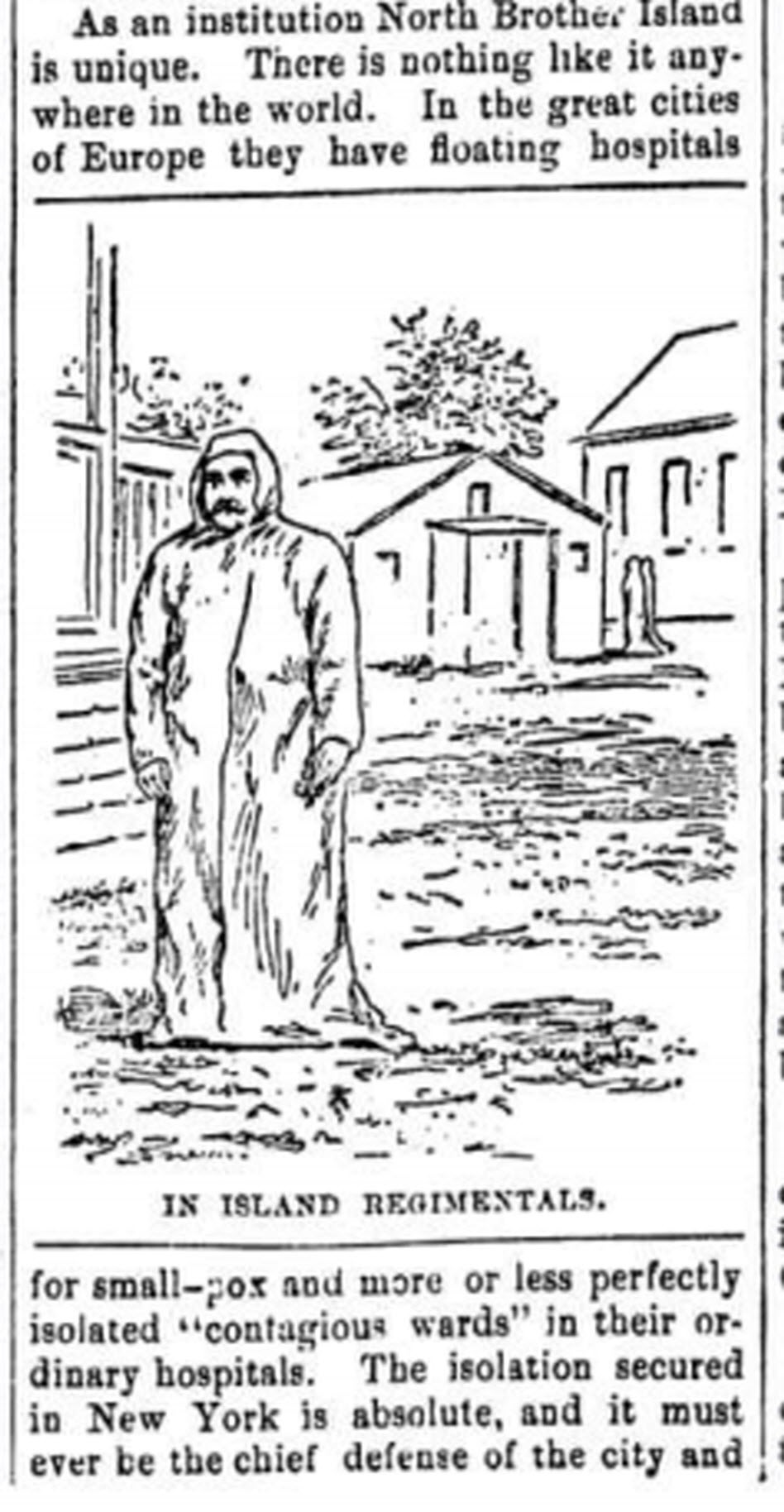
The Abbeville press and banner., October 12, 1892, Image 6/ www.chroniclingamerica.com
Epidemics, quarantines, and communities trying to protect citizens have been age old dilemmas, so it makes sense to look back through history at the strategies employed. There is much to be learned.
If we ask the question “what would have happened if Ebola had struck the U.S. 130 years ago?” we don’t have to look much farther than the location of one of the most recent Ebola patient: New York.
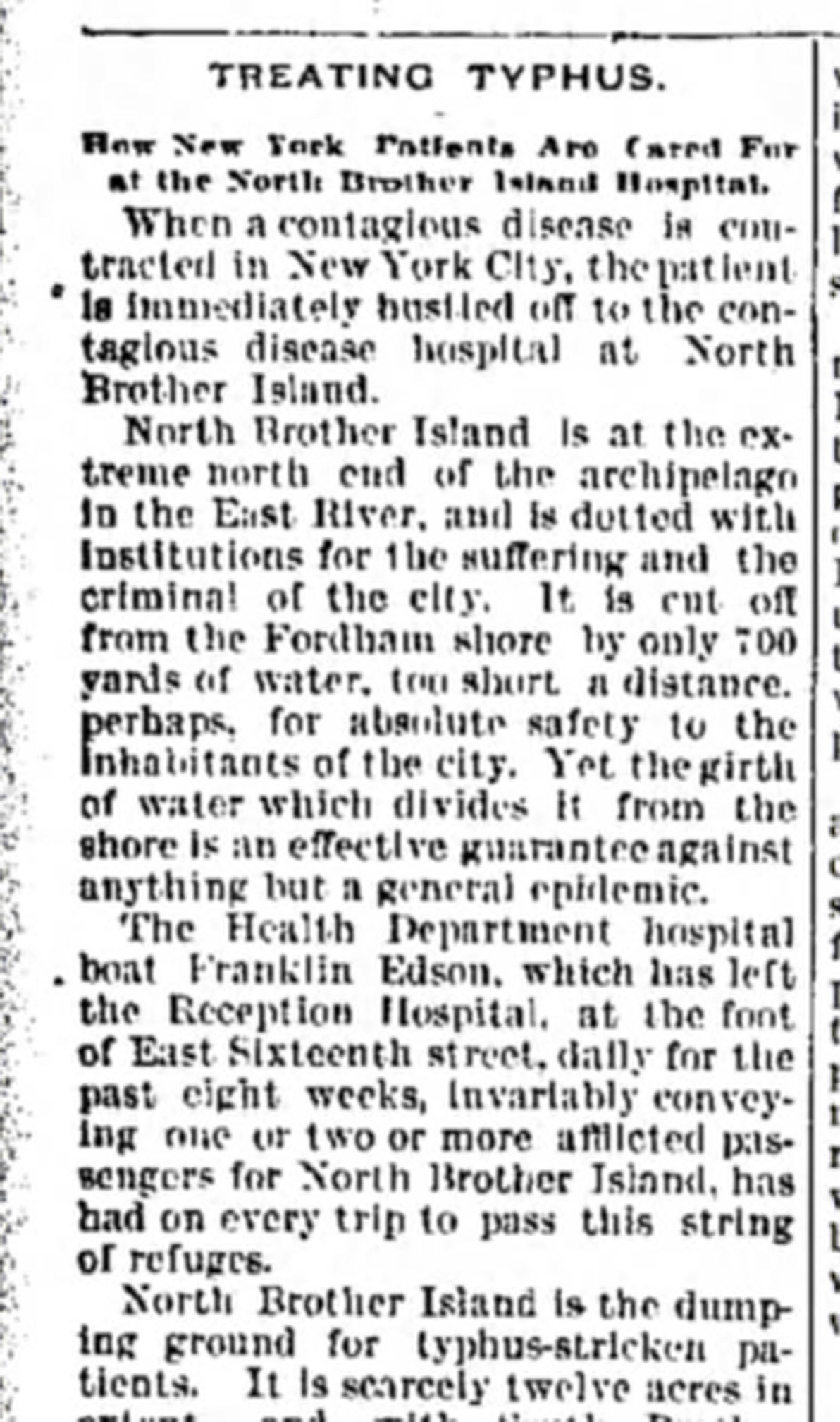
from the Humboldt Republican (Humboldt, Iowa) March 31, 1892
Courtesy www.Newspapers.com
In New York’s East River, tucked between the Bronx and Rikers Island lies North Brother Island, where in 1885 Riverside Hospital was relocated from Blackwell’s Island to isolate and treat small pox patients. From there it expanded to include the quarantine of other diseases.
North Brother Island stands idle today, closed to the public. However from 1907-1910 and 1915-1938 it housed the notorious Typhoid Mary, closing shortly after her death.
Although today the island is closed to the public, anyone can visit virtually with the aid of Google Earth. Join me on a 5+ minute tour of North Brother Island featuring the magazine and newspaper articles of the day, and written, audio and video tours of how it stands today a shell of what it once was. Click here to download and play my Google Earth Historic Tour KMZ file on your computer. It will be added to your “Places” panel in Google Earth under “Temporary Places.” Open the folder and click the “click to play the tour” icon. Be sure your speakers are on! And take time to click to watch the video and view the articles in the placemarks.
Don’t have Google Earth loaded yet? Download it free here.
If you would like to learn to create your own Google Earth family history tours watch this free video and then pick up your copies of Google Earth of Genealogy Volume I and Volume II.
by Lisa Cooke | Nov 19, 2015 | 01 What's New, Blogs, Google Earth
 Lisa Louise Cooke’s free Google Earth for Genealogy online video is so popular, the announcement about it was our #4 genealogy blog post for the year! Guess what? The online video is still there–and it’s still free.
Google Earth is one of Google’s most powerful tools for helping us understanding our ancestor’s world. (And if you read our #6 top post about other Google technologies you can use for genealogy, you know that’s saying something!)
With Google Earth, we can use satellite imagery, terrain maps, 3-D views of city streets and even overlays of old maps to learn about an ancestor’s town, neighborhood and even the very property they lived on. Even better, as Lisa demonstrates in her free video, we can also use Google Earth to share those discoveries with others in multimedia style.
Click here to “fly” (as Google Earth would say) to Lisa’s FREE Google Earth for Genealogy class!
We hope you are enjoying this week’s celebration of our Top 10 blog posts. Don’t forget about our countdown prize this week! Click here to see all Top 10 posts on our genealogy blog–and share that post on your Facebook page by THIS Friday (November 20, 2015). Use the hashtag #genealogygems, and you’ll be entered in a contest to win my Pain Free Family History Writing Project video course download, donated by our friends at Family Tree University. Add any comments you’d like on your “shared” post, like which Genealogy Gems blog post has most inspired you or helped your research. That feedback helps us bring you more posts you’ll love.
 Ready, set, SHARE! And thank YOU for helping us celebrate our 1000th blog post here at Genealogy Gems.
by Lisa Cooke | Jun 12, 2014 | 01 What's New, Google, Maps, Military
 World War II started a revolution in map-making. It didn’t just change maps, but it also changed how the world looked at maps.
Maps suddenly became very interesting to everyone. Not just war strategists and troops but all those left behind on the home front. This interest was fueled even more by a revolution in how maps were made–a revolution that anticipated the information-sharing power of Google Earth.
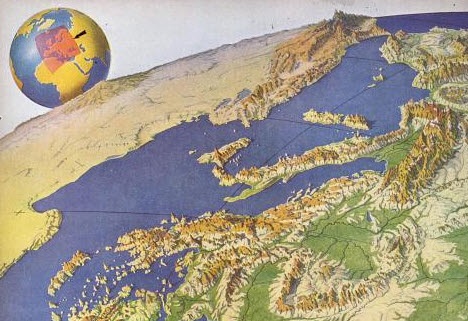
“War has perennially driven interest in geography, but World War II was different,” reports this article in New Republic. “The urgency of the war, coupled with the advent of aviation, fueled the demand not just for more but different maps, particularly ones that could explain why President Roosevelt was stationing troops in Iceland, or sending fleets to the Indian Ocean.”
The story focuses on artist Richard Edes Harrison, whose World War II maps portrayed theaters of war with vivid clarity. He used the artist’s tools of shading, color and perspective to create maps “that could be intuitively understood by readers of widely varied levels of literacy and sophistication.” His “colorful and sometimes disorienting pictures (not quite maps)…emphasized relationships between cities, nations, and continents at the heart of the war. These maps were published in Fortune, then issued in an atlas that became an instant bestseller in 1944.”
After reading the article I ran a quick check of Google Books, one of my favorite go-to genealogy resources online, on “Richard Edes Harrison:. Sure enough, Google Books has a fully digitized copy of Life magazine (Feb 28, 1944) which includes the article “Perspective Maps: Harrison Atlas Gives Fresh New Look to Old World.” It’s not only chock full of his color maps, but includes a detailed section on how he drew his maps. You can see it here
What really caught my attention was the article’s explanation of how these World War II maps anticipated the information-sharing power of Google Earth. Google Earth shows us the terrain as well as geographic boundaries. That helps us understand things like movements of troops–or movements of ancestors.
As genealogists, we can learn so much by studying maps–particularly the powerful ones on Google Earth. Genealogy Gems Premium Members have access to my series of videos on Geographic Genealogy, including:
- Google Earth for Genealogy
- Time Travel with Google Earth
- 5 Ways to Enhance Your Research with Old Maps (brand new full hour class – retail value alone $39.95)
P remium Membership is a bargain at only $29.95 for an entire
  year’s access, plus right now you get the free bonus ebook Lisa Louise Cooke’s 84 Best Tips, Tricks & Tools from Family Tree Magazine.
Click here to learn more about Premium Membership.
by Lacey Cooke | Jan 2, 2019 | 01 What's New, Military
Military ephemera outside of photographs are abundant and located at many research libraries and other facilities across the United States. Familiarizing yourself with historical collections and the finding aids online at many places can make all the difference in...