Thousands of Irish Genealogy Records New This Week!
If you’re looking for Irish ancestors, you’ll be delighted by all the new Irish record collections added this week! Also in this week’s new and updated record collections are court records and newspapers for Australia, parish records and more for England, millions of new Dutch records, South African probate records, and digitized newspapers across the United States.
Irish Genealogy: Thousands of New Records

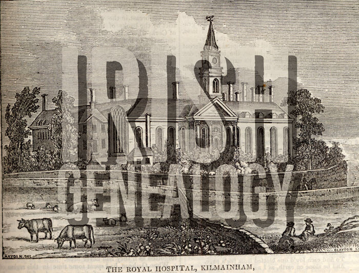
If you have ancestors from Ireland who received an army pension between 1724 and 1924, you’ll want to explore Fold3’s new collection of Royal Hospital Kilmainham Pensioner Discharge Documents. This collection is made up of certificates of pensioners of the Royal Kilmainham Hospital in Ireland. According to the collection: “For each record, details given include, where available: a brief description of the pensioner together with age, place of birth, particulars of service and the reason for discharge.”
New this week at Findmypast are Dublin Electoral Rolls. This new collection contains more than 427,000 transcripts and pertains to eligible voters located in the city of Dublin between 1908 and 1915. (FYI: You can also search Dublin City Electoral Lists 1908-1915 and other records for free from the Dublin City Council’s Civil Records webpage.)
Lastly, Irish records got a big update over at the Irish Genealogical Research Society (IGRS): 5,000 records have been added to IGRS’s Early Irish Birth, Marriage, and Death Indexes. This brings their total number of names to almost 260,000. From the announcement: “This particular update draws from a range material: surviving 19th century census records; marriage licence indexes; pre-1922 abstracts from exchequer and chancery court records; memorial inscriptions; biographical notices from newspapers; a large number of long forgotten published works on particular families and places; and memorials from Ireland’s Registry of Deeds.”
New Resources for Australia
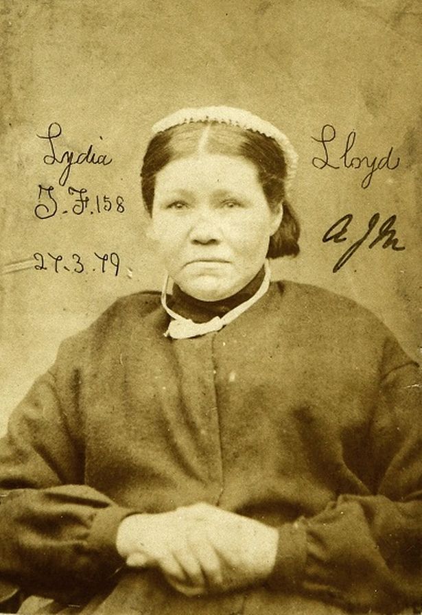 A fascinating new free website, Tracing London Convicts in Britain & Australia, 1780-1925 allows “genealogists and family historians to discover the fate of ancestors convicted of crimes and transported overseas.” This new website allows you to search millions of records from around fifty data sets, relating to the lives of 90,000 convicts from the Old Bailey. Pictured right: Lydia Lloyd, a Victorian era convict. (Image: The National Archives UK ref. PCOM4/71/6 (image 00001))
From the State Library of New South Wales Australia: The Lone Hand (1907-1921) newspaper has been digitized and made available through Trove. “Modelled on the London Strand and founded by J.F. Archibald and Frank Fox, The Lone Hand was a monthly magazine of literature and poetry, with illustrations by significant Australian artists of the time.”
England: Parish & Court Records
Ancestry.com has two new collections this week for England. Staffordshire Extracted Church of England Parish Records, 1538-1839 includes records for baptisms/christenings, burials, marriages, tombstone inscriptions, obituaries, tax lists, wills, and other miscellaneous types of records for Staffordshire, England. Also included are some records from non-conformist churches. Extracted Parish and Court Records, 1399-1795 is a collection of historical parish registers throughout England.
Also new for England, TheGenealogist has added over 1.1 million individuals to its Sussex County parish record collection. This update includes 717,000 baptisms, 213,000 marriages, and 208,000 burials.
Over at Newspapers.com, The Atlas newspaper has now been digitized. The London area paper operated from 1826 to 1869, and comprised a mixture of national and international social and political news, along with literary, theater, and music reviews. Another new newspaper available online is The Worthington Herald, from 1920-1959 in Worthington, West Sussex, England.
Millions of Dutch Records
FamilySearch has recently published millions of Dutch records (51 million to be exact) from the Netherlands, making it easier than ever to trace your Dutch roots. These new records have increased FamilySearch’s collection of Dutch names from 4,074,736 to over 55 million. From the collection description: “Archives around the Netherlands have contributed indexes which cover many record sources, such as civil registration, church records, emigration lists, military registers, and land and tax records.” Click here to search the collection.
South Africa Probate Records
New at FamilySearch: South Africa, Cape Province, Probate Records of the Master of the High Court, 1834-1989. This impressive collection is comprised of over 155,000 indexed records and 1.1 million digitized images! The original records are located in the Cape Archives Depot, Cape Town.
United States Newspapers
California. The Cal Poly University student newspaper has been digitized in honor of their 100 year celebration. 75,000 pages from 7,138 issues are now fully searchable online, thanks to optical character recognition (OCR) technology. Click here to explore the database.
North Carolina. Saint Mary’s Student School Newspaper, The Belles, is now online. Dating back to 1936 through 1995, the paper gives a good look into the viewpoint of North Carolina teen women over a 60 year period.
New Mexico. Now available at Newspapers.com is the Albuquerque Journal, with issues dating back to 1882. Almost 2 million pages are available to browse by date.
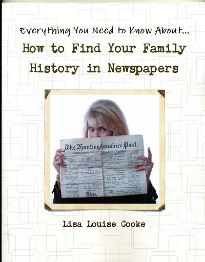
There’s a wealth of information about your ancestors in newspapers! Lisa’s book, How to Find Your Family History in Newspapers, provides you with a foolproof research process for discovering them, and is stuffed with everything you need for genealogical success. Available in both print and ebook formats, you’ll get step-by-step instructions, worksheets, tons of free online resources, case studies, and more!
Disclosure: This post contains affiliate links and Genealogy Gems will be compensated if you make a purchase after clicking on these links (at no additional cost to you). Thank you for supporting Genealogy Gems!