by Sunny | Dec 18, 2017 | 01 What's New, Ancestry, Genealogy Giants Websites, MyHeritage, Research Skills
Common surnames can make genealogy research more challenging. But learning more about your last name (including how common it is) can also enrich your family history. Check out 4 free online tools for learning more about your family’s surnames. Then share what you learn the next time your relatives get together!

If you have common surnames on your family tree, you may have become frustrated at times trying to determine whether the “John Williams” or “Elizabeth Smith” you’re looking at in a record belongs to your John or Elizabeth. Would it make a difference if you discovered they lived in an area where there very few folks by those names during that time period? It would. Furthermore, it would probably also be nice to know things like where else in the world–or within England, for example–that surname is found now (or was in the past).
The enormous amount of census, vital records, and family tree data now online is making it easier to answer questions like these. Below, find free online tools for mapping common surnames (and less-common ones, too) across time. They include surname search tools hosted by a couple of our Genealogy Giants, Ancestry.com and MyHeritage.com. What can you learn from the following sites? Do they agree with one another? Check them out!
Your surname in the 1990 and 2000 U.S. censuses
 The US Census Bureau has created databases of last names that appear in recent censuses. You can look at the results a couple of ways:
- Click here to search for your surname among the most common 150,000 surnames from the 1990 and 2000 censuses. These surnames cover about 90% of those who participated in the census.
- Click here to view a list of all surnames that appear 100 or more times in the 2000 census. (Smith, Johnson, Williams, Brown, Jones, Miller and Davis all top a million occurrences!) According to this webpage, the top 15 surnames have remained fairly steady in the most recent three censuses with one exceptional trend: Spanish-origin surnames are starting to make the lists.
 Common surnames of England and Wales
Find out how common your surname is today in England, Wales, and the Isle of Mann. The Surnames of England and Wales – the ONS List has a searchable database of almost 270,000 surnames shared by 54.4 million people (it excludes surnames occurring fewer than 5 times in the total database of nearly 60 million people). The list compiled between 1998-2002 does have some duplication and misspellings: “experience suggests that multiplying the result for your surname by 0.93 will give a good idea of the living population for your surname.”
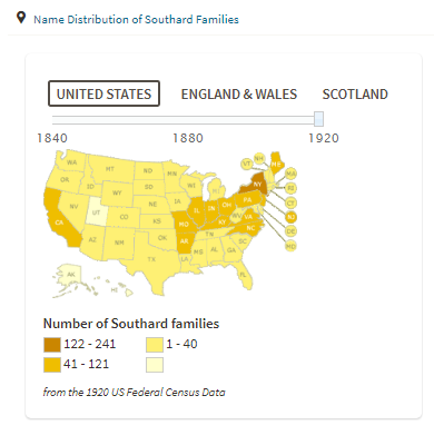
What’s in a name? Ancestry.com answers
Ancestry.com hosts this fun and free tool for those with roots in the U.S., England, Scotland, and Wales:
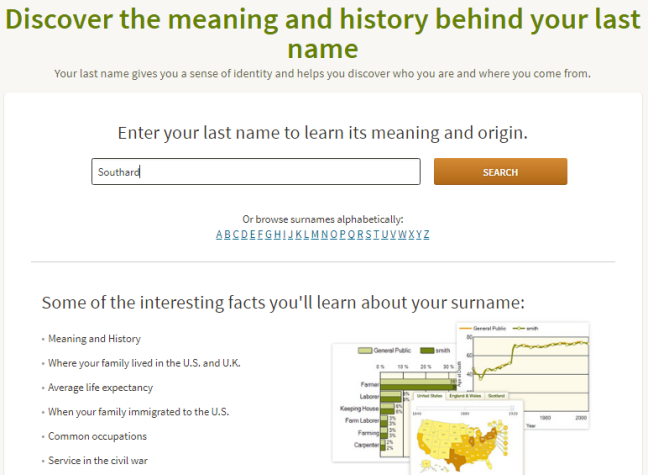
Remember, it’s not a precise genealogy research tool. But it can prove interesting. When I ran this search for the married surname of our Genealogy Gems DNA expert, Diahan Southard, I was shown (among other things) this interesting map illustrating how the Southard family was spread across the United States in 1920:
Surname directory at MyHeritage
MyHeritage.com hosts a searchable surname directory taken from data found on its site. To search the surname directory, choose the first letter of the last name from the alphabet shown below the search screen. (If you enter a name in the blue search boxes, you’ll be taken into their record-searching area, which isn’t the same):

You won’t find all names surnames here, though you may find variant spellings of yours. (I never knew McClellan could be spelled in so many different ways!) Here’s a map of how they find my husband’s surname, Morton, scattered across the globe:

Looking for more surname distribution maps? Click here to find a list organized by country.
Next Steps: Try this with your common surnames
 If you’ve taken a DNA test…Thousands of people are compiling their same-surname DNA test results into surname projects. Click here to learn more about how to “social network” your yDNA test results in a surname project.
If you’re a Genealogy Gems Premium subscriber…you can watch Lisa Louise Cooke’s fabulous video tutorial, Common Surname Google Search Strategies. Use her tips to find even your most commonly-named relatives online! (Not a Premium member? Click here to learn more–for one low price, you’ll get a year’s access to hundreds of Premium videos and podcast episodes!)
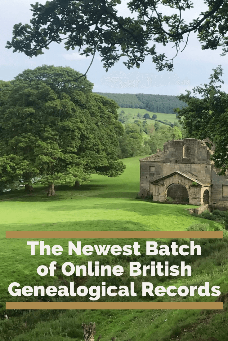
by Lisa Cooke | Aug 14, 2019 | 01 What's New, Findmypast
It’s always exciting to see new genealogical records come online because they offer new hope for discoveries and brick wall busting.
Findmypast, a leader in British genealogical records, has recently added thousands of new records to existing and new collections. Among these you’ll find everything from baptism and burial records to British and Irish digitized newspapers.
Huddersfield, England Baptisms
A large market and university town in West Yorkshire, England, Huddersfield is nestled between Leeds and Manchester. It’s the 11th largest town in the United Kingdom, and is known for it’s Victorian architecture. Huddersfield railway station was described by former Poet Laureate of the United Kingdom John Betjeman as “the most splendid station façade in England”, second only to St Pancras, London.
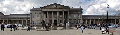
Over 52,000 records covering 14 new parishes have been added to Findmypast’s collection of Huddersfield Baptisms. All new parishes are highlighted in the Huddersfield baptisms parish list.
Each baptismal record includes a transcript of an original parish register entry. This will reveal a combination of your ancestor’s:
- baptism date,
- parent’s names,
- father’s occupation
- and father’s address.
Click here to search the Huddersfield Baptisms
Yorkshire, England Memorial Inscriptions
If you are trying to find out when your ancestor died and was laid to rest in Yorkshire, this growing collection is worth a look. Over 5000 additional records have been added to the Yorkshire Memorial Inscriptions collection.
These newly added records cover 14 Anglican churchyards across the York area (West Riding, North Riding and Ainsty).
The bulk of the records mainly cover the years of the First and Second World Wars.
Search for your ancestors now in the Yorkshire Memorial Inscriptions
Middlesex Baptisms and Monumental Inscriptions
An historic county in southeast England, Middlesex was established in the Anglo-Saxon system from the territory of the Middle Saxons. It existed as an official administrative unit until 1965, and now mostly falls within the ceremonial county of Greater London, with small sections in other neighboring ceremonial counties.
Baptisms
Findmypast has recently added over 64,000 new records to existing parishes within the collection of Middlesex Baptisms. These transcripts of original parish register entries will reveal a combination of your ancestor’s baptism date, parent’s names, father’s occupation and address.
The collection also covers parts of London, Surrey, and Hertfordshire.
Search the Middlesex Baptisms Collection
Monumental Inscriptions
Over 5,000 additional monumental inscription records are now available to search. The new records cover two cemeteries in Teddington as well as the Parish of St Mary’s in Sunbury.
Monumental Inscriptions can reveal the names of others buried in that plot as well as more specific details regarding age, birth and death dates. This can be incredibly helpful as it can provide you with the names and dates of your ancestor’s next of kin, including their relation to one another.
Search the Middlesex Monumental Inscriptions here.
Essex Genealogical Records
Essex is a large county in the south-east of England and forms part of the Metropolitan Green Belt just beyond greater London. The original Kingdom of Essex, founded by Saxon King Aescwine in AD 527, occupied territory to the north of the River Thames and east of the River Lee. In the 1640s, during the English Civil War, notorious witch hunter General Matthew Hopkins lived in the county accused 23 women in Chelmsford in 1645.
You will find five million baptism, banns, marriages, and burial records from Essex on Findmypast. These records were created from the original registers held by the Essex Record Office and other sources.
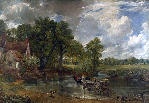
The oil on canvas The Hay Wain by John Constable shows the Essex landscape on the right bank.
Essex Baptisms
This collection covers 532 parishes and reveals:
- birth place,
- birth date,
- birth place,
- denomination,
- residence,
- baptism date,
- baptism place,
- parents’ names,
- and father’s occupation.
Search the Essex Baptism Index 1538-1920 here.
Essex Marriages and Banns
These records cover 553 parishes and provide the following information:
- residence
- occupation
- marital status
- banns year
- marriage date
- location
- spouse’s name
- spouse’s residence
- spouse’s marital status
- father’s name
- spouse’s father’s name
- names of any witnesses
Search the Essex Marriages and Banns 1537-1935
Essex Burials
This collection covers 455 parishes and provide:
- birth year
- age at death
- denomination
- birth year
- burial year
- burials date
- burial place
Search the Essex Burial Index 1530-1994
Derbyshire Genealogical Records
Derbyshire stole my heart this year during a recent trip to England where I spoke at THE Genealogy Show conference. It’s preserved historic beauty can be greatly attributed to the Peak District National Park which mostly falls within this East Midlands area county.
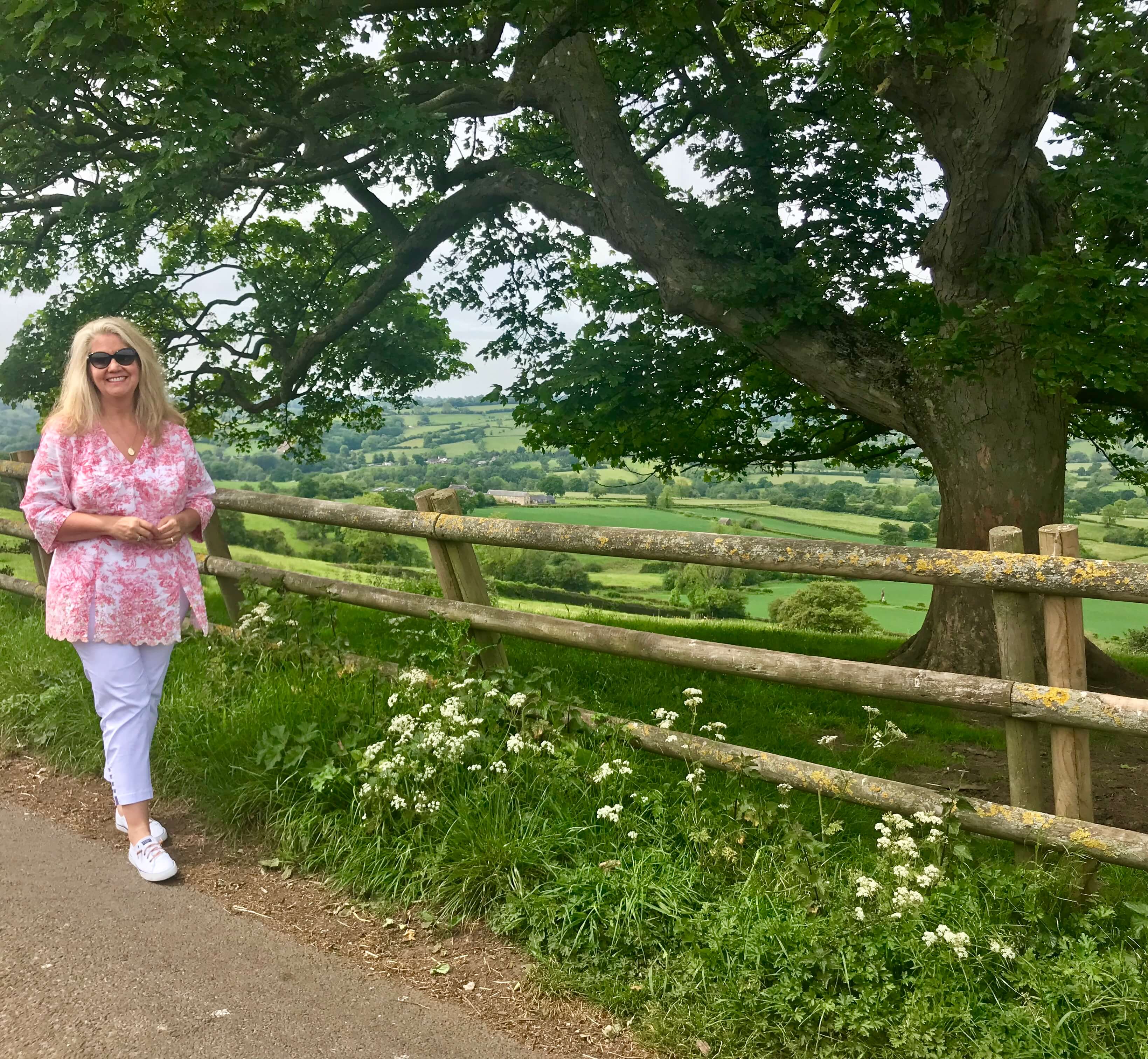
Photo: My recent visit to beautiful Derbyshire, England
Births and Baptisms
Just under a thousand additional records from 15 non-conformist parishes have been added to the Findmypast collection of Derbyshire Births and Baptisms.
Mainly covering Methodists, Baptists, and Presbyterians, the full list of new additions has been highlighted in their Derbyshire parish list.
Search Derbyshire Births and Baptisms here.
Kent Burials
Over 4,500 records of burials that took place at St Martin’s church in Cheriton are now available to search here. These new additions cover two periods, 1843 to 1855 and 1907 to 1958. Search these records to discover where and when your ancestor was buried, as well as the names of their spouse and father.
These burial records constitute a valuable resource for researching ancestry in Kent and have been provided in association with:
- Canterbury Cathedral Archives
- Kent County Council
- the North West Kent Family History Society,
- Folkestone & District Family History Society
- and Val Brown.
Billion Graves Cemetery Indexes at Findmypast
You just might be able to pinpoint your ancestor’s final resting place with the new additions to Findmypast’s Billion Graves Cemetery Indexes. The latest update includes:
Cemetery records like these can provide you with information regarding your ancestor’s birth and marriage dates.
According to Alex Cox of Findmypast, “With an abundance of cemeteries, it can be overwhelming trying to pinpoint the precise cemetery in which your ancestor was laid to rest, and visiting each potential location is costly. However, in partnering with BillionGraves, we aim to make available all the cemetery records held on their site for free, saving you time and money as you search for your ancestor. BillionGraves is the largest resource for GPS-tagged headstone and burial records on the web, with over 12 million headstone records.”
British and Irish Newspapers
Additions to Existing Newspaper Collections
Findmpast has added 98,602 brand new pages to eleven of their existing titles. Spanning the years 1865 to 1999, the new additions include extensive updates the Huddersfield Daily Examiner as well as titles covering the south of England (Crawley and London), the Midlands (Coventry), and the North West (Liverpool).
Further updates have also been made to the specialist publication – Field – for which they now have editions up to 1911.
Additional updates have been made to twenty-one existing titles, covering the length and breadth of Scotland, Ireland and England. These include updates to two Cornish titles – the Royal Cornwall Gazette and Lake’s Falmouth Packet and Cornwall Advertiser, as well as updates to seven Scottish titles, including the John o’Groat Journal and the Perthshire Advertiser.
There has been a significant update to the Bristol Times and Mirror, with over 33,000 pages added, covering the years 1897 to 1911.
Also updated are two early Labour publications – Clarion and the Labour Leader – as well as one of our religious titles, Witness (Edinburgh), and the sporting title, the Football Post (Nottingham). As you can see, there is a diverse range of interests represented.
New Newspaper Titles
The Queen, The Ladies’ Newspaper and Court Chronicle, a society magazine by Samuel Beeton established in 1861, and the Women’s Gazette and Weekly News have also been added. Published in Manchester, this was a ‘journal devoted to the social and political position of women.’
More historical newspapers added this summer include:
- Hawick Express covering the years 1892, 1903-1904, 1913-1914, 1919-1940, 1950-1952
- Coatbridge Express covering the years 1885-1951
- Dalkeith Advertiser covering the years 1869-1953
- Barrhead News covering the years 1897-1912
- Banffshire Herald covering the years 1893-1912
- Banffshire Advertiser covering the years 1881-1902, 1905-1912
Check out the latest British & Irish Newspaper Updates here.
by Diahan Southard | Oct 26, 2014 | 01 What's New, Google Earth, History, Maps
When Liberian national Thomas Eric Duncan was diagnosed with Ebola it was unnerving for everyone here in the U.S. As a new Dallas area resident, and someone who was hopping from plane to plane for a Fall series of speaking engagements, it definitely gave me pause.
The Abbeville press and banner., October 12, 1892, Image 6/ www.chroniclingamerica.com
Epidemics, quarantines, and communities trying to protect citizens have been age old dilemmas, so it makes sense to look back through history at the strategies employed. There is much to be learned.
If we ask the question “what would have happened if Ebola had struck the U.S. 130 years ago?” we don’t have to look much farther than the location of one of the most recent Ebola patient: New York.
from the Humboldt Republican (Humboldt, Iowa) March 31, 1892
Courtesy www.Newspapers.com
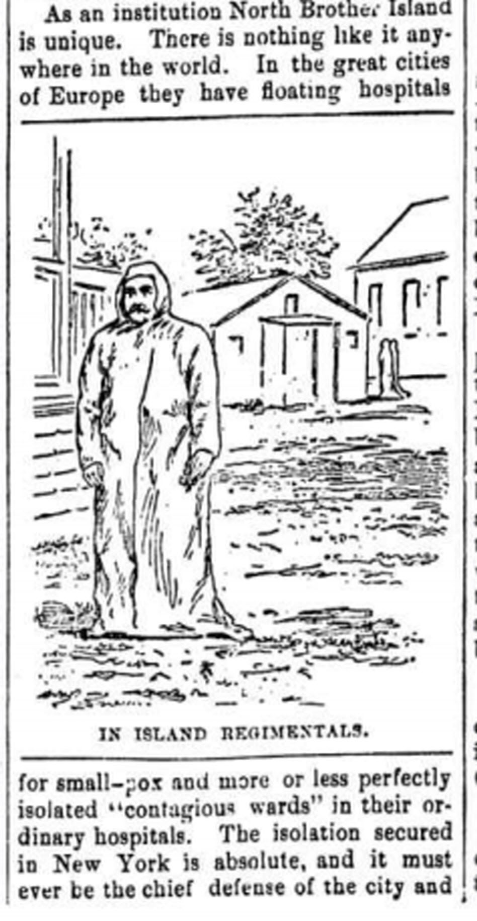
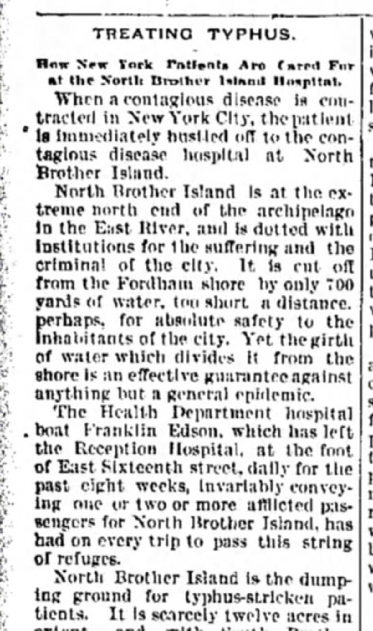
In New York’s East River, tucked between the Bronx and Rikers Island lies North Brother Island, where in 1885 Riverside Hospital was relocated from Blackwell’s Island to isolate and treat small pox patients. From there it expanded to include the quarantine of other diseases.
North Brother Island stands idle today, closed to the public. However from 1907-1910 and 1915-1938 it housed the notorious Typhoid Mary, closing shortly after her death.
Although today the island is closed to the public, anyone can visit virtually with the aid of Google Earth. Join me on a 5+ minute tour of North Brother Island featuring the magazine and newspaper articles of the day, and written, audio and video tours of how it stands today a shell of what it once was. Click here to download and play my Google Earth Historic Tour KMZ file on your computer. It will be added to your “Places” panel in Google Earth under “Temporary Places.” Open the folder and click the “click to play the tour” icon. Be sure your speakers are on! And take time to click to watch the video and view the articles in the placemarks.
Don’t have Google Earth loaded yet? Download it free here.
If you would like to learn to create your own Google Earth family history tours watch this free video and then pick up your copies of Google Earth of Genealogy Volume I and Volume II.
by Lisa Cooke | Apr 1, 2015 | 01 What's New, Google, History, images

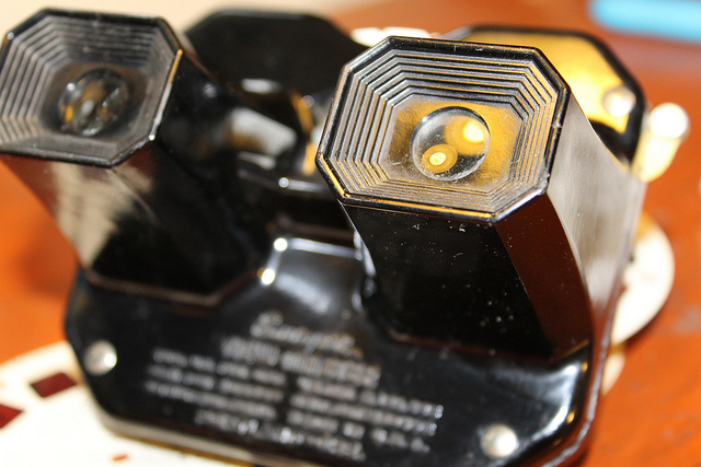
” The View-Master first appeared in 1939 at the New York Worlds Fair. My View-Master Model C, pictured here, was produced between 1946 and 1955. It was made from bakelite and was the first viewer to have a slot into which the reels were placed for viewing. Believe it or not, all reels made for any view master will work in any model from 1939 to present.” Image by Jack Pearce, Flickr Creative Commons. Image used without changes; find it at https://www.flickr.com/photos/jwpearce/10725366513/.
Did you have a View-Master toy as a kid? Using these stereoscopic viewers (long before kids had cameras of their own), children could see pictures of any topic from Disney to dinosaurs to the 1958 World’s Fair in Brussels. According to a collector, whose image is posted here, “all reels made for any View-Master will work in any model from 1939 to the present.”
Well, this decades-only technology is about to get boosted into the 21st century. According to this news report, “Mattel is teaming up with Google on an upcoming virtual reality-based View-Master that is infused with Google Cardboard VR technology.”
“The Cardboard-based View-Master…will share some design elements with vintage View-Masters, but instead of dropping in a reel, you slide an Android smartphone into the unit. View-Master will work with a custom Mattel app, as well as any Google Cardboard-compatible app, of which there are now about 200 in the Google Play Store.”
Want to learn more about these great vintage toys–or share one with the next generation? Click here to purchase a View-Master Viewer and Reels and click here to purchase Collectible View-Master: An Illustrated Reference and Value Guide . (Thank you! Purchasing from these links helps support the Genealogy Gems podcast and blog.
 )
)
 Did you know that nostalgia buffs (and anyone else) can search Google Patents for fun objects like the View-Master? Click here to see the original patent application materials for the 1939 View-Master, including a design drawing of that first model. Here’s a tip: if your ancestor ever applied for a patent, search Google Patents for his or her name! Learn more about Google Patents–and other fabulous and FREE Google tools you can use for family history–in the new, fully-revised 2nd edition of The Genealogist’s Google Toolbox by Lisa Louise Cooke.
by Lisa Cooke | Oct 18, 2013 | 01 What's New, British, Canadian, Google, Inspiration, Maps
Gail Rogers in Ottawa, Ontario, Canada recently shared how my presentation on using Google Earth for genealogy helped her find her way to the site of an old family business–and the place where her ancestor died. She’s given me permission to share it with you. I hope you find it as inspiring as I do!
“Just last week, I received an 1879 death certificate for my great-great-great-grandmother. She ran The Castle Inn in Stafford, Staffordshire, England after the death of her husband in 1863. To my sorrow and horror, I learned that she hanged herself probably within the establishment where she also lived!
“When I shared this with a group of English and Australian cousins who are also researching this family, one of them sent me a link to a 1960s photo of The Castle Inn, shortly before its demolition:
“Then I remembered your presentation about pinpointing your ancestor’s home in San Francisco. I’ve had several “family history” maps with icons that I’ve been working on for the past five years at Google Maps, so I went to the one for my Staffordshire ancestors, clicked on my icon for Eastgate Street in Stafford, and used the Street View to wander down the street, looking for the outline of the roofs, as you did with your old family photo. (You can view a video of my Google Earth for Genealogy class for free here on my website that demonstrates this technique.)
“I soon spotted the outline at the extreme left of the photo, “turned around” (virtually) and wham! There were the double Elizabethan-style timber-framed gables, just as they appeared in the older photo!”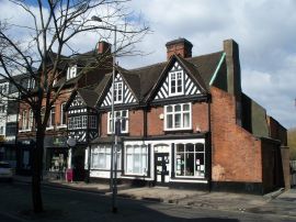
Gail, I was so glad to read that this helped you. I’ve gotten so much great feedback on that particular example of how to use powerful Google Earth (and Google Maps) tools to find important family landmarks.
.jpg)