The free Ellis Island Passenger Search database is home to 65 million records of passengers arriving at the Port of New York from 1820 to 1957. Kathryn Marks, Manager at The Statue of Liberty-Ellis Island Foundation explains the best strategies for finding your ancestors’ passenger list records in the Passenger Search Database on the Ellis Island website. Along the way, you’ll learn some surprising facts about Ellis Island and these invaluable records that will have your genealogy jumping for joy!
Here’s a list of the type of information you may be able to find in passengers lists, depending on the year:
Name
Age
Place of Birth
Physical Description
Occupation
Last Place of Residence
Where they are going
Ship name
What Else You Can Find at the Ellis Island Passenger Search
Crew Manifests
Ellis Island Detention Records and Records of Special Inquiry
How to find Ellis Island records about detained passengers:
Find the manifest in the database.
Look to the left of the name for markings. X or SI stands for Special Inquiry indicates the person was probably held on Ellis Island. LPC: Likely to Become a Public Charge.
Detention records will tell you why they were detained. Detention records aren’t indexed. You can find them by locating the manifest first, and then scrolling through the carousel of images to find them at the beginning or end of the ship’s list.
Determine the length of your ancestor’s detention by counting the number of meals recorded.
Ellis Island Records Through the Years
Ellis Island records coverage: 1820-1957
Pre-Ellis Island AKA Castle Garden Era Records: 1820-1892
Before 1892: Castle Garden was the state-run immigration station. The federal government took over the process of immigration, they built Ellis Island in 1892.
Pre-1897: Records are technically customs records. That’s why they have a very limited amount of information. Manifests were destroyed in a fire in 1897.
Peak Years at Ellis Island: 1892-1924
After 1907: Passenger lists became 2-page documents containing approximately 30 questions.
1924: Ellis Island’s focus turned to detention and deportation. Therefore, most people wouldn’t have actually stepped foot on Ellis Island.
Ellis Island closure: 1954
Records available through: 1957
Records were created at the port of departure. Upon arrival, Ellis Island inspectors asked the passenger the same questions to make sure they were answered the same way.
How to Search for Ancestors at Ellis Island Passenger Search
Select from a variety of wild card searches. Kathryn recommends Close Matches, Sounds Like, and Alternative Spelling.
If you get too many results, click Filters, or use the Wizard or OnePageform. Kathryn recommends the One Page form.
On the One Page form, Kathryn recommends using age at arrival, year of arrival, port of departure and/or country of origin. Pad the years to allow for errors and deviations.
If you’re searching outside the peak year period, don’t use the filters. This is because the records after 1924 were indexed differently. Many passenger lists are only indexed by the year of arrival and are given a placeholder date of Jan. 1. Therefore, if you search for a month or day, you will not get results.
5 Search Strategies for Ellis Island Passenger Lists
Strategy 1: Start by running a broad search.
Strategy 2: Use the original ethnic name, because names were recorded at the port of departure. If you’re unsure of the first name, try entering just the first initial and checking the Contains wildcard. This often helps because the first letter of the name is often the same regardless of the language.
Strategy 4: Be persistent. There are many factors that could lead to not initially finding your ancestor.
Strategy 5: Consider other scenarios.
Name variations – try searching many variations.
Remember that the clerks may have spelled names phonetically.
Many passenger lists are handwritten so they may have been transcribed and/or entered into the database incorrectly.
Your ancestors may have arrived at a different port of entry, such as Philadelphia, Boston, or Baltimore. Many of those passenger lists are also available online.
More Ellis Island Search Tips:
Italian women travel with their maiden name. Children may be under either the father or mother’s last name.
Jewish people may be traveling under their Yiddish name.
Families are listed together. If you can’t find the head of the family, try searching for the children.
In pre-Ellis records names may be abbreviated. Example: Wm. for William, and women may be listed under their husband’s name, such as “Mrs. Adam Smith”.
Coming to the Ellis Island Passenger Search in the Future
The Statue of Liberty-Ellis Island Foundation is planning on expanding and adding the records of all the other ports to the database.
Alternative Search Tool for the Ellis Island Database
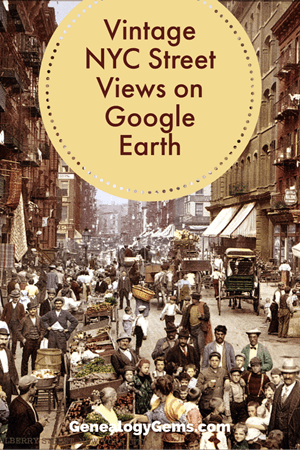
You can now see New York City street views from the late 1800s and early 1900s as Google Earth street views. Take a virtual visit to the Big Apple as it was 100 years ago! Or travel back even further in time to an 1836 map of NYC conveniently overlaid on a modern Google Earth view. These are just two of the many ways to use Google Earth for genealogy—and for fun.
Vintage New York City Street Views on Google Earth
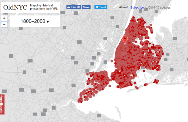
Over 80,000 original photos from the late 1800s and early 1900s have been mapped into Google Earth to provide what’s essentially a Google Street View map of old New York City!
As you can see from this overview map (below), the old photos are concentrated in the areas of Staten Island, Brooklyn, Queens and Lower and Upper Manhattan. Dots represents historic photos that have been overlaid on Google Earth’s modern map (satellite view is also available).
Old NYC
You can zoom in to click on individual dots, which will bring up one or more individual photos of certain neighborhoods or street fronts:
Select the photos that match up best with your family history interests, such as a shot of your family’s old store front or apartment building. Or choose images that represent the time period in which your relatives lived in the area, so you can get a flavor of what their neighborhood would have looked like. (Click here for some ideas about where to look for your family’s exact address during the late 1800s or early 1900s.)
According to this article at BusinessInsider.com, a developer Dan Vanderkam worked with the New York Public Library to plot all the photos onto Google Earth. (A hat-tip to Genealogy Gems listener and reader Jennifer, who sent me this article because she knows how much I love old maps and data visualization!)
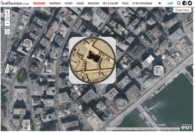
Another Old NYC Street View: 1836 Map
While we’re on the subject, I also want to mention another cool tool for visualizing old NYC street views. At the Smithsonian.com, there’s a cool historic map overlay of an 1836 New York City map in Google Earth. Use the scrolling and zooming tools to explore the parts of NYC that were already settled–and to compare them to what’s there today. You can also swap views to see the 1836 map with just a little round window of the modern streets.
The accompanying article quotes famous map collector David Rumsey about the 1836 map, which is his. He describes how you can see that much of the topography of Manhattan has changed over the years—did you know Manhattan used to be hilly? And I love how he calls out artistic features on the old map, too.
Smithsonian NYC street view 1836
Unfortunately, the old map doesn’t show much in the way of residents’ property lines or buildings. But you can clearly see the street layouts and where the parks and hills were. Comparing these areas with Google Earth’s street view today can help you better understand what things looked like in a much older version of one of the world’s great cities.
Use Google Earth for Your Genealogy
There are so many ways to use Google Earth for genealogy! My free video class will get you started. After a quick tutorial on downloading and navigating Google Earth, see how to utilize its powerful tools to identify an old family photo, map out addresses that may have changed and even plot an old ancestral homestead.
Recharge your genealogy research at the Fort Worth Genealogical Society End of Summer Seminar this Saturday, September 9, 2017. Genealogy and technology expert Lisa Louise Cooke will help you to discover, organize and share your family history more effectively.
To celebrate their 60th anniversary, the Society has invited internationally-renowned genealogy and technology expert Lisa Louise Cooke for a full day of genealogy fun and inspiration. She’ll be presenting four sessions packed with simple yet powerful strategies, how-to’s and examples that will help you discover your family history more effectively online, organize what you learn, and share it with attention-getting style.
THIS SATURDAY: Fort Worth Genealogical Society Seminar Details
Here’s what’s happening:
What: 2017 End of Summer Seminar Where: Trimble Tech High School, 1003 W. Cannon Street, Fort Worth, TX When: Saturday, September 9, 2017, 8:45 am – 4:30 pm (doors open at 8:15 am for registration) Hosted by: Fort Worth Genealogical Society
Lisa will be teaching some of her most empowering classes–the ones that give attendees immediate action items to help them take the next steps in their own genealogy research. Three of the four classes are entirely new in 2017. Here they are:
1. Google Books: The Tool You Should Use Every Day! Over 25 million digitized and searchable free books are at your fingertips with Google Books. Learn how to make the most of this goldmine chock full of historical data. (This was a BIG hit at Rootstech,)
2. Create a Free Google Earth Map Collection for Your Research. Learn how to find free digital maps for your ancestral locations, add them as permanent overlays to Google Earth, and then organize them into your personal map reference collection. You’ll learn best practices for keeping them organized and enriching your research.
3. Making Evernote Effortless. Learn the best strategies for making Evernote a breeze to use for your genealogy research. Shave time off your note-taking with quick keys, shortcuts, saved searches, search operators, Reminders, note sharing, source citation, and building Evernote into any browser you use (including mobile devices). (Evernote is one of the world’s top free organization tech tools:click hereto learn more about it.)
4. 7 Awesome Apps that Eliminate Eye-Rolling! Eliminate your relative’s bored eye-rolling and captivate them with compelling stories and imagery! We’ll cover seven easy-to-use and free mobile apps that will help you tell your family history stories in a riveting way.
More Learning Opportunities with Lisa Louise Cooke
If you can’t make it this weekend, you can still get the benefit of Lisa’s expertise and inspiring teaching style.
First, head to her Seminar schedule to see if she’ll be headed to a town near you!
Then, check out her books and quick guides. They are packed with her signature approach to technology: she shares creative ideas and simple, step-by-step instructions for using powerful, mainstream and mostly free technologies for family history.
The Genealogist’s Google Toolbox (2nd edition) is a must-have for all family history researchers who work online (and that’s just about everyone). Find detailed instructions and explanations for making your Google searches more effective, along with entire chapters on using Google Earth, Google Books, Google Scholar, Google Alerts and even YouTube for genealogy.
The Evernote for Genealogists quick reference guide (available for Windows and Mac users) is a handy cheat sheet you’ll want to keep close at hand. It takes you from the “getting started” level quickly into navigating Evernote to maximize and organize your research note-taking.
Mobile Genealogy: How to Use Your Tablet and Smartphone for Family History Researchwill help you put your iPad, tablet and/or smartphone to work for your genealogy research. This expanded second edition of her original, groundbreaking book on mobile genealogy goes into greater depth with more apps and is loaded with tips and tricks that make your mobile device a genealogy powerhouse.
Google celebrated Earth Day by releasing Google Earth 7.1 and announcing some great new content! And there are three reasons you will want to make the upgrade:
1. New Hands-Free Navigation Technology
The big news with version 7.1 is Leap Motion support, a touch-free 3d technology that lets you “navigate Google earth with simple hand gestures.” The Leap Motion Controller ($79.99) will start shipping mid-July, so you’ve got some time to get to know Google Earth a little better before you start flying around in it like this:
You KNOW I have to get me some of that!
2. More 3D City Views There’s also exciting new 3D data in Google Earth, most notably for New York City. But there’s also more imagery for other cities around the world: Innsbruck, Austria; Dijon, France; Cagliari, Italy and the Spanish cities of San Sebastian, Santander, Pamplona, Manresa and Burgos. Other U.S. cities with 3D coverage include Miami, FL; Houston, TX; Orlando, FL; Encinitas, CA and Spokane, WA.
3. The Addition of the 50th Country to Google Maps’ popular Street View Feature
You can now view 50 countries buy lasix medication online with Google Maps’ popular Street View feature. The newest nations to be added are Hungary and Lesotho (a tiny country within South Africa), and there’s new or updated coverage for Poland, Romania, France, Italy, Russia, Singapore, Thailand and other locations worldwide. Google calls this “the largest single update of Street View imagery we’ve ever pushed, including new and updated imagery for nearly 350,000 miles of roads across 14 countries.”
Help for Using Google Earth for Genealogy
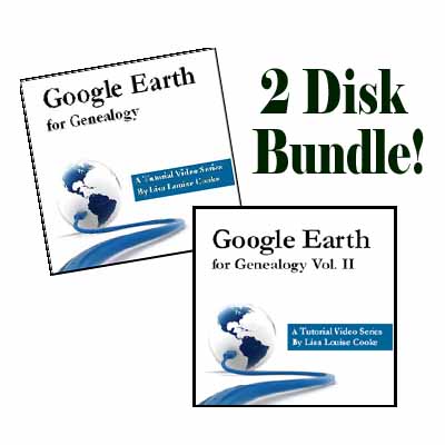
How can you access these fabulous features, both for fun virtual travel and for seriously fun genealogy research? Upload the latest version of Google Earth for free (for PC, Mac or Linux). Then check out my Google Earth for Genealogy 2-CD Bundle. There’s a reason is this one of my best-selling presentations: Google Earth is one of the best genealogy research tools around! In these CD presentations, I show you how to locate and map ancestral homesteads; use historical map overlays; identify where old photos were taken; create 3D models of ancestral locations; create custom family history tours and much more.