Create Your Family History Google Earth Tour
Tours are great way to see highlights in the shortest amount of time. Why not take your relatives on a virtual family history tour? You can do just that using the free Google Earth Pro software. Read more as Lisa shares some tips and strategies to use Google Earth to...German Marriages and More in New and Updated Genealogy Records Online
German marriages, Indexed obituaries for the U.S., Canada, the U.K., Ireland, Australia, and New Zealand, The ultimate photo map of the 1906 San Francisco earthquake, and UN War Crimes Commission reports from World War II are all in our new and updated genealogy records today!
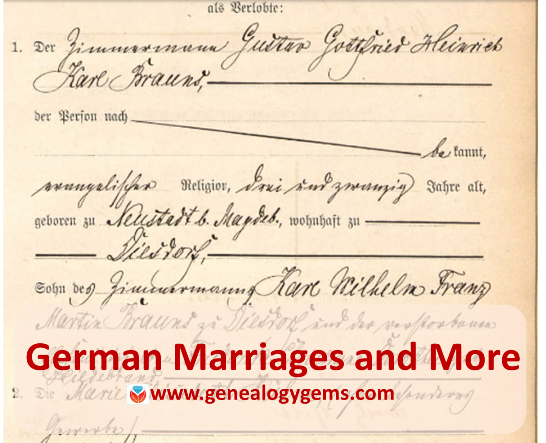
Germany Marriages: Magdeburg
Ancestry.com has published a new collection of over 600,000 marriages recorded in Magdeburg, a city about 80 miles west of Berlin. According to the collection description, “Beginning on October 1, 1874, local registry offices were made responsible for creating birth, marriage, and death records in the former Prussian provinces. The collected records are arranged chronologically and usually in bound yearbook form which are collectively referred to as ‘civil registers.’ For most of the communities included in the collection, corresponding alphabetical directories of names were also created.” The records date from 1874-1923.
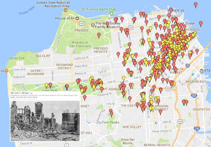 1906 San Francisco Earthquake: The Ultimate Map
A new interactive map plots the likely locations of thousands of photos taken of the “smoke, fire, ruins and refugees” after the 1906 San Francisco earthquake. The map at OpenSFHistory references stunning images of bewildered survivors amidst their devastated neighborhood, reminders of the brutal and total losses many incurred in a few seconds.
- Got a disaster story in your family history? Read these tips on researching it.
- Was London the scene of your family’s disaster–specifically, the London Blitz? Click here to learn about an interactive map of the bombing of London during World War II.
Indexed Obituaries at Ancestry.com
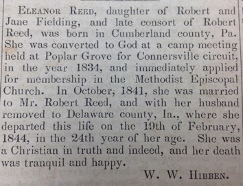
Obituaries such as this one from the Western Christian Advocate (Cincinnati, June 28, 1844) often reveal unique personal and family information.
Ancestry.com recently updated several enormous national obituary indexes:
- U.S., Obituary Collection, 1930-2016 (and a related collection, U.S., Cemetery and Funeral Home Collection, 1847-2017)
- Canada, Obituary Collection, 1898-2015
- UK and Ireland, Obituary Index, 2004-2017
- Australia and New Zealand, Obituary Index, 2004-2015
Thousands of obituaries or death notices are searchable in digitized newspaper collections, but indexes dramatically improve the odds of discovering them. Then the trick becomes tracking down the original paper to see it for yourself. Learn more about finding obituaries (and everything else in newspapers) in How to Find Your Family History in Newspapers by Lisa Louise Cooke.
South Africa Court Records
Over 200,00 records appear in Ancestry.com’s new database, South Africa, Miscellaneous Court Records Index, 1652-2004, 2008-2011. Spanning more than 350 years, the collection indexes records from the Courts of Justice (1652-1956), Cape Town Criminal Records (1854-1855), Official Name Changes (2008-2011), South African Law Reports (1828-2004), and the 1859 Weenan, Natal Jury List.
“The details provided for each person typically include name, record date, record place, collection, and source,” states the collection description. “Depending on the collection, additional details such as occupation, place of residence, names of relatives, or information on a court case or crime may be available as well.”
UN War Crimes Commissions Archive Opened
The Guardian recently reported that the UN War Crimes Commission archives is being opened in London and its catalog is now searchable online. “War crimes files revealing early evidence of Holocaust death camps…are among tens of thousands of files to be made public for the first time this week,” says the story. “The archive, along with the UNWCC, was closed in the late 1940s as West Germany was transformed into a pivotal ally at the start of the cold war and use of the records was effectively suppressed.” The archive contains thousands of pages of evidence collected (much of it in secret) even as the war raged, and includes detailed descriptions of Nazi extermination camps, massacres in Czechoslovakia, and early war crimes tribunals.
Newspapers in the News
North Carolina
Digitized issues of The Franklin Times (weekly, searchable 1909-1924) are now searchable at Digital NC. The paper served Lewisburg, the seat of Franklin County, North Carolina. The paper has a fairly local focus, according to a blog post announcing the collection. “For example, one weekly column, ‘The Moving People,’ tracks ‘those who have visited Louisburg the past week’ and ‘those who have gone elsewhere for business or pleasure.’ The column lists individuals who returned from trips and those who visited from afar….Local meetings, contests, municipal issues, social events, and more are recounted each week.”
Washington
 Lisa Louise Cooke just found a little piece of her own history in Washington State University’s student newspaper, now fully searchable online for free. It’s a short snippet that refers to a two-woman play Lisa was in!
According to a Facebook announcement, a new digital archive includes 13,200+ issues of the The Daily Evergreen (1895-2016) and 660 pages of other newspapers, including an early official student paper, the College Record (1892-1893).
Find your own family history in newspapers of all kinds, from local dailies to labor presses or church regionals, or even student papers such as the one Lisa used above. “Read all about it!” in Lisa’s book, How to Find Your Family History in Newspapers.

Available at http://genealogygems.com
Were Your Ancestors “Viscious” or in “Chronic Want”? London Poverty Maps Map It Out
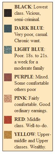
Booth Poverty Maps key
There is a fantastic blog posting on Mad About Genealogy about the Booth Poverty Maps, which look like a riveting way to understand your ancestor’s 1880s London neighborhood.
According to blogger Linda Elliott, “Booth employed a team of social investigators who walked around the London streets often in the company of the local policeman and recorded what they saw and heard. The notebooks that they filled out can be viewed online and make for fascinating reading with amongst other findings they record what the policeman thought of each street and sometime each building and its inhabitants.”
I’ve shown the map key here (right), clipped from The Charles Booth Online Archive. Linda describes each category in greater detail in her blog post, along with everything a genealogist needs to know to use the maps.
How to Find Enumeration District Maps
Looking for enumeration district maps for the U.S. Federal Census? You’re not alone!
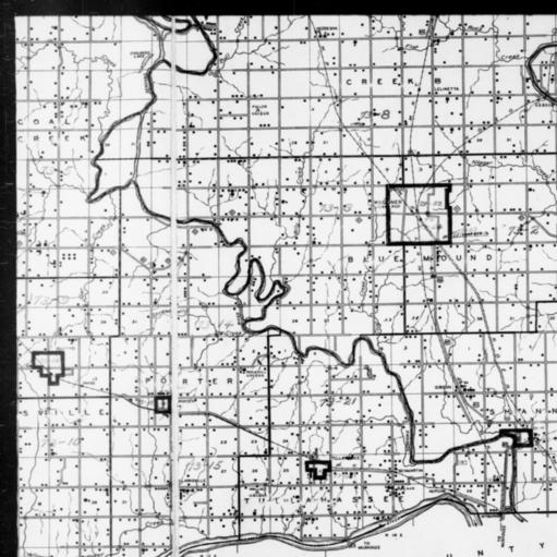
1940 Census Enumeration District Map, Oklahoma, Wagoner County, http://research.archives.gov/description/5836456
Recently Genealogy Gems podcast listener Michelle in Denver, Colorado, wrote in with this question:
“Where can I find individual enumeration district maps? I don’t need a state-wide map showing the divisions between enumeration districts, but a map showing the numbered households within a single enumeration district.”
My answer: How to find Enumeration District Maps
First, here’s a little back story from the National Archives (U.S.) website:
“An enumeration district, as used by the Bureau of the Census, was an area that could be covered by a single enumerator (census taker) in one census period. Enumeration districts varied in size from several city blocks in densely populated urban areas to an entire county in sparsely populated rural areas.
Enumeration district maps show the boundaries and the numbers of the census enumeration districts, which were established to help administer and control data collection. Wards, precincts, incorporated areas, urban unincorporated areas, townships, census supervisors` districts, and congressional districts may also appear on some maps. The content of enumeration district maps vary greatly.
The base maps were obtained locally and include postal route maps, General Land Office maps, soil survey maps, and maps produced by city, county, and state government offices as well as commercial printers. Census officials then drew the enumeration district boundaries and numbers on these base maps.” (Check out the full article here.)
Enumeration district maps are not available in all years and all locations. 1940 ED maps are available on the National Archives (U.S.) website. (Scroll down to item 3 for instructions on getting to these through the Online Public Access search.) You’ll see that only the enumeration district numbers and street names are marked on the maps. Individual homes are not.
You might be wondering, are there enumeration district maps before 1940? They are limited but the answer is yes. Enumeration District maps are also available for the 1900 through 1930 censuses. You can browse and download the maps for free at FamilySearch. Search for title The United States enumeration district maps for the twelfth through the sixteenth US censuses, 1900-1940.
For censuses before 1900, the government used voting districts as enumeration districts. Find voting district maps in the Library of Congress book, Ward Maps of the United States : A Selective Checklist of Pre-1900 Maps in the Library of Congress. (The links here lead to WorldCat search results for these titles. WorldCat will tell you about libraries that have these books.)
Next, turn to the book Cartographic Records of the Census Bureau for a listing of maps available back into the 19th century at the National Archives. It’s available as an ebook which you can read online or download for free from Google Books. This book is an invaluable resource for finding much early maps at available at the National Archives on microfilm.
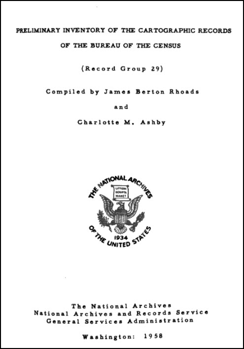
Read Preliminary Inventory of the Cartographic Records of the Bureau of the Census free at Google Books.
Enumeration District (ED) Map Finder
If you just want to find the enumeration district number of an address you already know, go to the Unified Census ED Finder at Steve Morse’s One-Step genealogy website.
At the top of the Unified Census ED Finder page start by selecting the census year (currently 1870 through 1950.) Next, enter as much information as you know about the location such as the county. Select the city from the list of cities displayed. You will then be able to enter street-level information. If you select “other” from the city list, you can then type in the city or town name. Continue to follow the prompts and instructions.
Here are a few more things to keep in mind as you find and use ED maps:
In cities, there are often two columns of numbers in the census population enumeration (typically on the far left of the page). There’s house number and the number representing the order in which the enumerator visited the house (which has nothing to do with the house number). If you can’t find a relative in once census, pull the address from one census and use it in the Steve Morse database above to pull up the enumeration district for your missing decade.

Sanborn Fire Insurance Maps can be helpful when searching for old Enumeration District Maps.
Depending on the year you are researching, try to locate a Sanborn fire insurance map for the area. Sanborn maps do include drawings of individual homes and include their house number. Genealogy Gems Premium Podcast Episode 47 is all about Sanborn fire maps. On the show notes page I even include a list of links to many Sanborn map collections, organized by state.
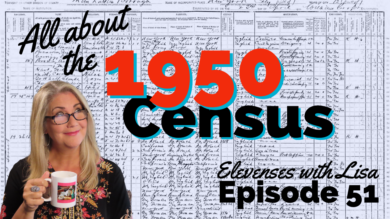
Final Thoughts: The Newest ED Maps Available Online
The 1950 enumeration district maps are now available for free online. Read my article The 1950 Census for Genealogy and watch the video to learn how to access them for free.