You can now see New York City street views from the late 1800s and early 1900s as Google Earth street views. Take a virtual visit to the Big Apple as it was 100 years ago! Or travel back even further in time to an 1836 map of NYC conveniently overlaid on a modern Google Earth view. These are just two of the many ways to use Google Earth for genealogy—and for fun.
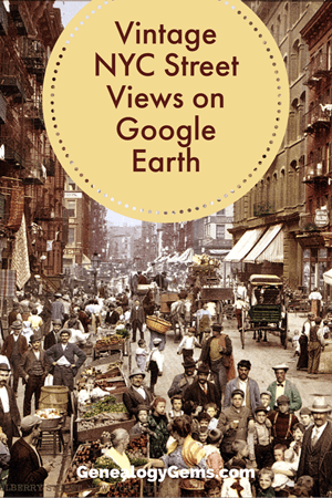
Vintage New York City Street Views on Google Earth
Over 80,000 original photos from the late 1800s and early 1900s have been mapped into Google Earth to provide what’s essentially a Google Street View map of old New York City!
The site is called OldNYC, and it’s free.
As you can see from this overview map (below), the old photos are concentrated in the areas of Staten Island, Brooklyn, Queens and Lower and Upper Manhattan. Dots represents historic photos that have been overlaid on Google Earth’s modern map (satellite view is also available).
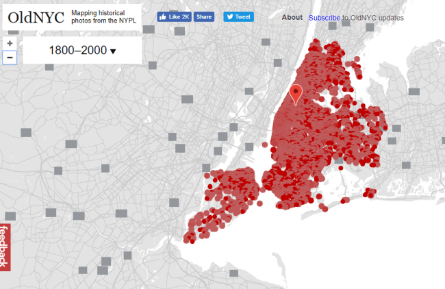
Old NYC
You can zoom in to click on individual dots, which will bring up one or more individual photos of certain neighborhoods or street fronts:
Select the photos that match up best with your family history interests, such as a shot of your family’s old store front or apartment building. Or choose images that represent the time period in which your relatives lived in the area, so you can get a flavor of what their neighborhood would have looked like. (Click here for some ideas about where to look for your family’s exact address during the late 1800s or early 1900s.)
These photos all come from the New York Public Library’s Photographic Views of New York City, 1870s-1970s collection, which is also free to view online.
According to this article at BusinessInsider.com, a developer Dan Vanderkam worked with the New York Public Library to plot all the photos onto Google Earth. (A hat-tip to Genealogy Gems listener and reader Jennifer, who sent me this article because she knows how much I love old maps and data visualization!)
Another Old NYC Street View: 1836 Map
While we’re on the subject, I also want to mention another cool tool for visualizing old NYC street views. At the Smithsonian.com, there’s a cool historic map overlay of an 1836 New York City map in Google Earth. Use the scrolling and zooming tools to explore the parts of NYC that were already settled–and to compare them to what’s there today. You can also swap views to see the 1836 map with just a little round window of the modern streets.
The accompanying article quotes famous map collector David Rumsey about the 1836 map, which is his. He describes how you can see that much of the topography of Manhattan has changed over the years—did you know Manhattan used to be hilly? And I love how he calls out artistic features on the old map, too.
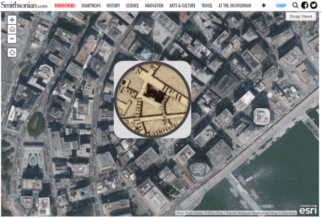
Smithsonian NYC street view 1836
Unfortunately, the old map doesn’t show much in the way of residents’ property lines or buildings. But you can clearly see the street layouts and where the parks and hills were. Comparing these areas with Google Earth’s street view today can help you better understand what things looked like in a much older version of one of the world’s great cities.
Use Google Earth for Your Genealogy
There are so many ways to use Google Earth for genealogy! My free video class will get you started. After a quick tutorial on downloading and navigating Google Earth, see how to utilize its powerful tools to identify an old family photo, map out addresses that may have changed and even plot an old ancestral homestead.
Click here to enjoy this free video!