Old maps are an essential tool for discovering more about your family’s history. If you have exhausted more traditional sources, here are three places to find maps that may surprise you.
#1 Surprising Finds within the David Rumsey Map Collection
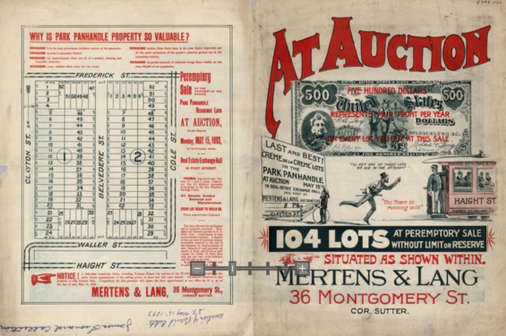
You’re probably aware that the David Rumsey map collection website is a terrific source for old maps. But you may be surprised by the variety of maps, some which you likely don’t come across every day. Here’s a fun little tactic I took today to see what it may hold in store beyond typical maps. A search of the word neighborhood reveals that their holdings go well beyond traditional maps. Here’s an example from San Francisco showing a neighborhood in its infancy:
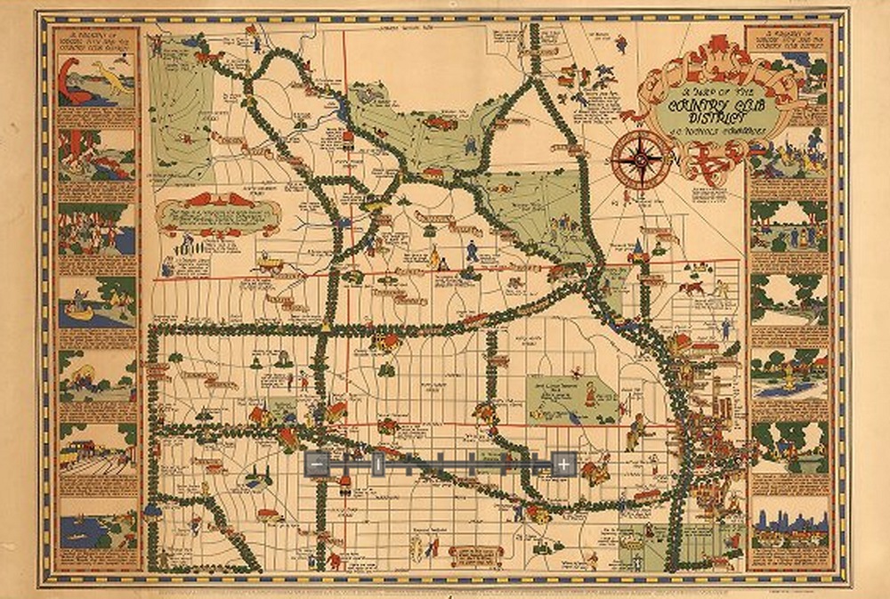
And the image below depicts the Country Club district of Kansas City in the 1930s. If your family lived there at that time, this is a real gem.
#2 Google Books
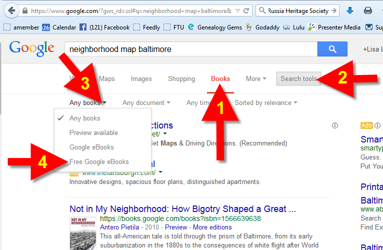
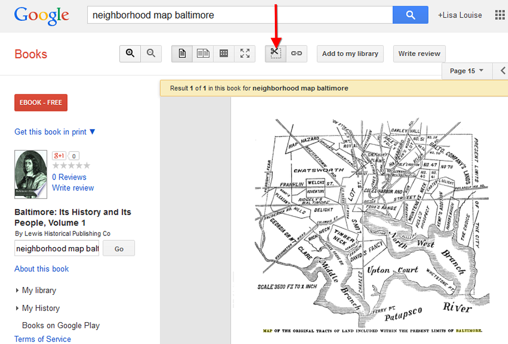
If you think Google Books is just books, think again. Historic maps, often unique and very specific, can often be found within those digitized pages. Try running a Google search such as: neighborhood map baltimore.
Click the MORE menu and select BOOKS. Then click the SEARCH TOOLS button at the top of the results list, and from the drop down menu select ANY BOOKS and then click FREE GOOGLE BOOKS:
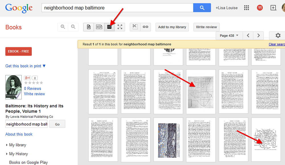
Select a book that looks promising. Then rather than reading through the pages or scanning the index, save loads of time by clicking the thumbnail view button at the top of the book. This way you can do a quick visual scan for pages featuring maps!
When you find a page featuring a map, click it display it on a single page. You can now use the clipper tool built right in to Google Books to clip an image of the map. Other options include using Evernote (free) or Snagit ($).
#3 Old Newspapers at Chronicling America
http://chroniclingamerica.loc.gov/
Like Google Books, the digitized pages housed at the Chronicling America website contain much more than just text. Old newspapers printed maps to help readers understand current events like the progress of war or the effect of a natural disaster. This map from The Tacoma Times in 1914 shows a map of Europe and several quick facts about the “Great War,” World War I:
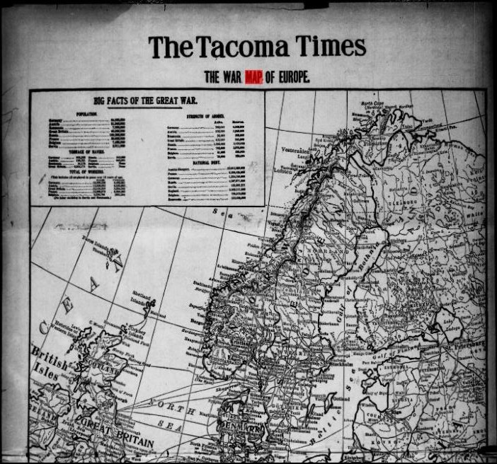
The Tacoma Times, August 22, 1914. Image from Chronicling America. Click on image to visit webpage.
Here’s one more example below. A search for “San Francisco earthquake” at Chronicling America brought up this bird’s eye view of San Francisco at the time of the major 1906 earthquake. Articles below the map explain what you’re seeing:
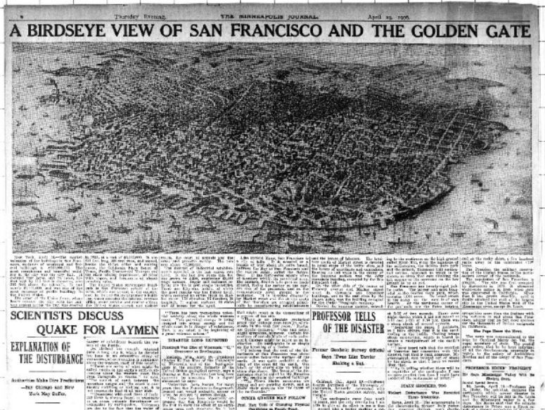
The Minneapolis Journal, April 19, 1906. Image at Chronicling America; click on image to see it there.
Learn more about using newspapers to understand your ancestors’ lives in my book, How to Find Your Family History in Newspapers.
Want more inspiring ideas for finding historic maps? Below is my FREE 8-minute video on using Sanborn maps. This is an excerpt from my Genealogy Gems Premium video, “5 Ways to Enhance Your Genealogy Research with Old Maps.” (Premium membership required to watch that full video along with others like “Best Websites for Finding Historical Maps.”)