by Lisa Cooke | Mar 24, 2015 | 01 What's New, History, images, Maps, United States

Mapping Migration in the United States. From the New York Times. Click to go straight to the source!
The U.S. has long been typified as a nation of restless wanderers. Are we still? Well, it depends on where in the U.S. you are from.
A new interactive infographic on the New York Times website looks at U.S. migration patterns: where residents of each U.S. state in 1900, 1950 and 2012 were born. According to the accompanying article, “You can trace the rise of migrant and immigrant populations all along the Southwest, particularly in Texas and Arizona, the influx of New Yorkers and other Northeasterners into Florida starting in the 1970s; and the growth in the Southern share of the Illinois population during the Great Migration.”
“In 1900, 95 percent of the people living in the Carolinas were born there, with similarly high numbers all through the Southeast. More than a hundred years later, those percentages are nearly cut in half. Taken individually, each state tells its own story, and each makes for fascinating reading.”
If you live in the U.S. now, click on your state to zoom in. You’ll see the statistics more fully represented. How many natives of that state still live there? Where else are its residents from? Where do you fall in? I am one of less than 1% of Ohioans who was born in a western state (excluding California). My husband and children are among the 75% of Ohio natives who still live here.
It might surprise you how little–or how much –your fellow state residents have been on the move. Now turn back the clock by clicking on the 1900 or 1950 maps. How did your family fit the norms for the time?
 If you love learning history through maps, go to our Home page and click on the Maps category in the lower left under Select Content by Topic. You’ll find lots more great online map resources and plenty of great map research strategies.
by Diahan Southard | Oct 16, 2014 | 01 What's New, British, FamilySearch, Maps
Did you know that FamilySearch has an interactive map to help you find English parish boundaries in 1851?
Daniel Poffenberger, who works at the British desk at the Family History Library in Salt Lake City, showed me this map gem. He says this map was about 7 years in the making!
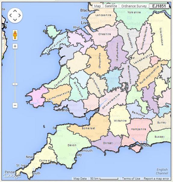
English parish boundaries: map on FamilySearch.org.
Before you click through to the map, you should know:
- Use the main Search interface to search by a specific location.
- Click on layers to indicate whether you want the map to show you boundaries to parishes, counties, civil registration districts, dioceses and more.
- Click and drag the map itself to explore it.
- Wales is also included here but the Welsh data doesn’t appear to be entirely complete (try it anyway–it might have what you need).
- The map isn’t yet permanently operational. It does go down sometimes, possibly because they’re still working on it. It doesn’t print easily. It’s suggested that if you want to print, you hit “Ctrl-Print Screen” and then paste it into Word or another program that accepts images.
Click here to see the FamilySearch England & Wales 1851 Parish map.
Want to learn more about using maps? Premium members can check out my video, “5 Ways to Enhance Your Genealogy Research with Old Maps.” Not a Premium member yet? Click here to learn more.
by | Feb 3, 2014 | 01 What's New, Google, Photographs
 Do you have old pictures but aren’t sure where they were taken? Sometimes Google Earth has the answer. Check out this question from podcast listener Dennis:
Q: “I am scanning slides from my only trip to my ancestor’s home in rural Germany and don’t recall the names or locations of a few people. The clue hear is ‘slides’. They were taken in 1986! I have a question regarding something I thought I heard on one of your podcasts regarding identifying a building via a picture that is uploaded to a web site. Can you give me some help with this?”
A: Yes! On my website, I offer a FREE video in which I demonstrate how to identify a building in an old photo using Google Earth. You can watch the free video by going to www.GenealogyGems.com, hover your mouse over VIDEO, and click on Google Earth for Genealogy in the drop down menu.
Another option is to use the free Google app on your smart phone or tablet. Open the app, tap in the search box, tap the Camera icon, and take a photo of the photo you have that contains the building you want to identify. (This works best with more well known locations.) It’s a long shot, but you never know – Google just may be able to identify it.
 Good luck, Dennis–and all the rest of you out there who are puzzling over how to identify old photos’ locations.
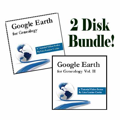
Find more tips on using Google Earth for Genealogy in my popular Google Earth for Genealogy 2-Disk Bundle. The free video is just the beginning of what you can do with Google Earth!
by Lisa Cooke | Jan 7, 2014 | 01 What's New, History, Maps
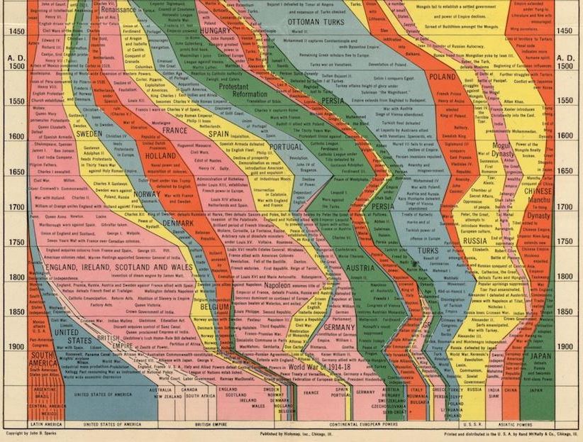
Partial image of Histomap of World History from Slate.com.
This might be the single most ambitious publication EVER: a chart that lays out the history of human civilization. It’s the ultimate infographic, created long before the era of the infographic!
What you see here is a partial image, a screenshot taken from a cool article on the 1931 Histomap: Four Thousand Years of World History.
It’s not perfectly accurate, it carries some cultural biases and ignorance of much of Africa’s rich history and the dates are given more as a range than anything. So what makes this a useful tool for genealogists?
We’re always looking for historical context: a way to understand how our ancestors fit into the “big picture” of history. Are you learning about a Portuguese or French line in your family? Learning by DNA tests that you have some deep Asian roots? Find these categories displayed on the map along with other dominant (or not-so-dominant) groups of your ancestor’s era. It’s cool to look at! Check out the entire map (and an explanatory post in this post by Rebecca Onion at Slate.com.
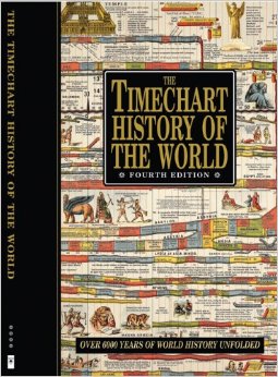 Genealogy Gems Contributing Editor Sunny Morton owns a book with a similar chart in it: Timechart History of the World (Timechart series)
The Timechart History of the World. The oversize, double-sided stiff cardboard pages fold out to more than 30 feet of full-color Victorian-decorated timecharts. She highly recommends it for the coffee table, if your coffee table is big enough to handle it!
Bonus: The Huffington Post has a neat article (with a photo) of another map from this series,The Histomap of Religion. (Time Chart of World Religion: A Histomap of Faith Through the Ages ) Religions can be tough to trace forward over time, as various sects divide or merge. Every tool helps!
by Lisa Cooke | Nov 21, 2013 | 01 What's New, Family History Library, Libraries
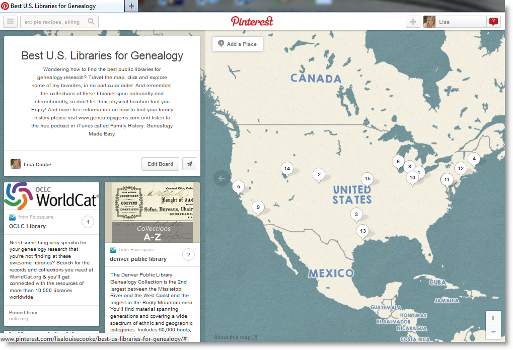 Are you wondering how to find the best public libraries for genealogy research? Travel this very special map on my brand new Pinterest board, and click to explore some of my favorites (in no particular order.)
The collections of these libraries span nationally and internationally, so don’t let their physical location fool you.
This map is part of my brand new Pinterest board “Best U.S. Libraries for Genealogy Research,” just one of my 33 boards (many of which are family history themed) on the free Pinterest site. Visit Lisa’s Boards
This mapping feature called “Place Pins” was just announced officially today by Pinterest.com. You can now add one of these can i buy medication for uti over the counter maps to any of your boards.
These 14 library pins include details on the collections they contain. Click the pin on the map, you’ll get contact information for the library. Click “Learn More” and you’ll be taken instantly to the library’s website.
If you still haven’t found just the collection you are looking for with these 14 stellar libraries, click the 15th pin which will take you to headquarters of OCLC, the home of WorldCat.org. From there you can search libraries across the country and around the world.
Visit Lisa’s Best Libraries Board
 If you love learning history through maps, go to our Home page and click on the Maps category in the lower left under Select Content by Topic. You’ll find lots more great online map resources and plenty of great map research strategies.